Targovishte elevation
Targovishte, Bulgaria elevation is 186 meters and Targovishte elevation in feet is 610 ft above sea level [src 1]. Targovishte is a seat of a first-order administrative division (feature code) with elevation that is 133 meters (436 ft) smaller than average city elevation in Bulgaria.
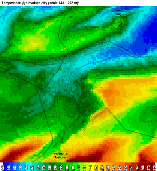
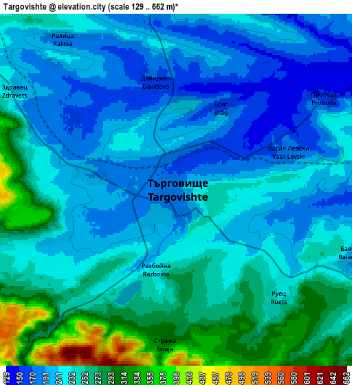
Below is the Elevation map of Targovishte, which displays elevation range with different colors. Scale of the first map is from 143 to 278 m (469 to 912 ft) with average elevation of 198.3 meters (=651 ft) [note 1]
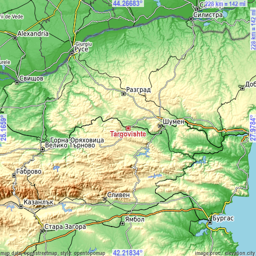
These maps also provides idea of topography and contour of this city, they are displayed at different zoom levels. More info about maps, scale and edge coordinates you can find below images.
| \ | Map #1 | Map #2 | Topo.Map |
| Scale [m] | 143..278 m | 129..662 m | × |
| Scale [ft] | 469..912 ft | 423..2172 ft | × |
| Average | 198.3 m = 651 ft | 230.8 m = 757 ft | × |
| Width | 7.12 km = 4.4 mi | 14.24 km = 8.8 mi | 227.8 km = 141.5 mi |
| Height | 7.12 km = 4.4 mi | 14.24 km = 8.8 mi | 227.8 km = 141.5 mi |
| ↑Max Latitude | 43.283199° | 43.315182° | 44.26683° |
| Latitude at center | 43.2512° | 43.2512° | 43.2512° |
| ↓Min Latitude | 43.219184° | 43.187151° | 42.21834° |
| ← Min Longitude | 26.528205° | 26.484259° | 25.1659° |
| Longitude center | 26.57215° | 26.57215° | 26.57215° |
| →Max Longitude | 26.616095° | 26.660041° | 27.9784° |
Nearby cities:
Cities around Targovishte sort by population:
• Shumen elevation 237 m
28.5 km,  85°
85°
• Razgrad 197 m
31.7 km,  351°
351°
• Popovo 190 m
29.5 km,  291°
291°
• Veliki Preslav 146 m
21.9 km,  115°
115°
• Omurtag 559 m
21 km,  216°
216°
• Smyadovo 86 m
41.5 km, 119°
• Varbitsa 279 m
28.4 km,  169°
169°
• Opaka 224 m
39.5 km,  303°
303°
• Loznitsa 265 m
13 km,  9°
9°
• Samuil 432 m
32.8 km,  25°
25°
• Antonovo 481 m
34.7 km,  251°
251°
• Gara Hitrino 332 m
34.4 km,  53°
53°
Multilingual:
 En español:
Tărgovište elevación 186 m.
 En France:
Targovichté élévation 186 m.
 Auf Deutsch:
Targowischte höhe über dem Meeresspiegel ist 186 m.

Sources and notes:
- [note 1] Map square and city borders are not equal. Map elevation data is calculated only from area inside that square.
- [src 1] Elevation data from geonames database provided with same terms of usage.
- [src 2] The elevation map of Targovishte is generated using elevation data from NASA's 3 arcsec (90m) resolution SRTM data.
- [src 3] Base (background) map © OpenStreetMap contributors tiles are generated by Geofabrik and OpenTopoMap.
Copyright & License:
This Targovishte Elevation Map is licensed under CC BY-SA. You may reuse any part from this page, if you give a proper credit by linking to this URL:
 More info on terms of use page.