Varbitsa elevation
Varbitsa (Shumen, Obshtina Varbitsa), Bulgaria elevation is 279 meters and Varbitsa elevation in feet is 915 ft above sea level [src 1]. Varbitsa is a populated place (feature code) with elevation that is 40 meters (131 ft) smaller than average city elevation in Bulgaria.
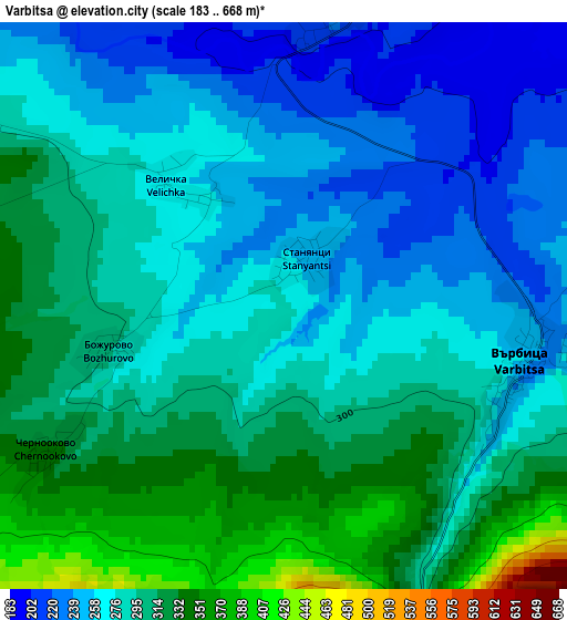
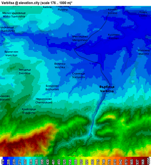
Below is the Elevation map of Varbitsa, which displays elevation range with different colors. Scale of the first map is from 183 to 668 m (600 to 2192 ft) with average elevation of 285.9 meters (=938 ft) [note 1]
These maps also provides idea of topography and contour of this city, they are displayed at different zoom levels. More info about maps, scale and edge coordinates you can find below images.
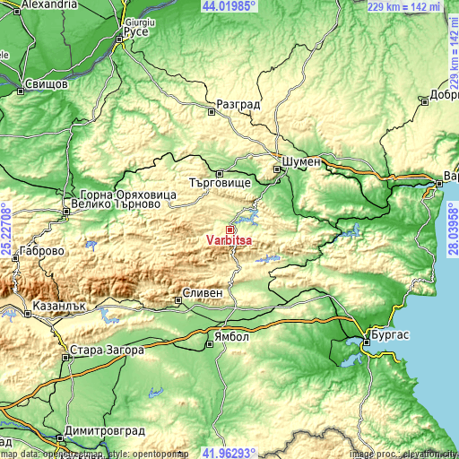
| \ | Map #1 | Map #2 | Topo.Map |
| Scale [m] | 183..668 m | 176..1000 m | × |
| Scale [ft] | 600..2192 ft | 577..3281 ft | × |
| Average | 285.9 m = 938 ft | 360.3 m = 1182 ft | × |
| Width | 7.15 km = 4.4 mi | 14.29 km = 8.9 mi | 228.7 km = 142.1 mi |
| Height | 7.15 km = 4.4 mi | 14.29 km = 8.9 mi | 228.7 km = 142.1 mi |
| ↑Max Latitude | 43.032131° | 43.064246° | 44.01985° |
| Latitude at center | 43° | 43° | 43° |
| ↓Min Latitude | 42.967852° | 42.935687° | 41.96293° |
| ← Min Longitude | 26.589385° | 26.545439° | 25.22708° |
| Longitude center | 26.63333° | 26.63333° | 26.63333° |
| →Max Longitude | 26.677275° | 26.721221° | 28.03958° |
Nearby cities:
Cities around Varbitsa sort by population:
• Sliven elevation 271 m
42.8 km,  215°
215°
• Shumen 237 m
38.2 km,  37°
37°
• Targovishte 186 m
28.4 km,  349°
349°
• Karnobat 208 m
48.3 km,  143°
143°
• Veliki Preslav 146 m
23.8 km, 38°
• Omurtag 559 m
20.8 km,  302°
302°
• Kotel 494 m
19.8 km,  228°
228°
• Straldzha 149 m
44.7 km,  174°
174°
• Smyadovo 86 m
32 km,  76°
76°
• Sungurlare 206 m
28.7 km,  154°
154°
• Loznitsa 265 m
40.9 km,  356°
356°
• Antonovo 481 m
41.4 km,  293°
293°
Multilingual:
 En español:
Varbitsa elevación 279 m.
 En France:
Varbitsa élévation 279 m.
 Auf Deutsch:
Varbitsa höhe über dem Meeresspiegel ist 279 m.

Sources and notes:
- [note 1] Map square and city borders are not equal. Map elevation data is calculated only from area inside that square.
- [src 1] Elevation data from geonames database provided with same terms of usage.
- [src 2] The elevation map of Varbitsa is generated using elevation data from NASA's 3 arcsec (90m) resolution SRTM data.
- [src 3] Base (background) map © OpenStreetMap contributors tiles are generated by Geofabrik and OpenTopoMap.
Copyright & License:
This Varbitsa Elevation Map is licensed under CC BY-SA. You may reuse any part from this page, if you give a proper credit by linking to this URL:
 More info on terms of use page.