Isperih elevation
Isperih (Razgrad, Obshtina Isperih), Bulgaria elevation is 279 meters and Isperih elevation in feet is 915 ft above sea level [src 1]. Isperih is a populated place (feature code) with elevation that is 40 meters (131 ft) smaller than average city elevation in Bulgaria.
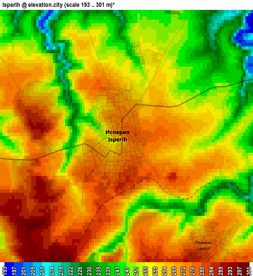
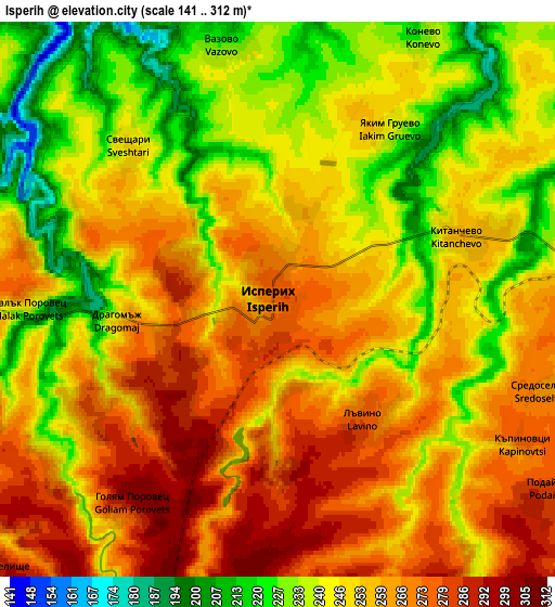
Below is the Elevation map of Isperih, which displays elevation range with different colors. Scale of the first map is from 193 to 301 m (633 to 988 ft) with average elevation of 260.4 meters (=854 ft) [note 1]
These maps also provides idea of topography and contour of this city, they are displayed at different zoom levels. More info about maps, scale and edge coordinates you can find below images.
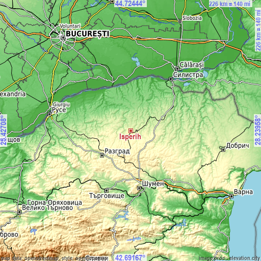
| \ | Map #1 | Map #2 | Topo.Map |
| Scale [m] | 193..301 m | 141..312 m | × |
| Scale [ft] | 633..988 ft | 463..1024 ft | × |
| Average | 260.4 m = 854 ft | 251.4 m = 825 ft | × |
| Width | 7.06 km = 4.4 mi | 14.13 km = 8.8 mi | 226 km = 140.4 mi |
| Height | 7.06 km = 4.4 mi | 14.13 km = 8.8 mi | 226 km = 140.4 mi |
| ↑Max Latitude | 43.748424° | 43.780161° | 44.72444° |
| Latitude at center | 43.71667° | 43.71667° | 43.71667° |
| ↓Min Latitude | 43.684899° | 43.653112° | 42.69167° |
| ← Min Longitude | 26.789385° | 26.745439° | 25.42708° |
| Longitude center | 26.83333° | 26.83333° | 26.83333° |
| →Max Longitude | 26.877275° | 26.921221° | 28.23958° |
Nearby cities:
Cities around Isperih sort by population:
• Razgrad elevation 197 m
32.6 km,  231°
231°
• Kubrat 202 m
28.2 km,  288°
288°
• Dulovo 226 m
27.8 km,  66°
66°
• Zavet 240 m
13.2 km, 291°
• Samuil 432 m
23.2 km,  196°
196°
• Glavinitsa 108 m
22.2 km,  0°
0°
• Kaolinovo 266 m
25.4 km,  116°
116°
• Venets 349 m
20.2 km,  156°
156°
• Gara Hitrino 332 m
32.2 km,  167°
167°
• Gorichevo 136 m
34.2 km,  295°
295°
• Tochilari 147 m
33 km, 296°
• Medovene 210 m
26 km,  282°
282°
Multilingual:
 En español:
Isperih elevación 279 m.
 En France:
Isperih élévation 279 m.


Sources and notes:
- [note 1] Map square and city borders are not equal. Map elevation data is calculated only from area inside that square.
- [src 1] Elevation data from geonames database provided with same terms of usage.
- [src 2] The elevation map of Isperih is generated using elevation data from NASA's 3 arcsec (90m) resolution SRTM data.
- [src 3] Base (background) map © OpenStreetMap contributors tiles are generated by Geofabrik and OpenTopoMap.
Copyright & License:
This Isperih Elevation Map is licensed under CC BY-SA. You may reuse any part from this page, if you give a proper credit by linking to this URL:
 More info on terms of use page.