Kozloduy elevation
Kozloduy (Vratsa, Obshtina Kozloduy), Bulgaria elevation is 41 meters and Kozloduy elevation in feet is 135 ft above sea level [src 1]. Kozloduy is a seat of a second-order administrative division (feature code) with elevation that is 278 meters (912 ft) smaller than average city elevation in Bulgaria.
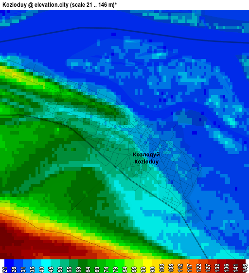
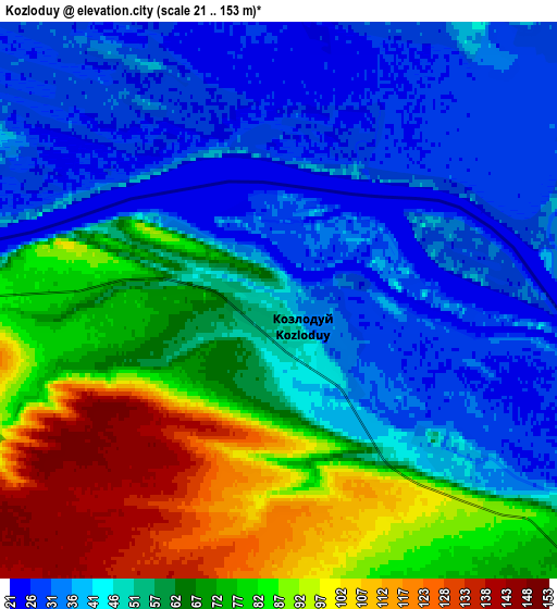
Below is the Elevation map of Kozloduy, which displays elevation range with different colors. Scale of the first map is from 21 to 146 m (69 to 479 ft) with average elevation of 47.4 meters (=156 ft) [note 1]
These maps also provides idea of topography and contour of this city, they are displayed at different zoom levels. More info about maps, scale and edge coordinates you can find below images.
| \ | Map #1 | Map #2 | Topo.Map |
| Scale [m] | 21..146 m | 21..153 m | × |
| Scale [ft] | 69..479 ft | 69..502 ft | × |
| Average | 47.4 m = 156 ft | 58.5 m = 192 ft | × |
| Width | 7.06 km = 4.4 mi | 14.11 km = 8.8 mi | 225.8 km = 140.3 mi |
| Height | 7.06 km = 4.4 mi | 14.11 km = 8.8 mi | 225.8 km = 140.3 mi |
| ↑Max Latitude | 43.810361° | 43.842065° | 44.78535° |
| Latitude at center | 43.77864° | 43.77864° | 43.77864° |
| ↓Min Latitude | 43.746902° | 43.715148° | 42.75469° |
| ← Min Longitude | 23.676635° | 23.632689° | 22.31433° |
| Longitude center | 23.72058° | 23.72058° | 23.72058° |
| →Max Longitude | 23.764525° | 23.808471° | 25.12683° |
Nearby cities:
Cities around Kozloduy sort by population:
• Lom elevation 23 m
39.1 km,  276°
276°
• Byala Slatina 125 m
38.7 km,  153°
153°
• Knezha 116 m
42.6 km,  136°
136°
• Oryahovo 56 m
19.8 km,  103°
103°
• Valchedram 65 m
24.1 km,  246°
246°
• Mizia 34 m
14.8 km,  133°
133°
• Krivodol 158 m
48.8 km,  202°
202°
• Borovan 189 m
38.5 km,  176°
176°
• Medkovets 172 m
47.6 km, 248°
• Yakimovo 97 m
33.6 km,  241°
241°
• Hayredin 45 m
20.2 km,  193°
193°
• Boychinovtsi 105 m
46 km,  222°
222°
Multilingual:
 En español:
Kozloduy elevación 41 m.
 En France:
Kozlodouy élévation 41 m.


Sources and notes:
- [note 1] Map square and city borders are not equal. Map elevation data is calculated only from area inside that square.
- [src 1] Elevation data from geonames database provided with same terms of usage.
- [src 2] The elevation map of Kozloduy is generated using elevation data from NASA's 3 arcsec (90m) resolution SRTM data.
- [src 3] Base (background) map © OpenStreetMap contributors tiles are generated by Geofabrik and OpenTopoMap.
Copyright & License:
This Kozloduy Elevation Map is licensed under CC BY-SA. You may reuse any part from this page, if you give a proper credit by linking to this URL:
 More info on terms of use page.