Krivodol elevation
Krivodol (Vratsa, Obshtina Krivodol), Bulgaria elevation is 158 meters and Krivodol elevation in feet is 518 ft above sea level [src 1]. Krivodol is a populated place (feature code) with elevation that is 161 meters (528 ft) smaller than average city elevation in Bulgaria.
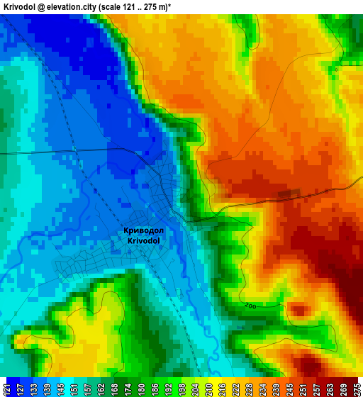
Below is the Elevation map of Krivodol, which displays elevation range with different colors. Scale of the first map is from 121 to 275 m (397 to 902 ft) with average elevation of 186.9 meters (=613 ft) [note 1]
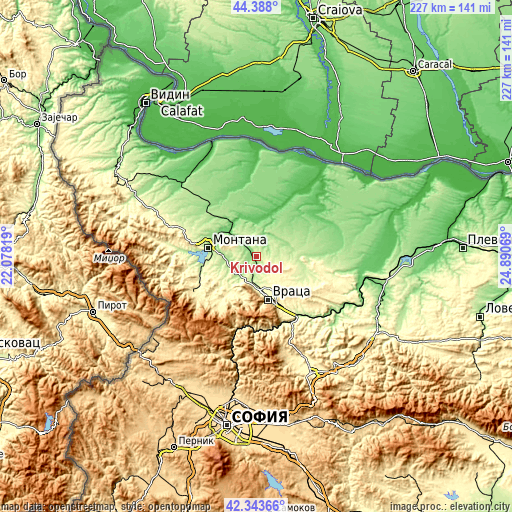
These maps also provides idea of topography and contour of this city, they are displayed at different zoom levels. More info about maps, scale and edge coordinates you can find below images.
| \ | Map #1 | Map #2 | Topo.Map |
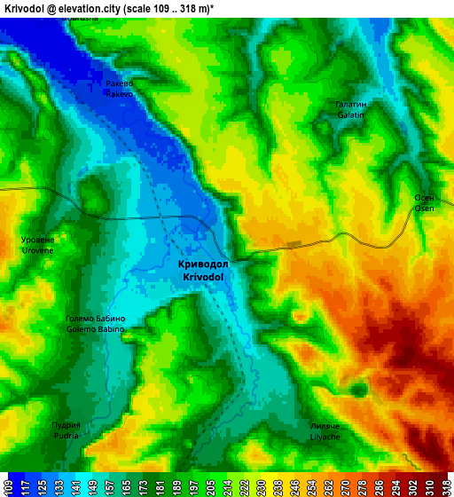
| Scale [m] | 121..275 m | 109..318 m | × |
| Scale [ft] | 397..902 ft | 358..1043 ft | × |
| Average | 186.9 m = 613 ft | 198.6 m = 652 ft | × |
| Width | 7.1 km = 4.4 mi | 14.21 km = 8.8 mi | 227.3 km = 141.2 mi |
| Height | 7.1 km = 4.4 mi | 14.21 km = 8.8 mi | 227.3 km = 141.2 mi |
| ↑Max Latitude | 43.406375° | 43.438292° | 44.388° |
| Latitude at center | 43.37444° | 43.37444° | 43.37444° |
| ↓Min Latitude | 43.342489° | 43.31052° | 42.34366° |
| ← Min Longitude | 23.440495° | 23.396549° | 22.07819° |
| Longitude center | 23.48444° | 23.48444° | 23.48444° |
| →Max Longitude | 23.528385° | 23.572331° | 24.89069° |
Nearby cities:
Cities around Krivodol sort by population:
• Vratsa elevation 352 m
19.3 km,  160°
160°
• Montana 148 m
21.4 km,  281°
281°
• Berkovitsa 369 m
32.7 km,  241°
241°
• Byala Slatina 125 m
37.7 km,  74°
74°
• Mezdra 277 m
30.5 km,  145°
145°
• Varshets 408 m
25.7 km,  218°
218°
• Valchedram 65 m
35.5 km,  354°
354°
• Borovan 189 m
22.4 km, 73°
• Yakimovo 97 m
30.8 km,  339°
339°
• Hayredin 45 m
29 km,  29°
29°
• Boychinovtsi 105 m
16.2 km,  312°
312°
• Lakatnik 811 m
36.7 km,  190°
190°
Multilingual:
 En español:
Krivodol elevación 158 m.
 En France:
Krivodol élévation 158 m.
 Auf Deutsch:
Krivodol höhe über dem Meeresspiegel ist 158 m.

Sources and notes:
- [note 1] Map square and city borders are not equal. Map elevation data is calculated only from area inside that square.
- [src 1] Elevation data from geonames database provided with same terms of usage.
- [src 2] The elevation map of Krivodol is generated using elevation data from NASA's 3 arcsec (90m) resolution SRTM data.
- [src 3] Base (background) map © OpenStreetMap contributors tiles are generated by Geofabrik and OpenTopoMap.
Copyright & License:
This Krivodol Elevation Map is licensed under CC BY-SA. You may reuse any part from this page, if you give a proper credit by linking to this URL:
 More info on terms of use page.