Svodna elevation
Svodna (Srpska), Bosnia and Herzegovina elevation is 144 meters and Svodna elevation in feet is 472 ft above sea level [src 1]. Svodna is a populated place (feature code) with elevation that is 219 meters (719 ft) smaller than average city elevation in Bosnia and Herzegovina.
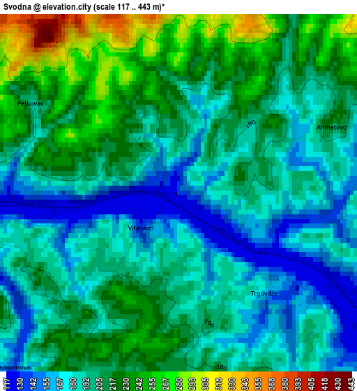
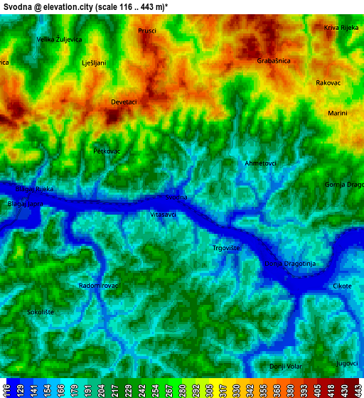
Below is the Elevation map of Svodna, which displays elevation range with different colors. Scale of the first map is from 117 to 443 m (384 to 1453 ft) with average elevation of 201.3 meters (=660 ft) [note 1]
These maps also provides idea of topography and contour of this city, they are displayed at different zoom levels. More info about maps, scale and edge coordinates you can find below images.
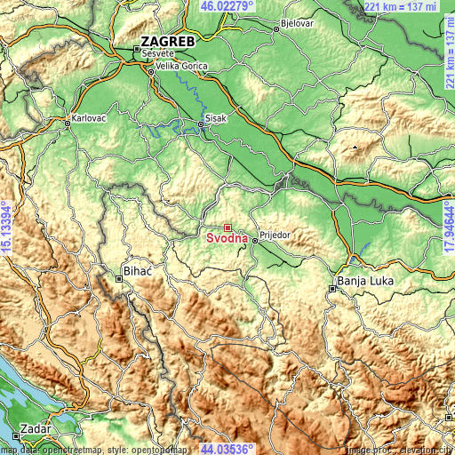
| \ | Map #1 | Map #2 | Topo.Map |
| Scale [m] | 117..443 m | 116..443 m | × |
| Scale [ft] | 384..1453 ft | 381..1453 ft | × |
| Average | 201.3 m = 660 ft | 232.6 m = 763 ft | × |
| Width | 6.91 km = 4.3 mi | 13.81 km = 8.6 mi | 221 km = 137.3 mi |
| Height | 6.91 km = 4.3 mi | 13.81 km = 8.6 mi | 221 km = 137.3 mi |
| ↑Max Latitude | 45.068745° | 45.099773° | 46.02279° |
| Latitude at center | 45.0377° | 45.0377° | 45.0377° |
| ↓Min Latitude | 45.006638° | 44.975559° | 44.03536° |
| ← Min Longitude | 16.496245° | 16.452299° | 15.13394° |
| Longitude center | 16.54019° | 16.54019° | 16.54019° |
| →Max Longitude | 16.584135° | 16.628081° | 17.94644° |
Nearby cities:
Cities around Svodna sort by population:
• Prijedor elevation 140 m
15.1 km,  115°
115°
• Sanski Most 158 m
31.7 km,  161°
161°
• Kozarska Dubica 99 m
26.2 km,  53°
53°
• Novi Grad 127 m
12.8 km,  274°
274°
• Otoka 141 m
29.7 km,  253°
253°
• Knežica 152 m
13.1 km, 54°
• Kostajnica 112 m
20.2 km,  359°
359°
• Lamovita 191 m
31.1 km,  114°
114°
• Marićka 152 m
31.1 km,  127°
127°
• Dobrljin 121 m
13.5 km,  339°
339°
• Donji Dubovik 324 m
23.6 km,  225°
225°
• Oštra Luka 268 m
21.9 km,  154°
154°
Multilingual:
 En español:
Svodna elevación 144 m.
 En France:
Svodna élévation 144 m.


Sources and notes:
- [note 1] Map square and city borders are not equal. Map elevation data is calculated only from area inside that square.
- [src 1] Elevation data from geonames database provided with same terms of usage.
- [src 2] The elevation map of Svodna is generated using elevation data from NASA's 3 arcsec (90m) resolution SRTM data.
- [src 3] Base (background) map © OpenStreetMap contributors tiles are generated by Geofabrik and OpenTopoMap.
Copyright & License:
This Svodna Elevation Map is licensed under CC BY-SA. You may reuse any part from this page, if you give a proper credit by linking to this URL:
 More info on terms of use page.