Cruz Alta elevation
Cruz Alta (Cordoba, Departamento de Marcos Juárez), Argentina elevation is 78 meters and Cruz Alta elevation in feet is 256 ft above sea level [src 1]. Cruz Alta is a populated place (feature code) with elevation that is 272 meters (892 ft) smaller than average city elevation in Argentina.
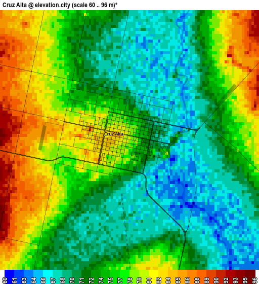
Below is the Elevation map of Cruz Alta, which displays elevation range with different colors. Scale of the first map is from 60 to 96 m (197 to 315 ft) with average elevation of 74.6 meters (=245 ft) [note 1]
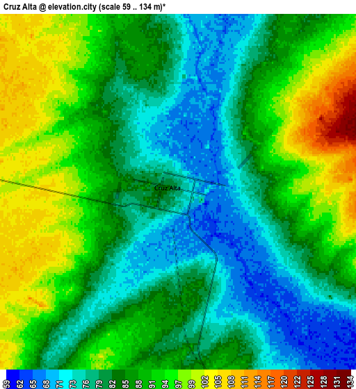
These maps also provides idea of topography and contour of this city, they are displayed at different zoom levels. More info about maps, scale and edge coordinates you can find below images.
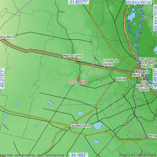
| \ | Map #1 | Map #2 | Topo.Map |
| Scale [m] | 60..96 m | 59..134 m | × |
| Scale [ft] | 197..315 ft | 194..440 ft | × |
| Average | 74.6 m = 245 ft | 85.9 m = 282 ft | × |
| Width | 8.2 km = 5.1 mi | 16.39 km = 10.2 mi | 262.2 km = 162.9 mi |
| Height | 8.2 km = 5.1 mi | 16.39 km = 10.2 mi | 262.2 km = 162.9 mi |
| ↑Max Latitude | -32.97201° | -32.935135° | -31.82177° |
| Latitude at center | -33.00887° | -33.00887° | -33.00887° |
| ↓Min Latitude | -33.045714° | -33.082543° | -34.1802° |
| ← Min Longitude | -61.851405° | -61.895351° | -63.21371° |
| Longitude center | -61.80746° | -61.80746° | -61.80746° |
| →Max Longitude | -61.763515° | -61.719569° | -60.40121° |
Nearby cities:
Cities around Cruz Alta sort by population:
• Cañada de Gómez elevation 93 m
44.1 km,  60°
60°
• Marcos Juárez 117 m
44.5 km,  321°
321°
• Firmat 109 m
58.5 km,  148°
148°
• Las Parejas 104 m
45.1 km,  37°
37°
• Armstrong 122 m
31.7 km, 37°
• Corral de Bustos 118 m
46.4 km,  229°
229°
• Chañar Ladeado 116 m
41.2 km,  211°
211°
• Camilo Aldao 113 m
29.8 km,  243°
243°
• Inriville 108 m
40.1 km,  280°
280°
• Los Surgentes 101 m
20.2 km, 277°
• General Roca 90 m
32.4 km,  341°
341°
• General Baldissera 112 m
48.2 km,  254°
254°
Multilingual:
 En español:
Cruz Alta elevación 78 m.
 En France:
Cruz Alta élévation 78 m.
 Auf Deutsch:
Cruz Alta höhe über dem Meeresspiegel ist 78 m.

Sources and notes:
- [note 1] Map square and city borders are not equal. Map elevation data is calculated only from area inside that square.
- [src 1] Elevation data from geonames database provided with same terms of usage.
- [src 2] The elevation map of Cruz Alta is generated using elevation data from NASA's 3 arcsec (90m) resolution SRTM data.
- [src 3] Base (background) map © OpenStreetMap contributors tiles are generated by Geofabrik and OpenTopoMap.
Copyright & License:
This Cruz Alta Elevation Map is licensed under CC BY-SA. You may reuse any part from this page, if you give a proper credit by linking to this URL:
 More info on terms of use page.