Inriville elevation
Inriville (Cordoba, Departamento de Marcos Juárez), Argentina elevation is 108 meters and Inriville elevation in feet is 354 ft above sea level [src 1]. Inriville is a populated place (feature code) with elevation that is 242 meters (794 ft) smaller than average city elevation in Argentina.
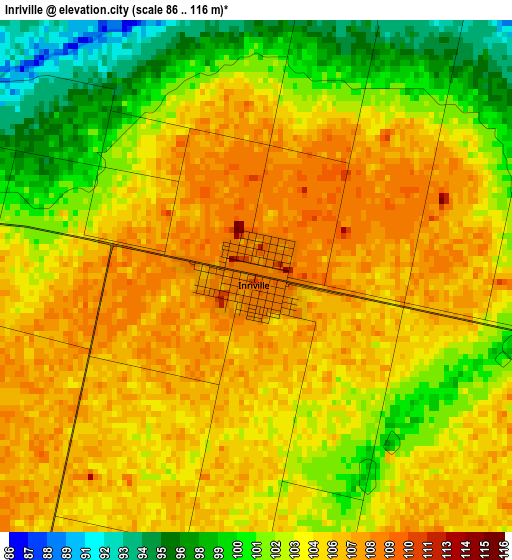
Below is the Elevation map of Inriville, which displays elevation range with different colors. Scale of the first map is from 86 to 116 m (282 to 381 ft) with average elevation of 103.7 meters (=340 ft) [note 1]
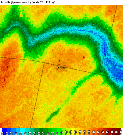
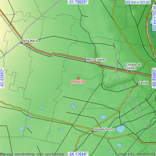
These maps also provides idea of topography and contour of this city, they are displayed at different zoom levels. More info about maps, scale and edge coordinates you can find below images.
| \ | Map #1 | Map #2 | Topo.Map |
| Scale [m] | 86..116 m | 82..119 m | × |
| Scale [ft] | 282..381 ft | 269..390 ft | × |
| Average | 103.7 m = 340 ft | 102.4 m = 336 ft | × |
| Width | 8.2 km = 5.1 mi | 16.4 km = 10.2 mi | 262.4 km = 163 mi |
| Height | 8.2 km = 5.1 mi | 16.4 km = 10.2 mi | 262.4 km = 163 mi |
| ↑Max Latitude | -32.907353° | -32.870451° | -31.75629° |
| Latitude at center | -32.94424° | -32.94424° | -32.94424° |
| ↓Min Latitude | -32.981111° | -33.017967° | -34.11644° |
| ← Min Longitude | -62.274225° | -62.318171° | -63.63653° |
| Longitude center | -62.23028° | -62.23028° | -62.23028° |
| →Max Longitude | -62.186335° | -62.142389° | -60.82403° |
Nearby cities:
Cities around Inriville sort by population:
• Marcos Juárez elevation 117 m
29.7 km,  22°
22°
• Leones 120 m
32 km,  348°
348°
• Corral de Bustos 118 m
37.8 km,  173°
173°
• Justiniano Posse 120 m
42.3 km,  279°
279°
• Monte Maíz 119 m
45.1 km,  230°
230°
• Cruz Alta 78 m
40.1 km,  100°
100°
• Monte Buey 113 m
21.4 km, 278°
• Camilo Aldao 113 m
24 km,  148°
148°
• Isla Verde 121 m
36.7 km,  205°
205°
• Los Surgentes 101 m
19.9 km, 102°
• General Roca 90 m
37.7 km,  51°
51°
• General Baldissera 112 m
21 km,  199°
199°
Multilingual:
 En español:
Inriville elevación 108 m.
 En France:
Inriville élévation 108 m.
 Auf Deutsch:
Inriville höhe über dem Meeresspiegel ist 108 m.

Sources and notes:
- [note 1] Map square and city borders are not equal. Map elevation data is calculated only from area inside that square.
- [src 1] Elevation data from geonames database provided with same terms of usage.
- [src 2] The elevation map of Inriville is generated using elevation data from NASA's 3 arcsec (90m) resolution SRTM data.
- [src 3] Base (background) map © OpenStreetMap contributors tiles are generated by Geofabrik and OpenTopoMap.
Copyright & License:
This Inriville Elevation Map is licensed under CC BY-SA. You may reuse any part from this page, if you give a proper credit by linking to this URL:
 More info on terms of use page.