Justiniano Posse elevation
Justiniano Posse (Cordoba, Departamento de Unión), Argentina elevation is 120 meters and Justiniano Posse elevation in feet is 394 ft above sea level [src 1]. Justiniano Posse is a populated place (feature code) with elevation that is 230 meters (755 ft) smaller than average city elevation in Argentina.
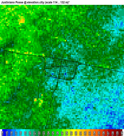
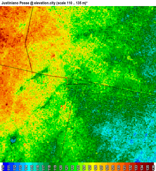
Below is the Elevation map of Justiniano Posse, which displays elevation range with different colors. Scale of the first map is from 114 to 132 m (374 to 433 ft) with average elevation of 121.7 meters (=399 ft) [note 1]
These maps also provides idea of topography and contour of this city, they are displayed at different zoom levels. More info about maps, scale and edge coordinates you can find below images.
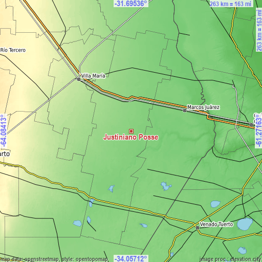
| \ | Map #1 | Map #2 | Topo.Map |
| Scale [m] | 114..132 m | 110..135 m | × |
| Scale [ft] | 374..433 ft | 361..443 ft | × |
| Average | 121.7 m = 399 ft | 121.7 m = 399 ft | × |
| Width | 8.21 km = 5.1 mi | 16.41 km = 10.2 mi | 262.6 km = 163.2 mi |
| Height | 8.21 km = 5.1 mi | 16.41 km = 10.2 mi | 262.6 km = 163.2 mi |
| ↑Max Latitude | -32.847198° | -32.810271° | -31.69536° |
| Latitude at center | -32.88411° | -32.88411° | -32.88411° |
| ↓Min Latitude | -32.921006° | -32.957887° | -34.05712° |
| ← Min Longitude | -62.721825° | -62.765771° | -64.08413° |
| Longitude center | -62.67788° | -62.67788° | -62.67788° |
| →Max Longitude | -62.633935° | -62.589989° | -61.27163° |
Nearby cities:
Cities around Justiniano Posse sort by population:
• Bell Ville elevation 132 m
28.7 km,  357°
357°
• Leones 120 m
43.4 km,  55°
55°
• Monte Maíz 119 m
36.4 km,  168°
168°
• Monte Buey 113 m
21 km,  99°
99°
• Laborde 127 m
34.2 km,  209°
209°
• Inriville 108 m
42.3 km, 99°
• Morrison 148 m
35.3 km,  335°
335°
• Pascanas 140 m
43.2 km,  231°
231°
• Ordóñez 138 m
18.2 km,  285°
285°
• General Baldissera 112 m
43.6 km,  127°
127°
• Idiazábal 150 m
34 km,  283°
283°
• Wenceslao Escalante 119 m
33.3 km,  195°
195°
Multilingual:
 En español:
Justiniano Posse elevación 120 m.
 En France:
Justiniano Posse élévation 120 m.
 Auf Deutsch:
Justiniano Posse höhe über dem Meeresspiegel ist 120 m.

Sources and notes:
- [note 1] Map square and city borders are not equal. Map elevation data is calculated only from area inside that square.
- [src 1] Elevation data from geonames database provided with same terms of usage.
- [src 2] The elevation map of Justiniano Posse is generated using elevation data from NASA's 3 arcsec (90m) resolution SRTM data.
- [src 3] Base (background) map © OpenStreetMap contributors tiles are generated by Geofabrik and OpenTopoMap.
Copyright & License:
This Justiniano Posse Elevation Map is licensed under CC BY-SA. You may reuse any part from this page, if you give a proper credit by linking to this URL:
 More info on terms of use page.