Firmat elevation
Firmat (Santa Fe, General López Department), Argentina elevation is 109 meters and Firmat elevation in feet is 358 ft above sea level [src 1]. Firmat is a populated place (feature code) with elevation that is 241 meters (791 ft) smaller than average city elevation in Argentina.
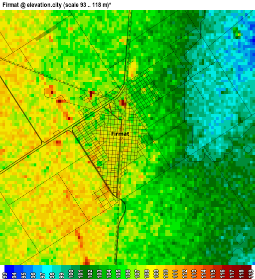
Below is the Elevation map of Firmat, which displays elevation range with different colors. Scale of the first map is from 93 to 118 m (305 to 387 ft) with average elevation of 104.5 meters (=343 ft) [note 1]
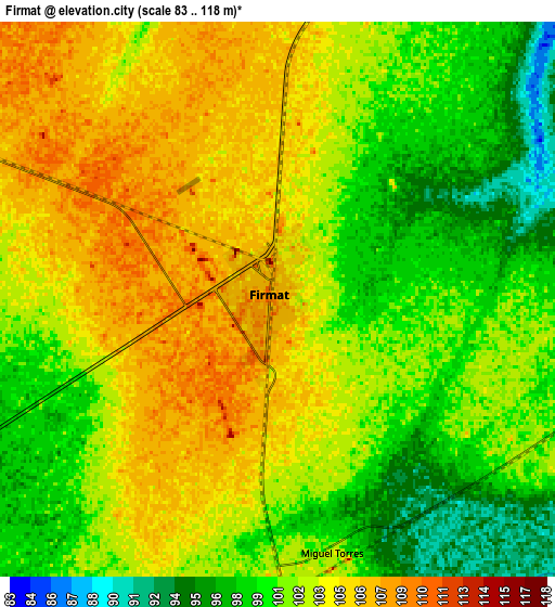
These maps also provides idea of topography and contour of this city, they are displayed at different zoom levels. More info about maps, scale and edge coordinates you can find below images.
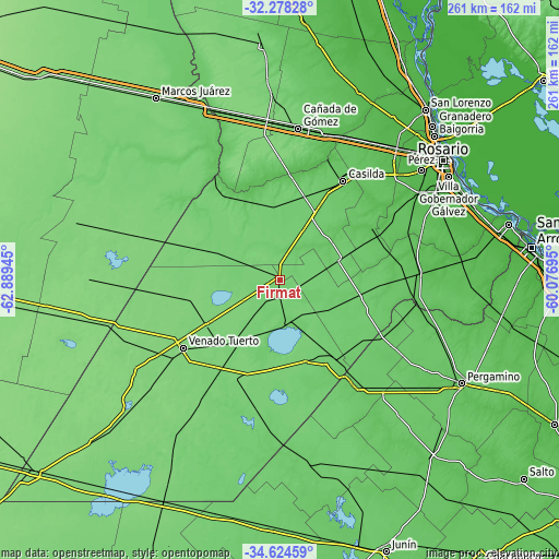
| \ | Map #1 | Map #2 | Topo.Map |
| Scale [m] | 93..118 m | 83..118 m | × |
| Scale [ft] | 305..387 ft | 272..387 ft | × |
| Average | 104.5 m = 343 ft | 102 m = 335 ft | × |
| Width | 8.15 km = 5.1 mi | 16.31 km = 10.1 mi | 260.9 km = 162.1 mi |
| Height | 8.15 km = 5.1 mi | 16.31 km = 10.1 mi | 260.9 km = 162.1 mi |
| ↑Max Latitude | -33.4227° | -33.386014° | -32.27828° |
| Latitude at center | -33.45937° | -33.45937° | -33.45937° |
| ↓Min Latitude | -33.496025° | -33.532664° | -34.62459° |
| ← Min Longitude | -61.527145° | -61.571091° | -62.88945° |
| Longitude center | -61.4832° | -61.4832° | -61.4832° |
| →Max Longitude | -61.439255° | -61.395309° | -60.07695° |
Nearby cities:
Cities around Firmat sort by population:
• Venado Tuerto elevation 117 m
55.1 km,  234°
234°
• Cañada de Gómez 93 m
72 km,  6°
6°
• Casilda 79 m
54.7 km,  32°
32°
• Corral de Bustos 118 m
68.1 km,  286°
286°
• Villa Cañás 104 m
61.8 km,  190°
190°
• Cruz Alta 78 m
58.5 km,  328°
328°
• Chañar Ladeado 116 m
53.6 km, 286°
• Camilo Aldao 113 m
67.8 km,  303°
303°
• Los Surgentes 101 m
72.8 km,  316°
316°
• Villa Mugueta 85 m
43 km,  67°
67°
• Colón 91 m
60 km,  143°
143°
• Melincué 91 m
22.3 km,  173°
173°
Multilingual:
 En español:
Firmat elevación 109 m.
 En France:
Firmat élévation 109 m.


Sources and notes:
- [note 1] Map square and city borders are not equal. Map elevation data is calculated only from area inside that square.
- [src 1] Elevation data from geonames database provided with same terms of usage.
- [src 2] The elevation map of Firmat is generated using elevation data from NASA's 3 arcsec (90m) resolution SRTM data.
- [src 3] Base (background) map © OpenStreetMap contributors tiles are generated by Geofabrik and OpenTopoMap.
Copyright & License:
This Firmat Elevation Map is licensed under CC BY-SA. You may reuse any part from this page, if you give a proper credit by linking to this URL:
 More info on terms of use page.