Cañada de Gómez elevation
Cañada de Gómez (Santa Fe, Iriondo Department), Argentina elevation is 93 meters and Cañada de Gómez elevation in feet is 305 ft above sea level [src 1]. Cañada de Gómez is a seat of a second-order administrative division (feature code) with elevation that is 257 meters (843 ft) smaller than average city elevation in Argentina.
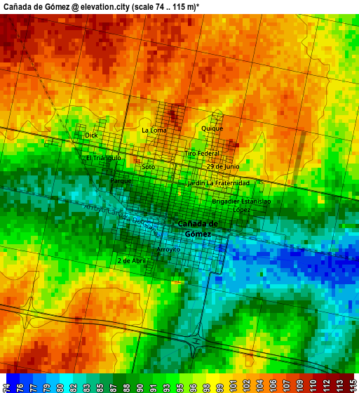
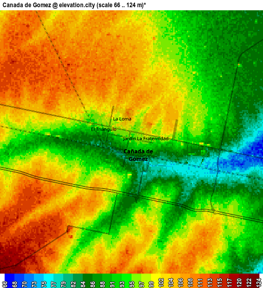
Below is the Elevation map of Cañada de Gómez, which displays elevation range with different colors. Scale of the first map is from 74 to 115 m (243 to 377 ft) with average elevation of 95.6 meters (=314 ft) [note 1]
These maps also provides idea of topography and contour of this city, they are displayed at different zoom levels. More info about maps, scale and edge coordinates you can find below images.
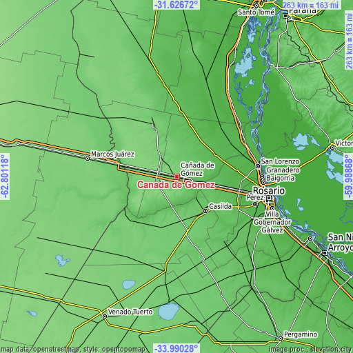
| \ | Map #1 | Map #2 | Topo.Map |
| Scale [m] | 74..115 m | 66..124 m | × |
| Scale [ft] | 243..377 ft | 217..407 ft | × |
| Average | 95.6 m = 314 ft | 98 m = 322 ft | × |
| Width | 8.21 km = 5.1 mi | 16.43 km = 10.2 mi | 262.8 km = 163.3 mi |
| Height | 8.21 km = 5.1 mi | 16.43 km = 10.2 mi | 262.8 km = 163.3 mi |
| ↑Max Latitude | -32.77942° | -32.742465° | -31.62672° |
| Latitude at center | -32.81636° | -32.81636° | -32.81636° |
| ↓Min Latitude | -32.853284° | -32.890194° | -33.99028° |
| ← Min Longitude | -61.438875° | -61.482821° | -62.80118° |
| Longitude center | -61.39493° | -61.39493° | -61.39493° |
| →Max Longitude | -61.350985° | -61.307039° | -59.98868° |
Nearby cities:
Cities around Cañada de Gómez sort by population:
• Casilda elevation 79 m
33 km,  140°
140°
• Pérez 37 m
61.9 km,  109°
109°
• Carcarañá 59 m
23 km,  101°
101°
• Funes 36 m
55.7 km, 101°
• Las Rosas 107 m
41.6 km,  335°
335°
• Roldán 43 m
46.5 km, 101°
• Las Parejas 104 m
18.5 km,  322°
322°
• Armstrong 122 m
19.7 km,  281°
281°
• Totoras 56 m
33.4 km,  39°
39°
• Cruz Alta 78 m
44.1 km,  240°
240°
• Los Surgentes 101 m
61.4 km,  252°
252°
• General Roca 90 m
49.6 km, 280°
Multilingual:
 En español:
Cañada de Gómez elevación 93 m.
 En France:
Cañada de Gómez élévation 93 m.
 Auf Deutsch:
Cañada de Gómez höhe über dem Meeresspiegel ist 93 m.

Sources and notes:
- [note 1] Map square and city borders are not equal. Map elevation data is calculated only from area inside that square.
- [src 1] Elevation data from geonames database provided with same terms of usage.
- [src 2] The elevation map of Cañada de Gómez is generated using elevation data from NASA's 3 arcsec (90m) resolution SRTM data.
- [src 3] Base (background) map © OpenStreetMap contributors tiles are generated by Geofabrik and OpenTopoMap.
Copyright & License:
This Cañada de Gómez Elevation Map is licensed under CC BY-SA. You may reuse any part from this page, if you give a proper credit by linking to this URL:
 More info on terms of use page.