Pueblo Libertador elevation
Pueblo Libertador (Corrientes, Departamento de Esquina), Argentina elevation is 38 meters and Pueblo Libertador elevation in feet is 125 ft above sea level [src 1]. Pueblo Libertador is a populated place (feature code) with elevation that is 312 meters (1024 ft) smaller than average city elevation in Argentina.
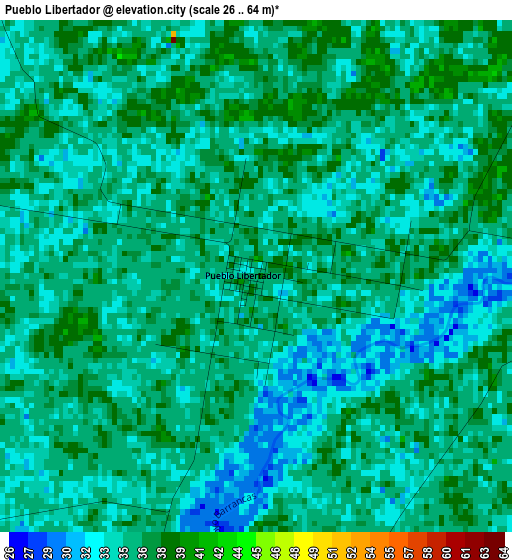
Below is the Elevation map of Pueblo Libertador, which displays elevation range with different colors. Scale of the first map is from 26 to 64 m (85 to 210 ft) with average elevation of 35.1 meters (=115 ft) [note 1]
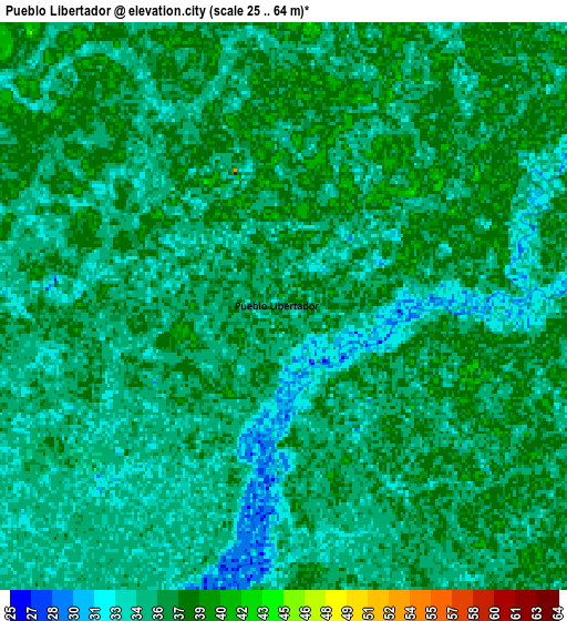
These maps also provides idea of topography and contour of this city, they are displayed at different zoom levels. More info about maps, scale and edge coordinates you can find below images.
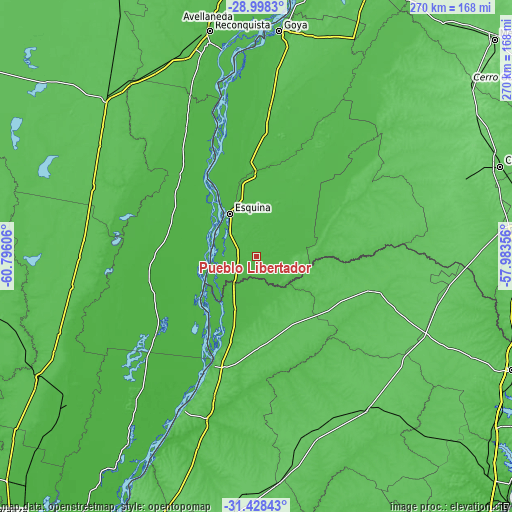
| \ | Map #1 | Map #2 | Topo.Map |
| Scale [m] | 26..64 m | 25..64 m | × |
| Scale [ft] | 85..210 ft | 82..210 ft | × |
| Average | 35.1 m = 115 ft | 35.3 m = 116 ft | × |
| Width | 8.44 km = 5.2 mi | 16.89 km = 10.5 mi | 270.2 km = 167.9 mi |
| Height | 8.44 km = 5.2 mi | 16.89 km = 10.5 mi | 270.2 km = 167.9 mi |
| ↑Max Latitude | -30.18289° | -30.144895° | -28.9983° |
| Latitude at center | -30.22087° | -30.22087° | -30.22087° |
| ↓Min Latitude | -30.258835° | -30.296786° | -31.42843° |
| ← Min Longitude | -59.433755° | -59.477701° | -60.79606° |
| Longitude center | -59.38981° | -59.38981° | -59.38981° |
| →Max Longitude | -59.345865° | -59.301919° | -57.98356° |
Nearby cities:
Cities around Pueblo Libertador sort by population:
• Esquina elevation 39 m
26.5 km,  329°
329°
• La Paz 53 m
62.9 km,  202°
202°
• Santa Elena 74 m
89 km,  205°
205°
• Federal 67 m
100.1 km,  144°
144°
• San Javier 27 m
65.4 km,  232°
232°
• San José de Feliciano 68 m
63.9 km,  106°
106°
• Calchaquí 59 m
94 km,  293°
293°
• Los Laureles 50 m
100.5 km,  340°
340°
• Conscripto Bernardi 70 m
96.5 km,  162°
162°
• San Gustavo 56 m
52.1 km,  180°
180°
• Los Conquistadores 75 m
97.5 km, 114°
• Sauce 71 m
59.8 km,  75°
75°
Multilingual:
 En español:
Pueblo Libertador elevación 38 m.
 En France:
Pueblo Libertador élévation 38 m.
 Auf Deutsch:
Pueblo Libertador höhe über dem Meeresspiegel ist 38 m.

Sources and notes:
- [note 1] Map square and city borders are not equal. Map elevation data is calculated only from area inside that square.
- [src 1] Elevation data from geonames database provided with same terms of usage.
- [src 2] The elevation map of Pueblo Libertador is generated using elevation data from NASA's 3 arcsec (90m) resolution SRTM data.
- [src 3] Base (background) map © OpenStreetMap contributors tiles are generated by Geofabrik and OpenTopoMap.
Copyright & License:
This Pueblo Libertador Elevation Map is licensed under CC BY-SA. You may reuse any part from this page, if you give a proper credit by linking to this URL:
 More info on terms of use page.