Federal elevation
Federal (Entre Rios, Departamento de Federal), Argentina elevation is 67 meters and Federal elevation in feet is 220 ft above sea level [src 1]. Federal is a seat of a second-order administrative division (feature code) with elevation that is 283 meters (928 ft) smaller than average city elevation in Argentina.
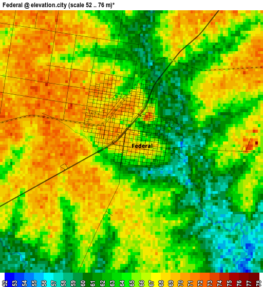
Below is the Elevation map of Federal, which displays elevation range with different colors. Scale of the first map is from 52 to 76 m (171 to 249 ft) with average elevation of 65 meters (=213 ft) [note 1]
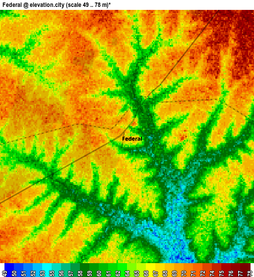
These maps also provides idea of topography and contour of this city, they are displayed at different zoom levels. More info about maps, scale and edge coordinates you can find below images.
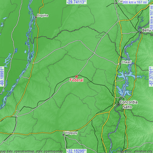
| \ | Map #1 | Map #2 | Topo.Map |
| Scale [m] | 52..76 m | 49..78 m | × |
| Scale [ft] | 171..249 ft | 161..256 ft | × |
| Average | 65 m = 213 ft | 65.6 m = 215 ft | × |
| Width | 8.38 km = 5.2 mi | 16.76 km = 10.4 mi | 268.2 km = 166.7 mi |
| Height | 8.38 km = 5.2 mi | 16.76 km = 10.4 mi | 268.2 km = 166.7 mi |
| ↑Max Latitude | -30.916956° | -30.879248° | -29.74113° |
| Latitude at center | -30.95465° | -30.95465° | -30.95465° |
| ↓Min Latitude | -30.992329° | -31.029993° | -32.15295° |
| ← Min Longitude | -58.827205° | -58.871151° | -60.18951° |
| Longitude center | -58.78326° | -58.78326° | -58.78326° |
| →Max Longitude | -58.739315° | -58.695369° | -57.37701° |
Nearby cities:
Cities around Federal sort by population:
• Chajarí elevation 58 m
80 km,  73°
73°
• San Salvador 75 m
79.1 km,  160°
160°
• San José de Feliciano 68 m
63.5 km,  2°
2°
• Bovril 81 m
76.4 km,  235°
235°
• Los Charrúas 72 m
61.8 km,  113°
113°
• General Campos 65 m
72.7 km,  150°
150°
• Sauce de Luna 76 m
52.1 km,  232°
232°
• Santa Ana 50 m
81.5 km,  85°
85°
• La Criolla 55 m
73.4 km,  118°
118°
• Conscripto Bernardi 70 m
30.5 km,  250°
250°
• San Gustavo 56 m
65.7 km,  296°
296°
• Los Conquistadores 75 m
50.5 km,  36°
36°
Multilingual:
 En español:
Federal elevación 67 m.
 En France:
Federal élévation 67 m.


Sources and notes:
- [note 1] Map square and city borders are not equal. Map elevation data is calculated only from area inside that square.
- [src 1] Elevation data from geonames database provided with same terms of usage.
- [src 2] The elevation map of Federal is generated using elevation data from NASA's 3 arcsec (90m) resolution SRTM data.
- [src 3] Base (background) map © OpenStreetMap contributors tiles are generated by Geofabrik and OpenTopoMap.
Copyright & License:
This Federal Elevation Map is licensed under CC BY-SA. You may reuse any part from this page, if you give a proper credit by linking to this URL:
 More info on terms of use page.