Yangī Qal‘ah elevation
Yangī Qal‘ah (Takhar), Afghanistan elevation is 471 meters and Yangī Qal‘ah elevation in feet is 1545 ft above sea level [src 1]. Yangī Qal‘ah is a populated place (feature code) with elevation that is 948 meters (3110 ft) smaller than average city elevation in Afghanistan.
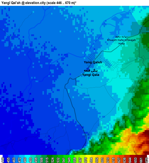
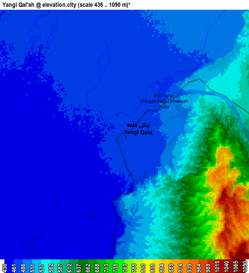
Below is the Elevation map of Yangī Qal‘ah, which displays elevation range with different colors. Scale of the first map is from 446 to 670 m (1463 to 2198 ft) with average elevation of 478.7 meters (=1571 ft) [note 1]
These maps also provides idea of topography and contour of this city, they are displayed at different zoom levels. More info about maps, scale and edge coordinates you can find below images.
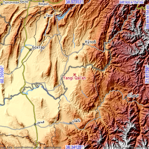
| \ | Map #1 | Map #2 | Topo.Map |
| Scale [m] | 446..670 m | 436..1090 m | × |
| Scale [ft] | 1463..2198 ft | 1430..3576 ft | × |
| Average | 478.7 m = 1571 ft | 521.9 m = 1712 ft | × |
| Width | 7.76 km = 4.8 mi | 15.51 km = 9.6 mi | 248.2 km = 154.2 mi |
| Height | 7.76 km = 4.8 mi | 15.51 km = 9.6 mi | 248.2 km = 154.2 mi |
| ↑Max Latitude | 37.500592° | 37.535448° | 38.57353° |
| Latitude at center | 37.46572° | 37.46572° | 37.46572° |
| ↓Min Latitude | 37.430832° | 37.395927° | 36.34125° |
| ← Min Longitude | 69.567365° | 69.523419° | 68.20506° |
| Longitude center | 69.61131° | 69.61131° | 69.61131° |
| →Max Longitude | 69.655255° | 69.699201° | 71.01756° |
Nearby cities:
Cities around Yangī Qal‘ah sort by population:
• Taloqan elevation 801 m
81.4 km,  184°
184°
• Rustāq 1314 m
42.5 km,  152°
152°
• Qarāwul 337 m
78.4 km,  249°
249°
• Ārt Khwājah 481 m
43.8 km,  195°
195°
• Imām Şāḩib 358 m
67.1 km,  242°
242°
• Dasht-e Archī 379 m
54 km,  226°
226°
• March 1607 m
74.2 km,  84°
84°
• Deh Khwāhān 1047 m
71.3 km,  48°
48°
• Khwājah Ghār 512 m
47.5 km, 200°
• Dasht-e Qal‘ah 449 m
37.7 km, 203°
• Chāh Āb 1034 m
19.5 km,  112°
112°
• Darqad 435 m
16.7 km, 237°
Multilingual:
 En español:
Yangī Qal‘ah elevación 471 m.
 En France:
Yangī Qal‘ah élévation 471 m.
 Auf Deutsch:
Yangī Qal‘ah höhe über dem Meeresspiegel ist 471 m.

Sources and notes:
- [note 1] Map square and city borders are not equal. Map elevation data is calculated only from area inside that square.
- [src 1] Elevation data from geonames database provided with same terms of usage.
- [src 2] The elevation map of Yangī Qal‘ah is generated using elevation data from NASA's 3 arcsec (90m) resolution SRTM data.
- [src 3] Base (background) map © OpenStreetMap contributors tiles are generated by Geofabrik and OpenTopoMap.
Copyright & License:
This Yangī Qal‘ah Elevation Map is licensed under CC BY-SA. You may reuse any part from this page, if you give a proper credit by linking to this URL:
 More info on terms of use page.