Redcliff elevation
Redcliff (Midlands), Zimbabwe elevation is 1232 meters and Redcliff elevation in feet is 4042 ft above sea level [src 1]. Redcliff is a populated place (feature code) with elevation that is 32 meters (105 ft) bigger than average city elevation in Zimbabwe.
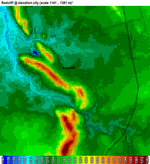
Below is the Elevation map of Redcliff, which displays elevation range with different colors. Scale of the first map is from 1141 to 1381 m (3743 to 4531 ft) with average elevation of 1228.5 meters (=4031 ft) [note 1]
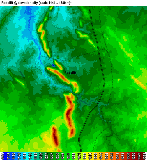
These maps also provides idea of topography and contour of this city, they are displayed at different zoom levels. More info about maps, scale and edge coordinates you can find below images.
| \ | Map #1 | Map #2 | Topo.Map |
| Scale [m] | 1141..1381 m | 1141..1389 m | × |
| Scale [ft] | 3743..4531 ft | 3743..4557 ft | × |
| Average | 1228.5 m = 4031 ft | 1233.8 m = 4048 ft | × |
| Width | 9.24 km = 5.7 mi | 18.48 km = 11.5 mi | 295.6 km = 183.7 mi |
| Height | 9.24 km = 5.7 mi | 18.48 km = 11.5 mi | 295.6 km = 183.7 mi |
| ↑Max Latitude | -18.991782° | -18.950224° | -17.69875° |
| Latitude at center | -19.03333° | -19.03333° | -19.03333° |
| ↓Min Latitude | -19.074868° | -19.116395° | -20.35727° |
| ← Min Longitude | 29.739385° | 29.695439° | 28.37708° |
| Longitude center | 29.78333° | 29.78333° | 29.78333° |
| →Max Longitude | 29.827275° | 29.871221° | 31.18958° |
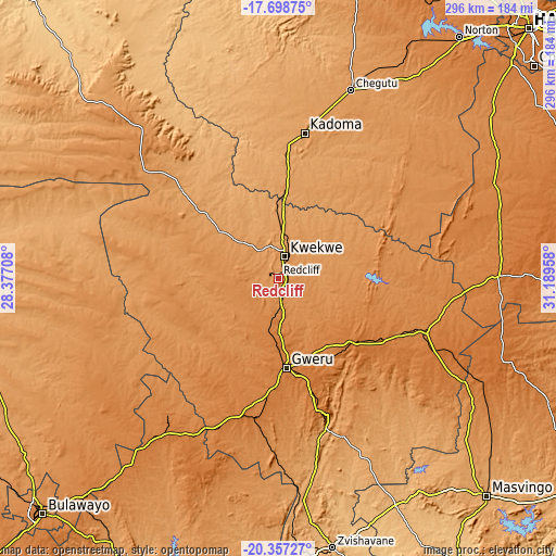
Nearby cities:
Cities around Redcliff sort by population:
• Gweru elevation 1412 m
46.5 km,  175°
175°
• Kwekwe 1203 m
12.2 km,  15°
15°
• Kadoma 1176 m
79.1 km,  10°
10°
• Chegutu 1187 m
107.3 km, 20°
• Shurugwi 1483 m
74.6 km,  161°
161°
• Chivhu 1450 m
116.6 km,  89°
89°
• Inyati 1333 m
121.5 km,  233°
233°
• Chakari 1107 m
108.5 km, 6°
• Mvuma 1387 m
82.9 km,  109°
109°
• Shangani 1377 m
94.1 km,  207°
207°
• Insiza 1422 m
103.4 km,  216°
216°
• Lalapanzi 1500 m
53.1 km,  128°
128°
Multilingual:
 En español:
Redcliff elevación 1232 m.
 En France:
Redcliff élévation 1232 m.
 Auf Deutsch:
Redcliff höhe über dem Meeresspiegel ist 1232 m.

Sources and notes:
- [note 1] Map square and city borders are not equal. Map elevation data is calculated only from area inside that square.
- [src 1] Elevation data from geonames database provided with same terms of usage.
- [src 2] The elevation map of Redcliff is generated using elevation data from NASA's 3 arcsec (90m) resolution SRTM data.
- [src 3] Base (background) map © OpenStreetMap contributors tiles are generated by Geofabrik and OpenTopoMap.
Copyright & License:
This Redcliff Elevation Map is licensed under CC BY-SA. You may reuse any part from this page, if you give a proper credit by linking to this URL:
 More info on terms of use page.