Mpulungu elevation
Mpulungu (Northern), Zambia elevation is 800 meters and Mpulungu elevation in feet is 2625 ft above sea level [src 1]. Mpulungu is a populated place (feature code) with elevation that is 343 meters (1125 ft) smaller than average city elevation in Zambia.
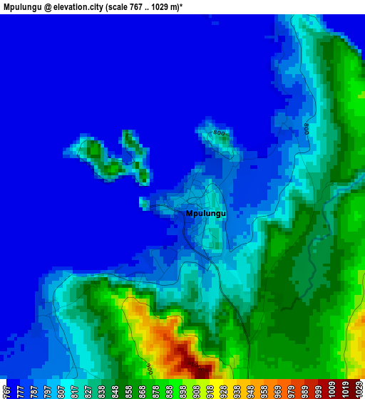
Below is the Elevation map of Mpulungu, which displays elevation range with different colors. Scale of the first map is from 767 to 1029 m (2516 to 3376 ft) with average elevation of 808.2 meters (=2652 ft) [note 1]
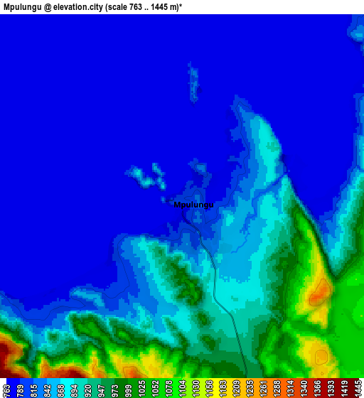
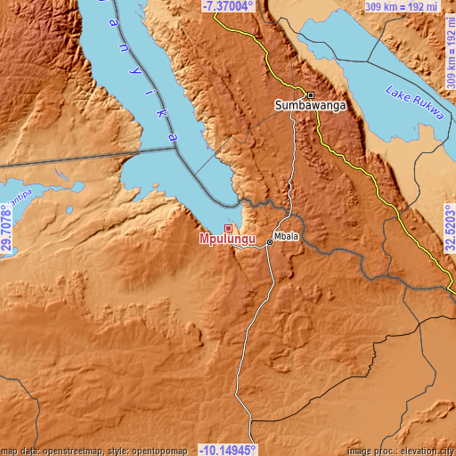
These maps also provides idea of topography and contour of this city, they are displayed at different zoom levels. More info about maps, scale and edge coordinates you can find below images.
| \ | Map #1 | Map #2 | Topo.Map |
| Scale [m] | 767..1029 m | 763..1445 m | × |
| Scale [ft] | 2516..3376 ft | 2503..4741 ft | × |
| Average | 808.2 m = 2652 ft | 847.8 m = 2781 ft | × |
| Width | 9.66 km = 6 mi | 19.32 km = 12 mi | 309 km = 192 mi |
| Height | 9.66 km = 6 mi | 19.32 km = 12 mi | 309.1 km = 192.1 mi |
| ↑Max Latitude | -8.718905° | -8.675465° | -7.37004° |
| Latitude at center | -8.76234° | -8.76234° | -8.76234° |
| ↓Min Latitude | -8.80577° | -8.849195° | -10.14945° |
| ← Min Longitude | 31.070105° | 31.026159° | 29.7078° |
| Longitude center | 31.11405° | 31.11405° | 31.11405° |
| →Max Longitude | 31.157995° | 31.201941° | 32.5203° |
Nearby cities:
Cities around Mpulungu sort by population:
• Kasama elevation 1394 m
161.5 km,  177°
177°
• Nchelenge 933 m
269.3 km,  256°
256°
• Kawambwa 1342 m
250.9 km,  242°
242°
• Mbala 1622 m
29 km,  107°
107°
• Chinsali 1286 m
224.5 km,  151°
151°
• Isoka 1321 m
227.9 km,  133°
133°
• Nakonde 1589 m
190.3 km, 109°
• Mungwi 1382 m
159.4 km,  169°
169°
• Luwingu 1381 m
211.5 km,  217°
217°
• Mwense 959 m
320.5 km, 235°
• Mporokoso 1442 m
128.1 km, 237°
• Kaputa 950 m
162.9 km,  281°
281°
Multilingual:
 En español:
Mpulungu elevación 800 m.
 En France:
Mpulungu élévation 800 m.
 Auf Deutsch:
Mpulungu höhe über dem Meeresspiegel ist 800 m.

Sources and notes:
- [note 1] Map square and city borders are not equal. Map elevation data is calculated only from area inside that square.
- [src 1] Elevation data from geonames database provided with same terms of usage.
- [src 2] The elevation map of Mpulungu is generated using elevation data from NASA's 3 arcsec (90m) resolution SRTM data.
- [src 3] Base (background) map © OpenStreetMap contributors tiles are generated by Geofabrik and OpenTopoMap.
Copyright & License:
This Mpulungu Elevation Map is licensed under CC BY-SA. You may reuse any part from this page, if you give a proper credit by linking to this URL:
 More info on terms of use page.