Reitz elevation
Reitz (Orange Free State, Thabo Mofutsanyana District Municipality), South Africa elevation is 1643 meters and Reitz elevation in feet is 5390 ft above sea level [src 1]. Reitz is a seat of a third-order administrative division (feature code) with elevation that is 671 meters (2201 ft) bigger than average city elevation in South Africa.
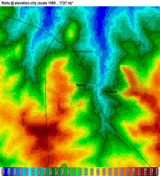
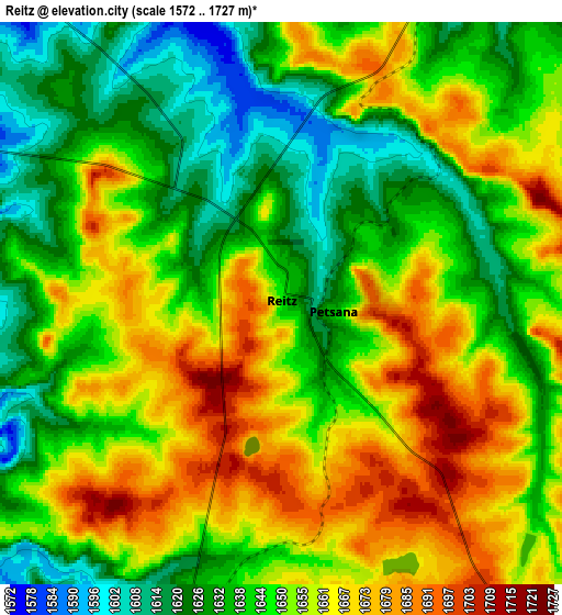
Below is the Elevation map of Reitz, which displays elevation range with different colors. Scale of the first map is from 1589 to 1727 m (5213 to 5666 ft) with average elevation of 1651.5 meters (=5418 ft) [note 1]
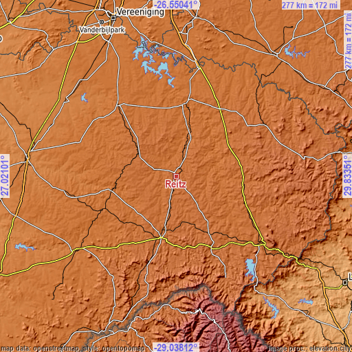
These maps also provides idea of topography and contour of this city, they are displayed at different zoom levels. More info about maps, scale and edge coordinates you can find below images.
| \ | Map #1 | Map #2 | Topo.Map |
| Scale [m] | 1589..1727 m | 1572..1727 m | × |
| Scale [ft] | 5213..5666 ft | 5157..5666 ft | × |
| Average | 1651.5 m = 5418 ft | 1649.3 m = 5411 ft | × |
| Width | 8.64 km = 5.4 mi | 17.29 km = 10.7 mi | 276.6 km = 171.9 mi |
| Height | 8.64 km = 5.4 mi | 17.29 km = 10.7 mi | 276.6 km = 171.9 mi |
| ↑Max Latitude | -27.7625° | -27.723607° | -26.55041° |
| Latitude at center | -27.80138° | -27.80138° | -27.80138° |
| ↓Min Latitude | -27.840246° | -27.879098° | -29.03812° |
| ← Min Longitude | 28.383315° | 28.339369° | 27.02101° |
| Longitude center | 28.42726° | 28.42726° | 28.42726° |
| →Max Longitude | 28.471205° | 28.515151° | 29.83351° |
Nearby cities:
Cities around Reitz sort by population:
• Kroonstad elevation 1399 m
118.6 km,  278°
278°
• Phuthaditjhaba 1671 m
88.9 km,  154°
154°
• Bethlehem 1630 m
49.2 km,  193°
193°
• Heilbron 1539 m
73.3 km,  322°
322°
• Senekal 1431 m
97.9 km,  233°
233°
• Harrismith 1643 m
86.6 km,  127°
127°
• Vrede 1678 m
83.9 km,  60°
60°
• Deneysville 1513 m
106.4 km,  342°
342°
• Lindley 1519 m
51.2 km,  260°
260°
• Koppies 1413 m
104.6 km,  306°
306°
• Villiers 1517 m
87.4 km,  11°
11°
• Frankfort 1545 m
58.5 km, 6°
Multilingual:
 En español:
Reitz elevación 1643 m.
 En France:
Reitz élévation 1643 m.


Sources and notes:
- [note 1] Map square and city borders are not equal. Map elevation data is calculated only from area inside that square.
- [src 1] Elevation data from geonames database provided with same terms of usage.
- [src 2] The elevation map of Reitz is generated using elevation data from NASA's 3 arcsec (90m) resolution SRTM data.
- [src 3] Base (background) map © OpenStreetMap contributors tiles are generated by Geofabrik and OpenTopoMap.
Copyright & License:
This Reitz Elevation Map is licensed under CC BY-SA. You may reuse any part from this page, if you give a proper credit by linking to this URL:
 More info on terms of use page.