Puerto Cabello elevation
Puerto Cabello (Carabobo, Municipio Puerto Cabello), Venezuela elevation is 49 meters and Puerto Cabello elevation in feet is 161 ft above sea level [src 1]. Puerto Cabello is a seat of a second-order administrative division (feature code) with elevation that is 332 meters (1089 ft) smaller than average city elevation in Venezuela.
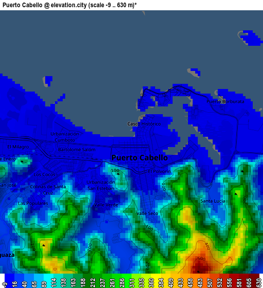
Below is the Elevation map of Puerto Cabello, which displays elevation range with different colors. Scale of the first map is from -9 to 630 m (-30 to 2067 ft) with average elevation of 96.8 meters (=318 ft) [note 1]
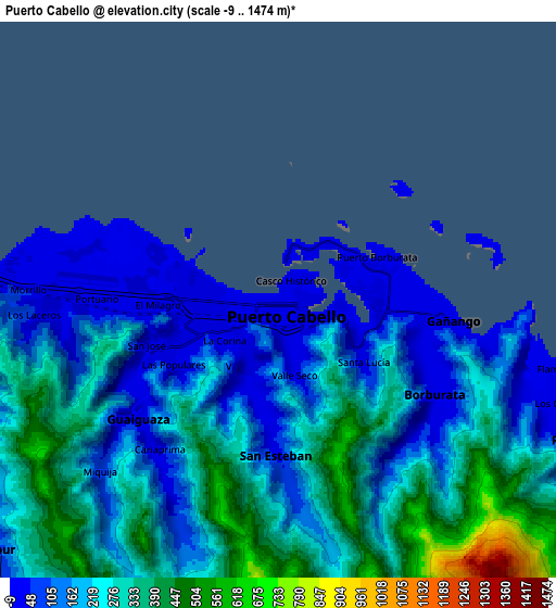
These maps also provides idea of topography and contour of this city, they are displayed at different zoom levels. More info about maps, scale and edge coordinates you can find below images.
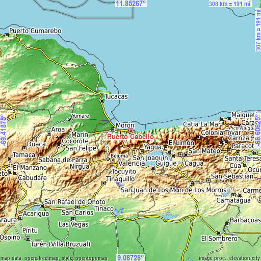
| \ | Map #1 | Map #2 | Topo.Map |
| Scale [m] | -9..630 m | -9..1474 m | × |
| Scale [ft] | -30..2067 ft | -30..4836 ft | × |
| Average | 96.8 m = 318 ft | 228.1 m = 748 ft | × |
| Width | 9.61 km = 6 mi | 19.22 km = 11.9 mi | 307.5 km = 191.1 mi |
| Height | 9.61 km = 6 mi | 19.22 km = 11.9 mi | 307.5 km = 191.1 mi |
| ↑Max Latitude | 10.51627° | 10.559474° | 11.85267° |
| Latitude at center | 10.47306° | 10.47306° | 10.47306° |
| ↓Min Latitude | 10.429844° | 10.386622° | 9.08728° |
| ← Min Longitude | -68.056445° | -68.100391° | -69.41875° |
| Longitude center | -68.0125° | -68.0125° | -68.0125° |
| →Max Longitude | -67.968555° | -67.924609° | -66.60625° |
Nearby cities:
Cities around Puerto Cabello sort by population:
• Valencia elevation 457 m
34.6 km,  179°
179°
• Guacara 442 m
31.2 km,  151°
151°
• Mariara 582 m
37.8 km,  121°
121°
• Morón 19 m
20.6 km,  274°
274°
• San Joaquín 533 m
33.6 km,  134°
134°
• Tacarigua 427 m
44.2 km,  166°
166°
• Bejuma 675 m
42.8 km,  219°
219°
• Tocuyito 538 m
40.4 km,  188°
188°
• Los Guayos 544 m
32.6 km, 165°
• Ocumare de la Costa 15 m
26.7 km,  92°
92°
• San Diego 471 m
24.5 km,  164°
164°
• Naguanagua 585 m
24.1 km, 181°
Multilingual:
 En español:
Puerto Cabello elevación 49 m.
 En France:
Puerto Cabello élévation 49 m.
 Auf Deutsch:
Puerto Cabello höhe über dem Meeresspiegel ist 49 m.
 На русском:
Пуерто Кабелло, Пуэрто-Кабельо высота над уровнем моря 49 м
Sources and notes:
- [note 1] Map square and city borders are not equal. Map elevation data is calculated only from area inside that square.
- [src 1] Elevation data from geonames database provided with same terms of usage.
- [src 2] The elevation map of Puerto Cabello is generated using elevation data from NASA's 3 arcsec (90m) resolution SRTM data.
- [src 3] Base (background) map © OpenStreetMap contributors tiles are generated by Geofabrik and OpenTopoMap.
Copyright & License:
This Puerto Cabello Elevation Map is licensed under CC BY-SA. You may reuse any part from this page, if you give a proper credit by linking to this URL:
 More info on terms of use page.