Skyline-Ganipa elevation
Skyline-Ganipa (New Mexico, Cibola County), United States elevation is 1901 meters and Skyline-Ganipa elevation in feet is 6237 ft above sea level [src 1]. Skyline-Ganipa is a populated place (feature code) with elevation that is 1622 meters (5322 ft) bigger than average city elevation in United States.
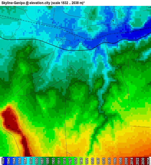
Below is the Elevation map of Skyline-Ganipa, which displays elevation range with different colors. Scale of the first map is from 1832 to 2038 m (6010 to 6686 ft) with average elevation of 1906.5 meters (=6255 ft) [note 1]
These maps also provides idea of topography and contour of this city, they are displayed at different zoom levels. More info about maps, scale and edge coordinates you can find below images.
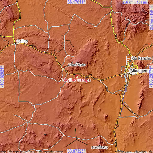
| \ | Map #1 | Topo.Map |
| Scale [m] | 1832..2038 m | × |
| Scale [ft] | 6010..6686 ft | × |
| Average | 1906.5 m = 6255 ft | × |
| Width | 8 km = 5 mi | 256.1 km = 159.1 mi |
| Height | 8 km = 5 mi | 256.1 km = 159.1 mi |
| ↑Max Latitude | 35.068766° | 36.17611° |
| Latitude at center | 35.03279° | 35.03279° |
| ↓Min Latitude | 34.996799° | 33.87325° |
| ← Min Longitude | -107.657905° | -109.02021° |
| Longitude center | -107.61396° | -107.61396° |
| →Max Longitude | -107.570015° | -106.20771° |
Nearby cities:
Cities around Skyline-Ganipa sort by population:
• South Valley elevation 1502 m
85.3 km,  91°
91°
• Los Lunas 1479 m
84.1 km,  107°
107°
• Grants 1970 m
25.2 km,  300°
300°
• Belen 1465 m
86.8 km,  118°
118°
• Los Chavez 1470 m
85.3 km, 113°
• Paradise Hills 1619 m
85.1 km,  77°
77°
• Bosque Farms 1485 m
85.2 km,  103°
103°
• Milan 1989 m
29.4 km, 301°
• Crownpoint 2129 m
86.7 km,  325°
325°
• Thoreau 2184 m
69 km,  306°
306°
• Laguna 1767 m
21 km, 88°
• Alamo 1885 m
68.7 km,  172°
172°
Multilingual:
 En español:
Skyline-Ganipa elevación 1901 m.
 En France:
Skyline-Ganipa élévation 1901 m.
 Auf Deutsch:
Skyline-Ganipa höhe über dem Meeresspiegel ist 1901 m.

Sources and notes:
- [note 1] Map square and city borders are not equal. Map elevation data is calculated only from area inside that square.
- [src 1] Elevation data from geonames database provided with same terms of usage.
- [src 2] The elevation map of Skyline-Ganipa is generated using elevation data from NASA's 3 arcsec (90m) resolution SRTM data.
- [src 3] Base (background) map © OpenStreetMap contributors tiles are generated by Geofabrik and OpenTopoMap.
Copyright & License:
This Skyline-Ganipa Elevation Map is licensed under CC BY-SA. You may reuse any part from this page, if you give a proper credit by linking to this URL:
 More info on terms of use page.