Los Chavez elevation
Los Chavez (New Mexico, Valencia County), United States elevation is 1470 meters and Los Chavez elevation in feet is 4823 ft above sea level [src 1]. Los Chavez is a populated place (feature code) with elevation that is 1191 meters (3907 ft) bigger than average city elevation in United States.
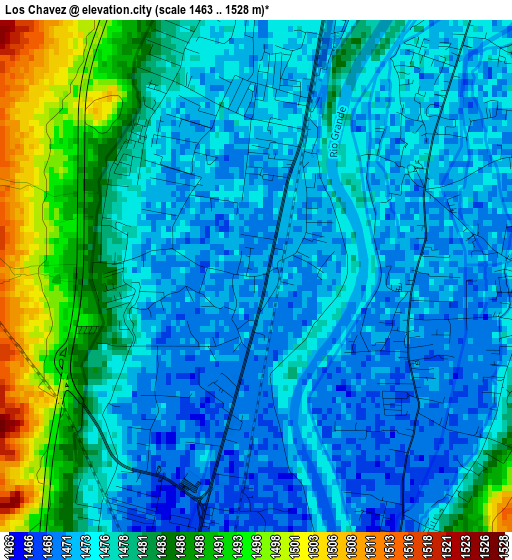
Below is the Elevation map of Los Chavez, which displays elevation range with different colors. Scale of the first map is from 1463 to 1528 m (4800 to 5013 ft) with average elevation of 1477.3 meters (=4847 ft) [note 1]
These maps also provides idea of topography and contour of this city, they are displayed at different zoom levels. More info about maps, scale and edge coordinates you can find below images.
| \ | Map #1 | Map #2 | Topo.Map |
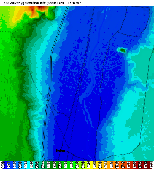
| Scale [m] | 1463..1528 m | 1459..1776 m | × |
| Scale [ft] | 4800..5013 ft | 4787..5827 ft | × |
| Average | 1477.3 m = 4847 ft | 1512.1 m = 4961 ft | × |
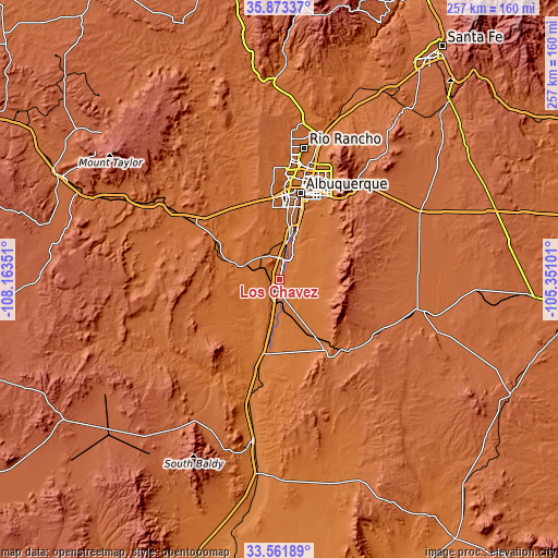
| Width | 8.03 km = 5 mi | 16.06 km = 10 mi | 257 km = 159.7 mi |
| Height | 8.03 km = 5 mi | 16.06 km = 10 mi | 257 km = 159.7 mi |
| ↑Max Latitude | 34.76182° | 34.797915° | 35.87337° |
| Latitude at center | 34.72571° | 34.72571° | 34.72571° |
| ↓Min Latitude | 34.689584° | 34.653442° | 33.56189° |
| ← Min Longitude | -106.801205° | -106.845151° | -108.16351° |
| Longitude center | -106.75726° | -106.75726° | -106.75726° |
| →Max Longitude | -106.713315° | -106.669369° | -105.35101° |
Nearby cities:
Cities around Los Chavez sort by population:
• Los Lunas elevation 1479 m
9.2 km,  13°
13°
• Belen 1465 m
7.2 km,  194°
194°
• Rio Communities 1470 m
8.7 km,  165°
165°
• El Cerro Mission 1538 m
11.1 km,  68°
68°
• Bosque Farms 1485 m
15.1 km,  18°
18°
• Peralta 1480 m
13.8 km,  26°
26°
• El Cerro 1477 m
4.2 km,  88°
88°
• Jarales 1460 m
12.5 km,  182°
182°
• Valencia 1477 m
9.7 km, 32°
• Tome 1471 m
3.1 km,  57°
57°
• Las Maravillas 1527 m
8.2 km,  80°
80°
• Monterey Park 1536 m
11.3 km, 70°
Multilingual:
 En español:
Los Chavez elevación 1470 m.
 En France:
Los Chavez élévation 1470 m.
 Auf Deutsch:
Los Chavez höhe über dem Meeresspiegel ist 1470 m.

Sources and notes:
- [note 1] Map square and city borders are not equal. Map elevation data is calculated only from area inside that square.
- [src 1] Elevation data from geonames database provided with same terms of usage.
- [src 2] The elevation map of Los Chavez is generated using elevation data from NASA's 3 arcsec (90m) resolution SRTM data.
- [src 3] Base (background) map © OpenStreetMap contributors tiles are generated by Geofabrik and OpenTopoMap.
Copyright & License:
This Los Chavez Elevation Map is licensed under CC BY-SA. You may reuse any part from this page, if you give a proper credit by linking to this URL:
 More info on terms of use page.