Fort Campbell North elevation
Fort Campbell North (Kentucky, Christian County), United States elevation is 166 meters and Fort Campbell North elevation in feet is 545 ft above sea level [src 1]. Fort Campbell North is a populated place (feature code) with elevation that is 113 meters (371 ft) smaller than average city elevation in United States.
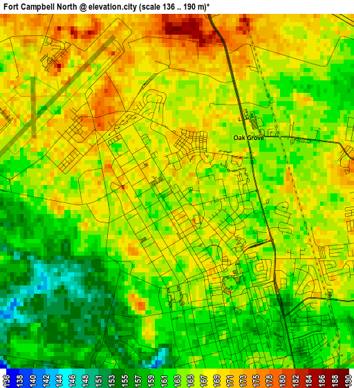
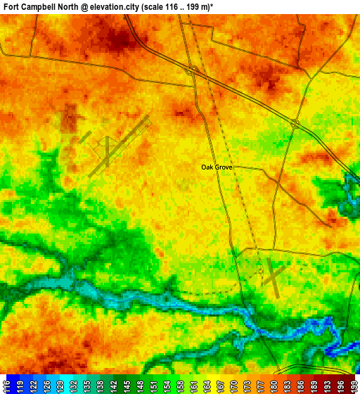
Below is the Elevation map of Fort Campbell North, which displays elevation range with different colors. Scale of the first map is from 136 to 190 m (446 to 623 ft) with average elevation of 165.3 meters (=542 ft) [note 1]
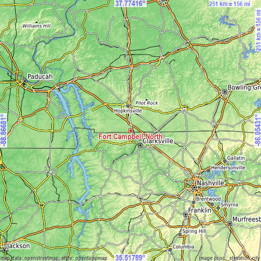
These maps also provides idea of topography and contour of this city, they are displayed at different zoom levels. More info about maps, scale and edge coordinates you can find below images.
| \ | Map #1 | Map #2 | Topo.Map |
| Scale [m] | 136..190 m | 116..199 m | × |
| Scale [ft] | 446..623 ft | 381..653 ft | × |
| Average | 165.3 m = 542 ft | 165.8 m = 544 ft | × |
| Width | 7.84 km = 4.9 mi | 15.68 km = 9.7 mi | 250.9 km = 155.9 mi |
| Height | 7.84 km = 4.9 mi | 15.68 km = 9.7 mi | 250.9 km = 155.9 mi |
| ↑Max Latitude | 36.689537° | 36.724768° | 37.77416° |
| Latitude at center | 36.65429° | 36.65429° | 36.65429° |
| ↓Min Latitude | 36.619027° | 36.583747° | 35.51789° |
| ← Min Longitude | -87.504505° | -87.548451° | -88.86681° |
| Longitude center | -87.46056° | -87.46056° | -87.46056° |
| →Max Longitude | -87.416615° | -87.372669° | -86.05431° |
Nearby cities:
Cities around Fort Campbell North sort by population:
• Clarksville elevation 145 m
16.5 km,  146°
146°
• Hopkinsville 159 m
23.7 km,  353°
353°
• Springfield 204 m
53.9 km,  107°
107°
• Oak Grove 166 m
2 km,  52°
52°
• Coopertown 223 m
50.2 km,  118°
118°
• Pleasant View 211 m
47.7 km,  127°
127°
• Cadiz 137 m
40.8 km,  305°
305°
• Elkton 190 m
32.3 km,  57°
57°
• Dover 128 m
38.5 km,  241°
241°
• Guthrie 168 m
26.2 km,  91°
91°
• Tennessee Ridge 229 m
47.2 km,  216°
216°
• Erin 136 m
42.8 km,  209°
209°
Multilingual:
 En español:
Fort Campbell North elevación 166 m.
 En France:
Fort Campbell North élévation 166 m.
 Auf Deutsch:
Fort Campbell North höhe über dem Meeresspiegel ist 166 m.
 На русском:
Fort Campbell North высота над уровнем моря 166 м
Sources and notes:
- [note 1] Map square and city borders are not equal. Map elevation data is calculated only from area inside that square.
- [src 1] Elevation data from geonames database provided with same terms of usage.
- [src 2] The elevation map of Fort Campbell North is generated using elevation data from NASA's 3 arcsec (90m) resolution SRTM data.
- [src 3] Base (background) map © OpenStreetMap contributors tiles are generated by Geofabrik and OpenTopoMap.
Copyright & License:
This Fort Campbell North Elevation Map is licensed under CC BY-SA. You may reuse any part from this page, if you give a proper credit by linking to this URL:
 More info on terms of use page.