Fountainhead-Orchard Hills elevation
Fountainhead-Orchard Hills (Maryland, Washington County), United States elevation is 193 meters and Fountainhead-Orchard Hills elevation in feet is 633 ft above sea level [src 1]. Fountainhead-Orchard Hills is a populated place (feature code) with elevation that is 86 meters (282 ft) smaller than average city elevation in United States.
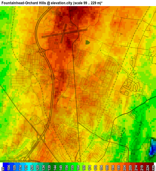
Below is the Elevation map of Fountainhead-Orchard Hills, which displays elevation range with different colors. Scale of the first map is from 99 to 229 m (325 to 751 ft) with average elevation of 183 meters (=600 ft) [note 1]
These maps also provides idea of topography and contour of this city, they are displayed at different zoom levels. More info about maps, scale and edge coordinates you can find below images.
| \ | Map #1 | Map #2 | Topo.Map |
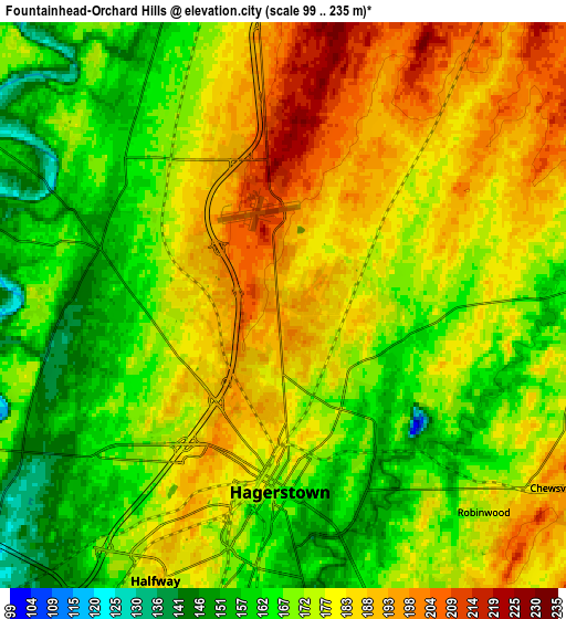
| Scale [m] | 99..229 m | 99..235 m | × |
| Scale [ft] | 325..751 ft | 325..771 ft | × |
| Average | 183 m = 600 ft | 175.2 m = 575 ft | × |
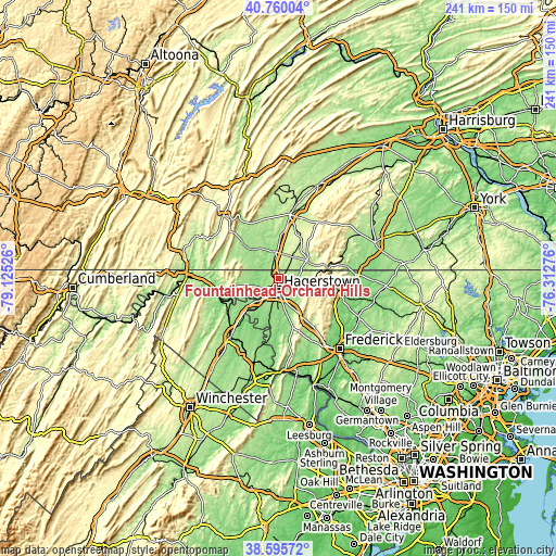
| Width | 7.52 km = 4.7 mi | 15.04 km = 9.3 mi | 240.6 km = 149.5 mi |
| Height | 7.52 km = 4.7 mi | 15.04 km = 9.3 mi | 240.6 km = 149.5 mi |
| ↑Max Latitude | 39.72017° | 39.753963° | 40.76004° |
| Latitude at center | 39.68636° | 39.68636° | 39.68636° |
| ↓Min Latitude | 39.652534° | 39.618691° | 38.59572° |
| ← Min Longitude | -77.762955° | -77.806901° | -79.12526° |
| Longitude center | -77.71901° | -77.71901° | -77.71901° |
| →Max Longitude | -77.675065° | -77.631119° | -76.31276° |
Nearby cities:
Cities around Fountainhead-Orchard Hills sort by population:
• Hagerstown elevation 168 m
5 km,  180°
180°
• Halfway 184 m
8.1 km,  205°
205°
• Robinwood 173 m
7.6 km,  135°
135°
• Greencastle 179 m
11.6 km,  356°
356°
• Maugansville 188 m
2.3 km,  288°
288°
• Smithsburg 234 m
13 km,  105°
105°
• Saint James 137 m
14.2 km,  193°
193°
• State Line 215 m
4.3 km,  353°
353°
• Paramount-Long Meadow 182 m
2.3 km, 106°
• Wilson-Conococheague 132 m
10.3 km,  249°
249°
• Williamsport 125 m
12.9 km,  222°
222°
• Cavetown 220 m
12.3 km, 112°
Multilingual:
 En español:
Fountainhead-Orchard Hills elevación 193 m.
 En France:
Fountainhead-Orchard Hills élévation 193 m.
 Auf Deutsch:
Fountainhead-Orchard Hills höhe über dem Meeresspiegel ist 193 m.
 На русском:
Fountainhead-Orchard Hills высота над уровнем моря 193 м
Sources and notes:
- [note 1] Map square and city borders are not equal. Map elevation data is calculated only from area inside that square.
- [src 1] Elevation data from geonames database provided with same terms of usage.
- [src 2] The elevation map of Fountainhead-Orchard Hills is generated using elevation data from NASA's 3 arcsec (90m) resolution SRTM data.
- [src 3] Base (background) map © OpenStreetMap contributors tiles are generated by Geofabrik and OpenTopoMap.
Copyright & License:
This Fountainhead-Orchard Hills Elevation Map is licensed under CC BY-SA. You may reuse any part from this page, if you give a proper credit by linking to this URL:
 More info on terms of use page.