Columbia Falls elevation
Columbia Falls (Montana, Flathead County), United States elevation is 938 meters and Columbia Falls elevation in feet is 3077 ft above sea level [src 1]. Columbia Falls is a populated place (feature code) with elevation that is 659 meters (2162 ft) bigger than average city elevation in United States.
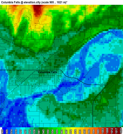
Below is the Elevation map of Columbia Falls, which displays elevation range with different colors. Scale of the first map is from 905 to 1021 m (2969 to 3350 ft) with average elevation of 937.5 meters (=3076 ft) [note 1]
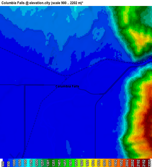
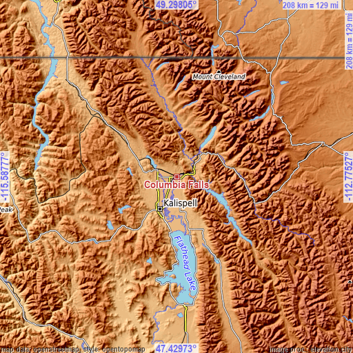
These maps also provides idea of topography and contour of this city, they are displayed at different zoom levels. More info about maps, scale and edge coordinates you can find below images.
| \ | Map #1 | Map #2 | Topo.Map |
| Scale [m] | 905..1021 m | 900..2202 m | × |
| Scale [ft] | 2969..3350 ft | 2953..7224 ft | × |
| Average | 937.5 m = 3076 ft | 1054.6 m = 3460 ft | × |
| Width | 6.49 km = 4 mi | 12.98 km = 8.1 mi | 207.7 km = 129.1 mi |
| Height | 6.49 km = 4 mi | 12.98 km = 8.1 mi | 207.7 km = 129.1 mi |
| ↑Max Latitude | 48.401644° | 48.430811° | 49.29805° |
| Latitude at center | 48.37246° | 48.37246° | 48.37246° |
| ↓Min Latitude | 48.343259° | 48.314042° | 47.42973° |
| ← Min Longitude | -114.225465° | -114.269411° | -115.58777° |
| Longitude center | -114.18152° | -114.18152° | -114.18152° |
| →Max Longitude | -114.137575° | -114.093629° | -112.77527° |
Nearby cities:
Cities around Columbia Falls sort by population:
• Kalispell elevation 904 m
21.9 km,  206°
206°
• Evergreen 891 m
17.7 km,  203°
203°
• Whitefish 928 m
12.3 km,  290°
290°
• Polson 892 m
75.5 km,  178°
178°
• Bigfork 908 m
35.3 km,  166°
166°
• Lakeside 888 m
39.4 km, 184°
• North Browning 1327 m
89.2 km,  75°
75°
• Pablo 939 m
86 km, 176°
• South Browning 1338 m
88.2 km, 77°
• Somers 892 m
32.6 km,  185°
185°
• Eureka 786 m
85.4 km,  311°
311°
• Browning 1331 m
88.5 km, 76°
Multilingual:
 En español:
Columbia Falls elevación 938 m.
 En France:
Columbia Falls élévation 938 m.
 Auf Deutsch:
Columbia Falls höhe über dem Meeresspiegel ist 938 m.

Sources and notes:
- [note 1] Map square and city borders are not equal. Map elevation data is calculated only from area inside that square.
- [src 1] Elevation data from geonames database provided with same terms of usage.
- [src 2] The elevation map of Columbia Falls is generated using elevation data from NASA's 3 arcsec (90m) resolution SRTM data.
- [src 3] Base (background) map © OpenStreetMap contributors tiles are generated by Geofabrik and OpenTopoMap.
Copyright & License:
This Columbia Falls Elevation Map is licensed under CC BY-SA. You may reuse any part from this page, if you give a proper credit by linking to this URL:
 More info on terms of use page.