Rotan elevation
Rotan (Texas, Fisher County), United States elevation is 595 meters and Rotan elevation in feet is 1952 ft above sea level [src 1]. Rotan is a populated place (feature code) with elevation that is 316 meters (1037 ft) bigger than average city elevation in United States.
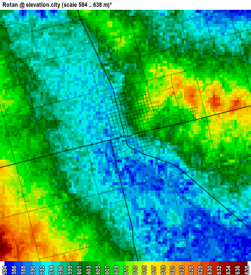
Below is the Elevation map of Rotan, which displays elevation range with different colors. Scale of the first map is from 584 to 638 m (1916 to 2093 ft) with average elevation of 601.1 meters (=1972 ft) [note 1]
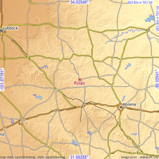
These maps also provides idea of topography and contour of this city, they are displayed at different zoom levels. More info about maps, scale and edge coordinates you can find below images.
| \ | Map #1 | Topo.Map |
| Scale [m] | 584..638 m | × |
| Scale [ft] | 1916..2093 ft | × |
| Average | 601.1 m = 1972 ft | × |
| Width | 8.21 km = 5.1 mi | 262.7 km = 163.2 mi |
| Height | 8.21 km = 5.1 mi | 262.7 km = 163.2 mi |
| ↑Max Latitude | 32.88896° | 34.02549° |
| Latitude at center | 32.85205° | 32.85205° |
| ↓Min Latitude | 32.815125° | 31.66288° |
| ← Min Longitude | -100.509605° | -101.87191° |
| Longitude center | -100.46566° | -100.46566° |
| →Max Longitude | -100.421715° | -99.05941° |
Nearby cities:
Cities around Rotan sort by population:
• Snyder elevation 709 m
44.8 km,  250°
250°
• Sweetwater 664 m
42.7 km,  172°
172°
• Colorado City 629 m
63.7 km,  215°
215°
• Stamford 497 m
62.7 km,  80°
80°
• Merkel 572 m
60 km,  135°
135°
• Anson 532 m
54.3 km,  101°
101°
• Hamlin 524 m
31.9 km, 83°
• Roscoe 728 m
45.7 km,  188°
188°
• Tye 549 m
70.8 km,  128°
128°
• Aspermont 545 m
38.4 km,  35°
35°
• Roby 600 m
14.5 km,  145°
145°
• Jayton 613 m
45.2 km,  347°
347°
Multilingual:
 En español:
Rotan elevación 595 m.
 En France:
Rotan élévation 595 m.


Sources and notes:
- [note 1] Map square and city borders are not equal. Map elevation data is calculated only from area inside that square.
- [src 1] Elevation data from geonames database provided with same terms of usage.
- [src 2] The elevation map of Rotan is generated using elevation data from NASA's 3 arcsec (90m) resolution SRTM data.
- [src 3] Base (background) map © OpenStreetMap contributors tiles are generated by Geofabrik and OpenTopoMap.
Copyright & License:
This Rotan Elevation Map is licensed under CC BY-SA. You may reuse any part from this page, if you give a proper credit by linking to this URL:
 More info on terms of use page.