Lamesa elevation
Lamesa (Texas, Dawson County), United States elevation is 911 meters and Lamesa elevation in feet is 2989 ft above sea level [src 1]. Lamesa is a seat of a second-order administrative division (feature code) with elevation that is 632 meters (2073 ft) bigger than average city elevation in United States.
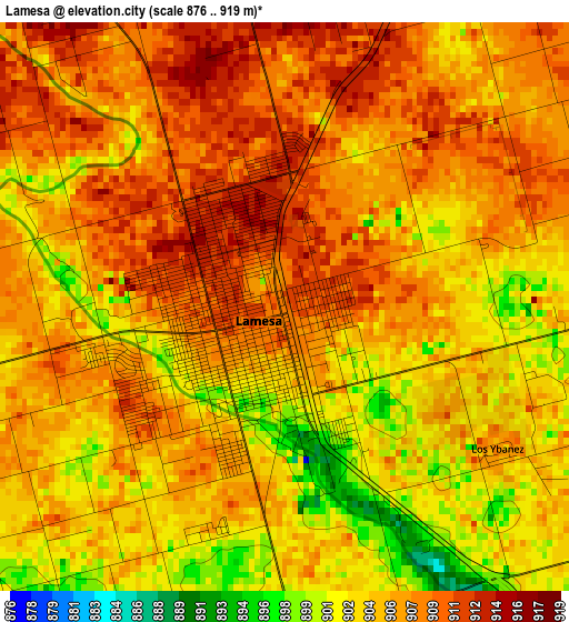
Below is the Elevation map of Lamesa, which displays elevation range with different colors. Scale of the first map is from 876 to 919 m (2874 to 3015 ft) with average elevation of 905.9 meters (=2972 ft) [note 1]
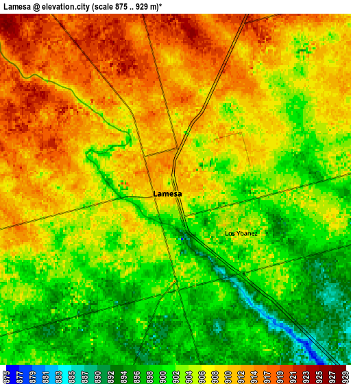
These maps also provides idea of topography and contour of this city, they are displayed at different zoom levels. More info about maps, scale and edge coordinates you can find below images.
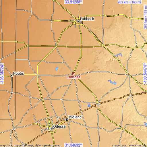
| \ | Map #1 | Map #2 | Topo.Map |
| Scale [m] | 876..919 m | 875..929 m | × |
| Scale [ft] | 2874..3015 ft | 2871..3048 ft | × |
| Average | 905.9 m = 2972 ft | 905.9 m = 2972 ft | × |
| Width | 8.22 km = 5.1 mi | 16.44 km = 10.2 mi | 263 km = 163.4 mi |
| Height | 8.22 km = 5.1 mi | 16.44 km = 10.2 mi | 263 km = 163.4 mi |
| ↑Max Latitude | 32.774557° | 32.811499° | 33.91258° |
| Latitude at center | 32.7376° | 32.7376° | 32.7376° |
| ↓Min Latitude | 32.700627° | 32.66364° | 31.54692° |
| ← Min Longitude | -101.994935° | -102.038881° | -103.35724° |
| Longitude center | -101.95099° | -101.95099° | -101.95099° |
| →Max Longitude | -101.907045° | -101.863099° | -100.54474° |
Nearby cities:
Cities around Lamesa sort by population:
• Midland elevation 862 m
83.2 km,  188°
188°
• Big Spring 747 m
70 km,  140°
140°
• Andrews 969 m
72.6 km,  230°
230°
• Brownfield 1010 m
57.8 km,  328°
328°
• Seminole 1008 m
64.9 km,  268°
268°
• Slaton 942 m
82.9 km,  20°
20°
• Post 795 m
73.4 km,  46°
46°
• Wolfforth 1012 m
85.6 km,  356°
356°
• Stanton 812 m
69.3 km,  167°
167°
• Seagraves 1024 m
61.8 km,  291°
291°
• Tahoka 944 m
49.9 km, 17°
• Gail 779 m
47.4 km,  85°
85°
Multilingual:
 En español:
Lamesa elevación 911 m.
 En France:
Lamesa élévation 911 m.


Sources and notes:
- [note 1] Map square and city borders are not equal. Map elevation data is calculated only from area inside that square.
- [src 1] Elevation data from geonames database provided with same terms of usage.
- [src 2] The elevation map of Lamesa is generated using elevation data from NASA's 3 arcsec (90m) resolution SRTM data.
- [src 3] Base (background) map © OpenStreetMap contributors tiles are generated by Geofabrik and OpenTopoMap.
Copyright & License:
This Lamesa Elevation Map is licensed under CC BY-SA. You may reuse any part from this page, if you give a proper credit by linking to this URL:
 More info on terms of use page.