Mesquite elevation
Mesquite (Nevada, Clark County), United States elevation is 493 meters and Mesquite elevation in feet is 1617 ft above sea level [src 1]. Mesquite is a populated place (feature code) with elevation that is 214 meters (702 ft) bigger than average city elevation in United States.
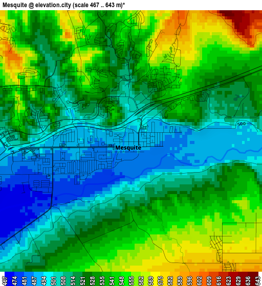
Below is the Elevation map of Mesquite, which displays elevation range with different colors. Scale of the first map is from 467 to 643 m (1532 to 2110 ft) with average elevation of 527.5 meters (=1731 ft) [note 1]
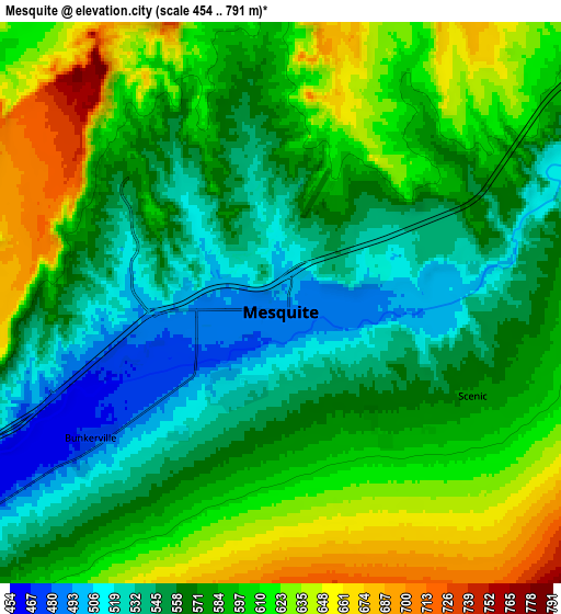
These maps also provides idea of topography and contour of this city, they are displayed at different zoom levels. More info about maps, scale and edge coordinates you can find below images.
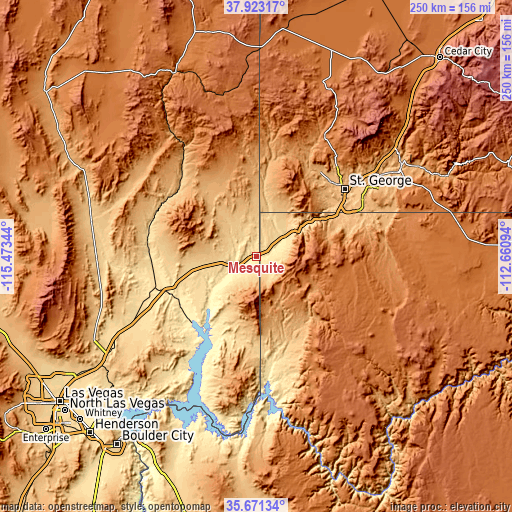
| \ | Map #1 | Map #2 | Topo.Map |
| Scale [m] | 467..643 m | 454..791 m | × |
| Scale [ft] | 1532..2110 ft | 1490..2595 ft | × |
| Average | 527.5 m = 1731 ft | 581.8 m = 1909 ft | × |
| Width | 7.82 km = 4.9 mi | 15.65 km = 9.7 mi | 250.4 km = 155.6 mi |
| Height | 7.82 km = 4.9 mi | 15.65 km = 9.7 mi | 250.4 km = 155.6 mi |
| ↑Max Latitude | 36.840708° | 36.875869° | 37.92317° |
| Latitude at center | 36.80553° | 36.80553° | 36.80553° |
| ↓Min Latitude | 36.770336° | 36.735126° | 35.67134° |
| ← Min Longitude | -114.111135° | -114.155081° | -115.47344° |
| Longitude center | -114.06719° | -114.06719° | -114.06719° |
| →Max Longitude | -114.023245° | -113.979299° | -112.66094° |
Nearby cities:
Cities around Mesquite sort by population:
• Saint George elevation 825 m
54.3 km,  52°
52°
• Washington 857 m
61.4 km, 53°
• Hurricane 991 m
80.3 km,  59°
59°
• Ivins 941 m
53.1 km,  40°
40°
• Moapa Valley 410 m
43.8 km,  235°
235°
• Santa Clara 848 m
51.7 km, 45°
• LaVerkin 978 m
83.4 km, 58°
• Beaver Dam 559 m
15.9 km, 48°
• Scenic 550 m
5 km,  105°
105°
• Toquerville 1033 m
85.5 km, 54°
• Bunkerville 468 m
6.5 km, 236°
• Moapa Town 491 m
48.9 km,  253°
253°
Multilingual:
 En español:
Mesquite elevación 493 m.
 En France:
Mesquite élévation 493 m.
 Auf Deutsch:
Mesquite höhe über dem Meeresspiegel ist 493 m.

Sources and notes:
- [note 1] Map square and city borders are not equal. Map elevation data is calculated only from area inside that square.
- [src 1] Elevation data from geonames database provided with same terms of usage.
- [src 2] The elevation map of Mesquite is generated using elevation data from NASA's 3 arcsec (90m) resolution SRTM data.
- [src 3] Base (background) map © OpenStreetMap contributors tiles are generated by Geofabrik and OpenTopoMap.
Copyright & License:
This Mesquite Elevation Map is licensed under CC BY-SA. You may reuse any part from this page, if you give a proper credit by linking to this URL:
 More info on terms of use page.