Ridgemark elevation
Ridgemark (California, San Benito County), United States elevation is 147 meters and Ridgemark elevation in feet is 482 ft above sea level [src 1]. Ridgemark is a populated place (feature code) with elevation that is 132 meters (433 ft) smaller than average city elevation in United States.
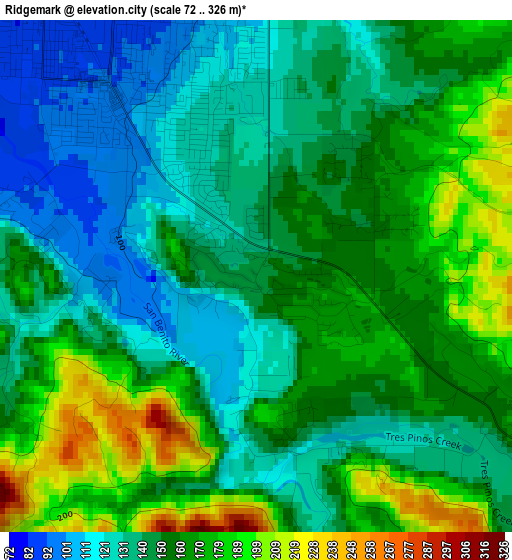
Below is the Elevation map of Ridgemark, which displays elevation range with different colors. Scale of the first map is from 72 to 326 m (236 to 1070 ft) with average elevation of 152.8 meters (=501 ft) [note 1]
These maps also provides idea of topography and contour of this city, they are displayed at different zoom levels. More info about maps, scale and edge coordinates you can find below images.
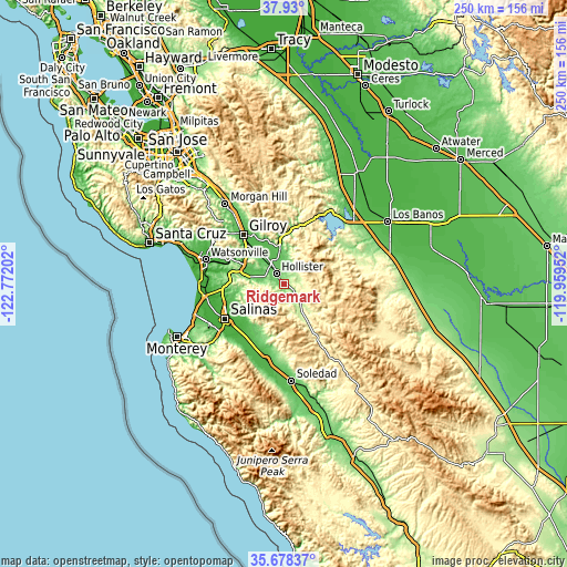
| \ | Map #1 | Topo.Map |
| Scale [m] | 72..326 m | × |
| Scale [ft] | 236..1070 ft | × |
| Average | 152.8 m = 501 ft | × |
| Width | 7.82 km = 4.9 mi | 250.4 km = 155.6 mi |
| Height | 7.82 km = 4.9 mi | 250.4 km = 155.6 mi |
| ↑Max Latitude | 36.847635° | 37.93° |
| Latitude at center | 36.81246° | 36.81246° |
| ↓Min Latitude | 36.777269° | 35.67837° |
| ← Min Longitude | -121.409715° | -122.77202° |
| Longitude center | -121.36577° | -121.36577° |
| →Max Longitude | -121.321825° | -119.95952° |
Nearby cities:
Cities around Ridgemark sort by population:
• Salinas elevation 17 m
29.8 km,  239°
239°
• Gilroy 60 m
28 km,  320°
320°
• Hollister 85 m
5.5 km, 324°
• Prunedale 25 m
27.4 km,  261°
261°
• Gonzales 44 m
34.7 km,  191°
191°
• Castroville 4 m
35.3 km, 261°
• Las Lomas 12 m
33.4 km,  280°
280°
• Aromas 39 m
26.1 km,  288°
288°
• San Juan Bautista 63 m
15.8 km, 283°
• Boronda 15 m
30.3 km,  245°
245°
• Elkhorn -1 m
33.4 km,  272°
272°
• Chualar 36 m
30.2 km,  206°
206°
Multilingual:
 En español:
Ridgemark elevación 147 m.
 En France:
Ridgemark élévation 147 m.
 Auf Deutsch:
Ridgemark höhe über dem Meeresspiegel ist 147 m.

Sources and notes:
- [note 1] Map square and city borders are not equal. Map elevation data is calculated only from area inside that square.
- [src 1] Elevation data from geonames database provided with same terms of usage.
- [src 2] The elevation map of Ridgemark is generated using elevation data from NASA's 3 arcsec (90m) resolution SRTM data.
- [src 3] Base (background) map © OpenStreetMap contributors tiles are generated by Geofabrik and OpenTopoMap.
Copyright & License:
This Ridgemark Elevation Map is licensed under CC BY-SA. You may reuse any part from this page, if you give a proper credit by linking to this URL:
 More info on terms of use page.