Bethel elevation
Bethel (Connecticut, Fairfield County), United States elevation is 121 meters and Bethel elevation in feet is 397 ft above sea level [src 1]. Bethel is a populated place (feature code) with elevation that is 158 meters (518 ft) smaller than average city elevation in United States.
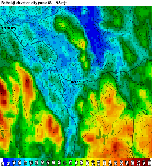
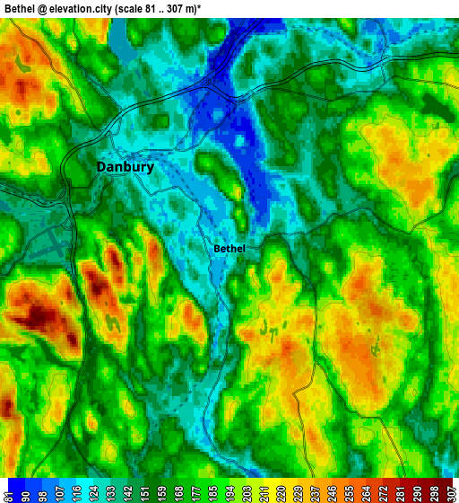
Below is the Elevation map of Bethel, which displays elevation range with different colors. Scale of the first map is from 86 to 288 m (282 to 945 ft) with average elevation of 159.7 meters (=524 ft) [note 1]
These maps also provides idea of topography and contour of this city, they are displayed at different zoom levels. More info about maps, scale and edge coordinates you can find below images.
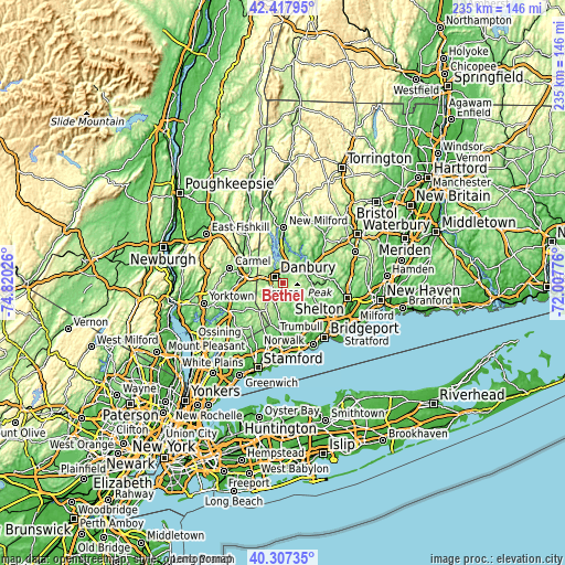
| \ | Map #1 | Map #2 | Topo.Map |
| Scale [m] | 86..288 m | 81..307 m | × |
| Scale [ft] | 282..945 ft | 266..1007 ft | × |
| Average | 159.7 m = 524 ft | 172.4 m = 566 ft | × |
| Width | 7.33 km = 4.6 mi | 14.67 km = 9.1 mi | 234.7 km = 145.8 mi |
| Height | 7.33 km = 4.6 mi | 14.67 km = 9.1 mi | 234.7 km = 145.8 mi |
| ↑Max Latitude | 41.40418° | 41.437133° | 42.41795° |
| Latitude at center | 41.37121° | 41.37121° | 41.37121° |
| ↓Min Latitude | 41.338223° | 41.30522° | 40.30735° |
| ← Min Longitude | -73.457955° | -73.501901° | -74.82026° |
| Longitude center | -73.41401° | -73.41401° | -73.41401° |
| →Max Longitude | -73.370065° | -73.326119° | -72.00776° |
Nearby cities:
Cities around Bethel sort by population:
• Danbury elevation 126 m
4.2 km,  308°
308°
• Wilton 86 m
19.7 km,  185°
185°
• New Fairfield 181 m
12.2 km,  330°
330°
• Ridgefield 226 m
12.2 km,  215°
215°
• Easton 122 m
16.4 km,  143°
143°
• Putnam Lake 159 m
15 km, 312°
• Heritage Village 104 m
19.4 km,  49°
49°
• Brewster 150 m
17.2 km,  279°
279°
• Brewster Hill 192 m
16.9 km,  290°
290°
• Newtown 145 m
10.4 km,  62°
62°
• Georgetown 112 m
13 km, 187°
• Peach Lake 175 m
13.7 km,  268°
268°
Multilingual:
 En español:
Bethel elevación 121 m.
 En France:
Bethel élévation 121 m.


Sources and notes:
- [note 1] Map square and city borders are not equal. Map elevation data is calculated only from area inside that square.
- [src 1] Elevation data from geonames database provided with same terms of usage.
- [src 2] The elevation map of Bethel is generated using elevation data from NASA's 3 arcsec (90m) resolution SRTM data.
- [src 3] Base (background) map © OpenStreetMap contributors tiles are generated by Geofabrik and OpenTopoMap.
Copyright & License:
This Bethel Elevation Map is licensed under CC BY-SA. You may reuse any part from this page, if you give a proper credit by linking to this URL:
 More info on terms of use page.