Ridgefield elevation
Ridgefield (Connecticut, Fairfield County), United States elevation is 226 meters and Ridgefield elevation in feet is 741 ft above sea level [src 1]. Ridgefield is a populated place (feature code) with elevation that is 53 meters (174 ft) smaller than average city elevation in United States.
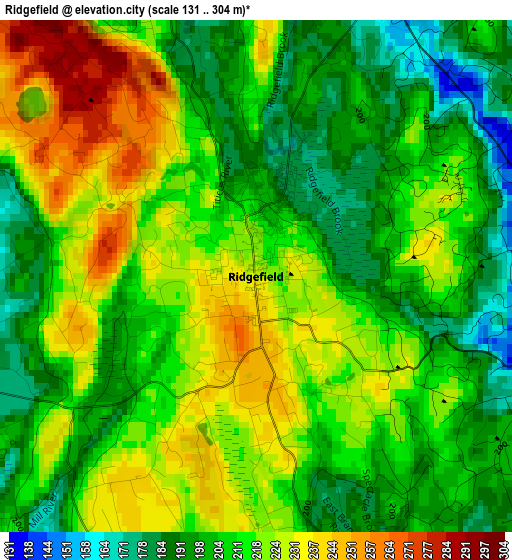
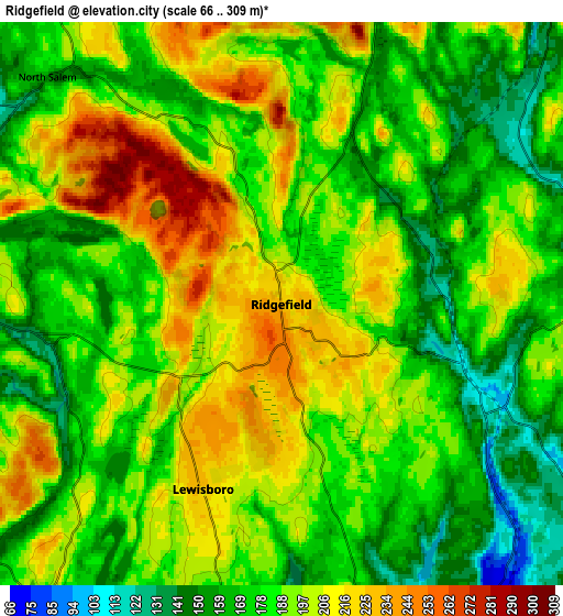
Below is the Elevation map of Ridgefield, which displays elevation range with different colors. Scale of the first map is from 131 to 304 m (430 to 997 ft) with average elevation of 212.4 meters (=697 ft) [note 1]
These maps also provides idea of topography and contour of this city, they are displayed at different zoom levels. More info about maps, scale and edge coordinates you can find below images.
| \ | Map #1 | Map #2 | Topo.Map |
| Scale [m] | 131..304 m | 66..309 m | × |
| Scale [ft] | 430..997 ft | 217..1014 ft | × |
| Average | 212.4 m = 697 ft | 187.7 m = 616 ft | × |
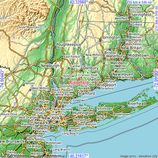
| Width | 7.34 km = 4.6 mi | 14.69 km = 9.1 mi | 235 km = 146 mi |
| Height | 7.34 km = 4.6 mi | 14.69 km = 9.1 mi | 235 km = 146 mi |
| ↑Max Latitude | 41.314496° | 41.347494° | 42.32968° |
| Latitude at center | 41.28148° | 41.28148° | 41.28148° |
| ↓Min Latitude | 41.248448° | 41.215399° | 40.21617° |
| ← Min Longitude | -73.542125° | -73.586071° | -74.90443° |
| Longitude center | -73.49818° | -73.49818° | -73.49818° |
| →Max Longitude | -73.454235° | -73.410289° | -72.09193° |
Nearby cities:
Cities around Ridgefield sort by population:
• North Stamford elevation 76 m
16.4 km,  193°
193°
• Danbury 126 m
13.1 km,  16°
16°
• New Canaan 97 m
15 km,  178°
178°
• Wilton 86 m
10.8 km,  152°
152°
• Bethel 121 m
12.2 km,  35°
35°
• Pound Ridge 191 m
10.3 km,  218°
218°
• Brewster 150 m
16.3 km,  322°
322°
• Bedford 118 m
14.9 km,  234°
234°
• Georgetown 112 m
6 km,  118°
118°
• Katonah 79 m
15.8 km,  260°
260°
• Goldens Bridge 72 m
15 km,  275°
275°
• Peach Lake 175 m
11.7 km,  325°
325°
Multilingual:
 En español:
Ridgefield elevación 226 m.
 En France:
Ridgefield élévation 226 m.
 Auf Deutsch:
Ridgefield höhe über dem Meeresspiegel ist 226 m.

Sources and notes:
- [note 1] Map square and city borders are not equal. Map elevation data is calculated only from area inside that square.
- [src 1] Elevation data from geonames database provided with same terms of usage.
- [src 2] The elevation map of Ridgefield is generated using elevation data from NASA's 3 arcsec (90m) resolution SRTM data.
- [src 3] Base (background) map © OpenStreetMap contributors tiles are generated by Geofabrik and OpenTopoMap.
Copyright & License:
This Ridgefield Elevation Map is licensed under CC BY-SA. You may reuse any part from this page, if you give a proper credit by linking to this URL:
 More info on terms of use page.