Pound Ridge elevation
Pound Ridge (New York, Westchester County), United States elevation is 191 meters and Pound Ridge elevation in feet is 627 ft above sea level [src 1]. Pound Ridge is a populated place (feature code) with elevation that is 88 meters (289 ft) smaller than average city elevation in United States.
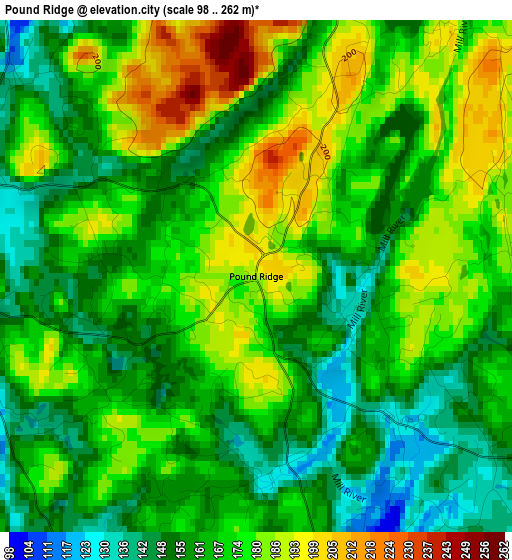
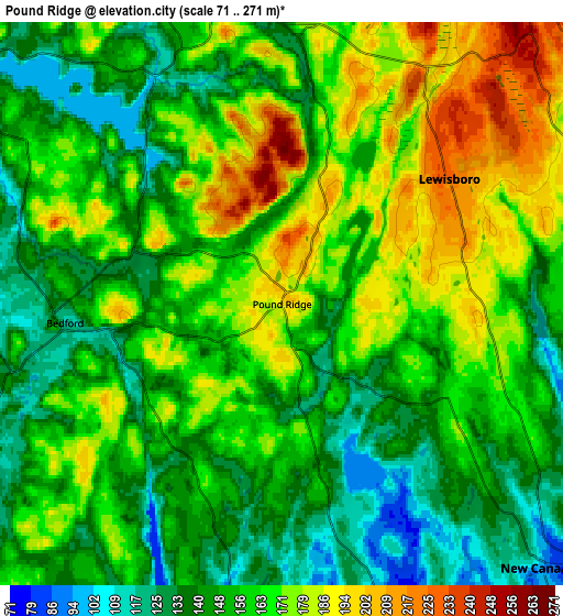
Below is the Elevation map of Pound Ridge, which displays elevation range with different colors. Scale of the first map is from 98 to 262 m (322 to 860 ft) with average elevation of 168.6 meters (=553 ft) [note 1]
These maps also provides idea of topography and contour of this city, they are displayed at different zoom levels. More info about maps, scale and edge coordinates you can find below images.
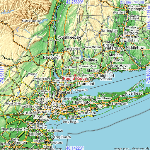
| \ | Map #1 | Map #2 | Topo.Map |
| Scale [m] | 98..262 m | 71..271 m | × |
| Scale [ft] | 322..860 ft | 233..889 ft | × |
| Average | 168.6 m = 553 ft | 158.7 m = 521 ft | × |
| Width | 7.35 km = 4.6 mi | 14.7 km = 9.1 mi | 235.3 km = 146.2 mi |
| Height | 7.35 km = 4.6 mi | 14.7 km = 9.1 mi | 235.3 km = 146.2 mi |
| ↑Max Latitude | 41.241762° | 41.274798° | 42.25809° |
| Latitude at center | 41.20871° | 41.20871° | 41.20871° |
| ↓Min Latitude | 41.175641° | 41.142555° | 40.14223° |
| ← Min Longitude | -73.618795° | -73.662741° | -74.9811° |
| Longitude center | -73.57485° | -73.57485° | -73.57485° |
| →Max Longitude | -73.530905° | -73.486959° | -72.1686° |
Nearby cities:
Cities around Pound Ridge sort by population:
• North Stamford elevation 76 m
8.3 km,  161°
161°
• New Canaan 97 m
9.6 km,  135°
135°
• Wilton 86 m
11.6 km,  97°
97°
• North Castle 190 m
11.9 km,  230°
230°
• Mount Kisco 102 m
12.7 km,  267°
267°
• Ridgefield 226 m
10.3 km,  38°
38°
• Armonk 125 m
14.8 km, 231°
• Bedford Hills 113 m
10.5 km,  287°
287°
• Bedford 118 m
5.8 km, 265°
• Georgetown 112 m
12.8 km,  65°
65°
• Katonah 79 m
10.8 km,  301°
301°
• Goldens Bridge 72 m
12.7 km,  317°
317°
Multilingual:
 En español:
Pound Ridge elevación 191 m.
 En France:
Pound Ridge élévation 191 m.
 Auf Deutsch:
Pound Ridge höhe über dem Meeresspiegel ist 191 m.

Sources and notes:
- [note 1] Map square and city borders are not equal. Map elevation data is calculated only from area inside that square.
- [src 1] Elevation data from geonames database provided with same terms of usage.
- [src 2] The elevation map of Pound Ridge is generated using elevation data from NASA's 3 arcsec (90m) resolution SRTM data.
- [src 3] Base (background) map © OpenStreetMap contributors tiles are generated by Geofabrik and OpenTopoMap.
Copyright & License:
This Pound Ridge Elevation Map is licensed under CC BY-SA. You may reuse any part from this page, if you give a proper credit by linking to this URL:
 More info on terms of use page.