Weyauwega elevation
Weyauwega (Wisconsin, Waupaca County), United States elevation is 244 meters and Weyauwega elevation in feet is 801 ft above sea level [src 1]. Weyauwega is a populated place (feature code) with elevation that is 35 meters (115 ft) smaller than average city elevation in United States.
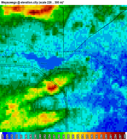
Below is the Elevation map of Weyauwega, which displays elevation range with different colors. Scale of the first map is from 226 to 300 m (741 to 984 ft) with average elevation of 245.1 meters (=804 ft) [note 1]
These maps also provides idea of topography and contour of this city, they are displayed at different zoom levels. More info about maps, scale and edge coordinates you can find below images.
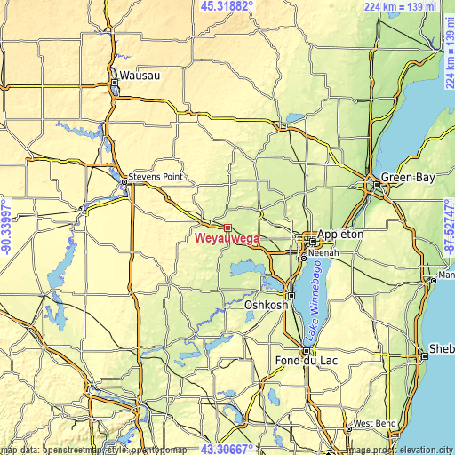
| \ | Map #1 | Topo.Map |
| Scale [m] | 226..300 m | × |
| Scale [ft] | 741..984 ft | × |
| Average | 245.1 m = 804 ft | × |
| Width | 6.99 km = 4.3 mi | 223.7 km = 139 mi |
| Height | 6.99 km = 4.3 mi | 223.7 km = 139 mi |
| ↑Max Latitude | 44.352801° | 45.31882° |
| Latitude at center | 44.32137° | 44.32137° |
| ↓Min Latitude | 44.289922° | 43.30667° |
| ← Min Longitude | -88.977665° | -90.33997° |
| Longitude center | -88.93372° | -88.93372° |
| →Max Longitude | -88.889775° | -87.52747° |
Nearby cities:
Cities around Weyauwega sort by population:
• New London elevation 235 m
17.3 km,  62°
62°
• Waupaca 259 m
12.8 km,  288°
288°
• Clintonville 252 m
35.9 km,  22°
22°
• Omro 231 m
34.8 km,  154°
154°
• Hortonville 245 m
23.6 km,  86°
86°
• Winneconne 231 m
29.3 km,  143°
143°
• Redgranite 242 m
33.7 km,  202°
202°
• King 276 m
16.6 km,  276°
276°
• Manawa 251 m
15.9 km,  3°
3°
• Iola 291 m
26 km,  322°
322°
• Mount Morris 274 m
30.8 km,  221°
221°
• Amherst 321 m
31.4 km,  297°
297°
Multilingual:
 En español:
Weyauwega elevación 244 m.
 En France:
Weyauwega élévation 244 m.
 Auf Deutsch:
Weyauwega höhe über dem Meeresspiegel ist 244 m.

Sources and notes:
- [note 1] Map square and city borders are not equal. Map elevation data is calculated only from area inside that square.
- [src 1] Elevation data from geonames database provided with same terms of usage.
- [src 2] The elevation map of Weyauwega is generated using elevation data from NASA's 3 arcsec (90m) resolution SRTM data.
- [src 3] Base (background) map © OpenStreetMap contributors tiles are generated by Geofabrik and OpenTopoMap.
Copyright & License:
This Weyauwega Elevation Map is licensed under CC BY-SA. You may reuse any part from this page, if you give a proper credit by linking to this URL:
 More info on terms of use page.