Jefferson elevation
Jefferson (Wisconsin, Jefferson County), United States elevation is 246 meters and Jefferson elevation in feet is 807 ft above sea level [src 1]. Jefferson is a seat of a second-order administrative division (feature code) with elevation that is 33 meters (108 ft) smaller than average city elevation in United States.
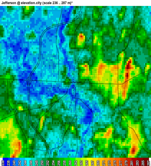
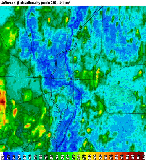
Below is the Elevation map of Jefferson, which displays elevation range with different colors. Scale of the first map is from 236 to 287 m (774 to 942 ft) with average elevation of 250.5 meters (=822 ft) [note 1]
These maps also provides idea of topography and contour of this city, they are displayed at different zoom levels. More info about maps, scale and edge coordinates you can find below images.
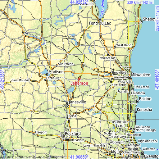
| \ | Map #1 | Map #2 | Topo.Map |
| Scale [m] | 236..287 m | 235..311 m | × |
| Scale [ft] | 774..942 ft | 771..1020 ft | × |
| Average | 250.5 m = 822 ft | 252.4 m = 828 ft | × |
| Width | 7.15 km = 4.4 mi | 14.29 km = 8.9 mi | 228.7 km = 142.1 mi |
| Height | 7.15 km = 4.4 mi | 14.29 km = 8.9 mi | 228.7 km = 142.1 mi |
| ↑Max Latitude | 43.037688° | 43.0698° | 44.02532° |
| Latitude at center | 43.00556° | 43.00556° | 43.00556° |
| ↓Min Latitude | 42.973415° | 42.941253° | 41.96859° |
| ← Min Longitude | -88.851275° | -88.895221° | -90.21358° |
| Longitude center | -88.80733° | -88.80733° | -88.80733° |
| →Max Longitude | -88.763385° | -88.719439° | -87.40108° |
Nearby cities:
Cities around Jefferson sort by population:
• Watertown elevation 262 m
22 km,  16°
16°
• Whitewater 252 m
20.1 km,  162°
162°
• Fort Atkinson 240 m
8.9 km,  195°
195°
• Lake Mills 256 m
12 km,  314°
314°
• Johnson Creek 247 m
8.3 km, 18°
• Deerfield 268 m
22.4 km,  283°
283°
• Concord 268 m
18.4 km,  67°
67°
• Lake Ripley 266 m
14.5 km,  270°
270°
• Cambridge 260 m
17 km, 269°
• Aztalan 263 m
8.7 km,  329°
329°
• Lake Koshkonong 240 m
14 km,  220°
220°
• Milford 246 m
11.1 km,  343°
343°
Multilingual:
 En español:
Jefferson elevación 246 m.
 En France:
Jefferson élévation 246 m.
 Auf Deutsch:
Jefferson höhe über dem Meeresspiegel ist 246 m.

Sources and notes:
- [note 1] Map square and city borders are not equal. Map elevation data is calculated only from area inside that square.
- [src 1] Elevation data from geonames database provided with same terms of usage.
- [src 2] The elevation map of Jefferson is generated using elevation data from NASA's 3 arcsec (90m) resolution SRTM data.
- [src 3] Base (background) map © OpenStreetMap contributors tiles are generated by Geofabrik and OpenTopoMap.
Copyright & License:
This Jefferson Elevation Map is licensed under CC BY-SA. You may reuse any part from this page, if you give a proper credit by linking to this URL:
 More info on terms of use page.