Concord elevation
Concord (Wisconsin, Jefferson County), United States elevation is 268 meters and Concord elevation in feet is 879 ft above sea level [src 1]. Concord is a populated place (feature code) with elevation that is 11 meters (36 ft) smaller than average city elevation in United States.
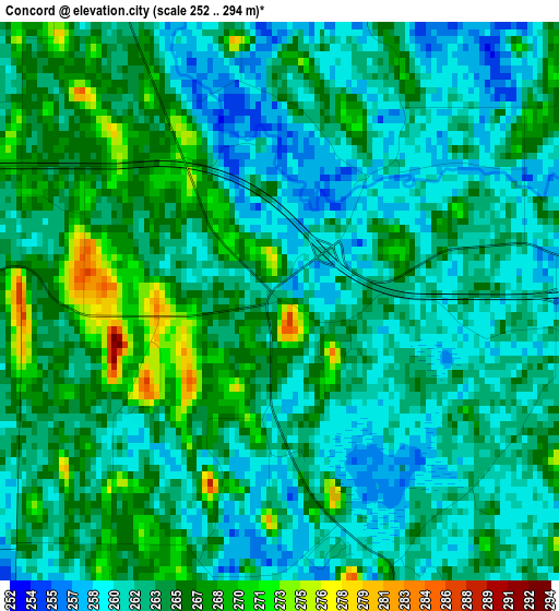
Below is the Elevation map of Concord, which displays elevation range with different colors. Scale of the first map is from 252 to 294 m (827 to 965 ft) with average elevation of 263.4 meters (=864 ft) [note 1]
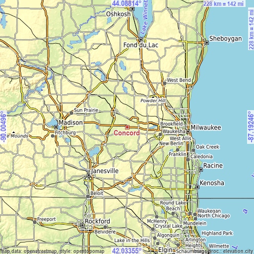
These maps also provides idea of topography and contour of this city, they are displayed at different zoom levels. More info about maps, scale and edge coordinates you can find below images.
| \ | Map #1 | Topo.Map |
| Scale [m] | 252..294 m | × |
| Scale [ft] | 827..965 ft | × |
| Average | 263.4 m = 864 ft | × |
| Width | 7.14 km = 4.4 mi | 228.4 km = 141.9 mi |
| Height | 7.14 km = 4.4 mi | 228.4 km = 141.9 mi |
| ↑Max Latitude | 43.101545° | 44.08814° |
| Latitude at center | 43.06945° | 43.06945° |
| ↓Min Latitude | 43.037338° | 42.03355° |
| ← Min Longitude | -88.642655° | -90.00496° |
| Longitude center | -88.59871° | -88.59871° |
| →Max Longitude | -88.554765° | -87.19246° |
Nearby cities:
Cities around Concord sort by population:
• Watertown elevation 262 m
17.5 km,  322°
322°
• Oconomowoc 264 m
9.3 km,  59°
59°
• Hartland 289 m
21.2 km,  79°
79°
• Jefferson 246 m
18.4 km,  247°
247°
• Delafield 277 m
15.9 km,  93°
93°
• Okauchee Lake 267 m
14.2 km, 64°
• Johnson Creek 247 m
14.3 km,  272°
272°
• Wales 305 m
19.4 km,  111°
111°
• Dousman 265 m
11.9 km,  120°
120°
• Ixonia 266 m
8.3 km,  0°
0°
• Nashotah 292 m
16.3 km, 78°
• Milford 246 m
20.4 km,  279°
279°
Multilingual:
 En español:
Concord elevación 268 m.
 En France:
Concord élévation 268 m.


Sources and notes:
- [note 1] Map square and city borders are not equal. Map elevation data is calculated only from area inside that square.
- [src 1] Elevation data from geonames database provided with same terms of usage.
- [src 2] The elevation map of Concord is generated using elevation data from NASA's 3 arcsec (90m) resolution SRTM data.
- [src 3] Base (background) map © OpenStreetMap contributors tiles are generated by Geofabrik and OpenTopoMap.
Copyright & License:
This Concord Elevation Map is licensed under CC BY-SA. You may reuse any part from this page, if you give a proper credit by linking to this URL:
 More info on terms of use page.