Fort Atkinson elevation
Fort Atkinson (Wisconsin, Jefferson County), United States elevation is 240 meters and Fort Atkinson elevation in feet is 787 ft above sea level [src 1]. Fort Atkinson is a populated place (feature code) with elevation that is 39 meters (128 ft) smaller than average city elevation in United States.
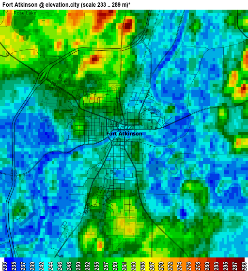
Below is the Elevation map of Fort Atkinson, which displays elevation range with different colors. Scale of the first map is from 233 to 289 m (764 to 948 ft) with average elevation of 248 meters (=814 ft) [note 1]
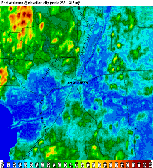
These maps also provides idea of topography and contour of this city, they are displayed at different zoom levels. More info about maps, scale and edge coordinates you can find below images.
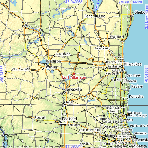
| \ | Map #1 | Map #2 | Topo.Map |
| Scale [m] | 233..289 m | 233..315 m | × |
| Scale [ft] | 764..948 ft | 764..1033 ft | × |
| Average | 248 m = 814 ft | 252.2 m = 827 ft | × |
| Width | 7.16 km = 4.4 mi | 14.31 km = 8.9 mi | 229 km = 142.3 mi |
| Height | 7.16 km = 4.4 mi | 14.31 km = 8.9 mi | 229 km = 142.3 mi |
| ↑Max Latitude | 42.961058° | 42.99321° | 43.94993° |
| Latitude at center | 42.92889° | 42.92889° | 42.92889° |
| ↓Min Latitude | 42.896705° | 42.864503° | 41.89064° |
| ← Min Longitude | -88.880995° | -88.924941° | -90.2433° |
| Longitude center | -88.83705° | -88.83705° | -88.83705° |
| →Max Longitude | -88.793105° | -88.749159° | -87.4308° |
Nearby cities:
Cities around Fort Atkinson sort by population:
• Whitewater elevation 252 m
13.6 km,  141°
141°
• Jefferson 246 m
8.9 km,  15°
15°
• Lake Mills 256 m
18 km,  340°
340°
• Milton 274 m
19.1 km,  207°
207°
• Edgerton 253 m
21.5 km,  241°
241°
• Johnson Creek 247 m
17.1 km, 17°
• Lake Ripley 266 m
14.8 km,  305°
305°
• Palmyra 260 m
21.2 km,  105°
105°
• Cambridge 260 m
16.8 km,  299°
299°
• Aztalan 263 m
16.1 km,  352°
352°
• Lake Koshkonong 240 m
7 km,  252°
252°
• Milford 246 m
19.1 km,  357°
357°
Multilingual:
 En español:
Fort Atkinson elevación 240 m.
 En France:
Fort Atkinson élévation 240 m.
 Auf Deutsch:
Fort Atkinson höhe über dem Meeresspiegel ist 240 m.

Sources and notes:
- [note 1] Map square and city borders are not equal. Map elevation data is calculated only from area inside that square.
- [src 1] Elevation data from geonames database provided with same terms of usage.
- [src 2] The elevation map of Fort Atkinson is generated using elevation data from NASA's 3 arcsec (90m) resolution SRTM data.
- [src 3] Base (background) map © OpenStreetMap contributors tiles are generated by Geofabrik and OpenTopoMap.
Copyright & License:
This Fort Atkinson Elevation Map is licensed under CC BY-SA. You may reuse any part from this page, if you give a proper credit by linking to this URL:
 More info on terms of use page.