Hustisford elevation
Hustisford (Wisconsin, Dodge County), United States elevation is 266 meters and Hustisford elevation in feet is 873 ft above sea level [src 1]. Hustisford is a populated place (feature code) with elevation that is 13 meters (43 ft) smaller than average city elevation in United States.
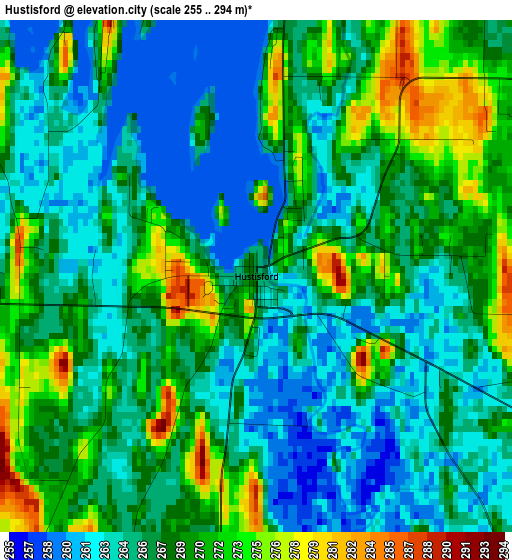
Below is the Elevation map of Hustisford, which displays elevation range with different colors. Scale of the first map is from 255 to 294 m (837 to 965 ft) with average elevation of 266.7 meters (=875 ft) [note 1]
These maps also provides idea of topography and contour of this city, they are displayed at different zoom levels. More info about maps, scale and edge coordinates you can find below images.
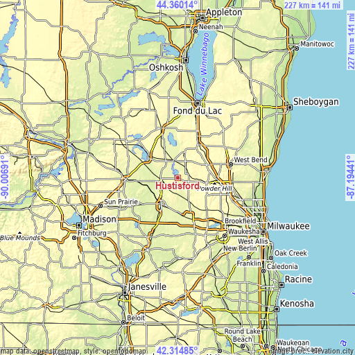
| \ | Map #1 | Topo.Map |
| Scale [m] | 255..294 m | × |
| Scale [ft] | 837..965 ft | × |
| Average | 266.7 m = 875 ft | × |
| Width | 7.11 km = 4.4 mi | 227.4 km = 141.3 mi |
| Height | 7.11 km = 4.4 mi | 227.4 km = 141.3 mi |
| ↑Max Latitude | 43.37806° | 44.36014° |
| Latitude at center | 43.34611° | 43.34611° |
| ↓Min Latitude | 43.314144° | 42.31485° |
| ← Min Longitude | -88.644605° | -90.00691° |
| Longitude center | -88.60066° | -88.60066° |
| →Max Longitude | -88.556715° | -87.19441° |
Nearby cities:
Cities around Hustisford sort by population:
• Watertown elevation 262 m
19.8 km,  211°
211°
• Beaver Dam 268 m
22.8 km,  302°
302°
• Oconomowoc 264 m
27.3 km,  162°
162°
• Hartford 301 m
18.2 km,  99°
99°
• Slinger 330 m
25.5 km,  93°
93°
• Mayville 283 m
17.1 km,  15°
15°
• Okauchee Lake 267 m
28 km,  152°
152°
• Horicon 271 m
12 km,  348°
348°
• Addison 320 m
20.2 km,  64°
64°
• Juneau 283 m
10.7 km,  308°
308°
• Ixonia 266 m
22.5 km,  179°
179°
• Theresa 292 m
22.5 km,  32°
32°
Multilingual:
 En español:
Hustisford elevación 266 m.
 En France:
Hustisford élévation 266 m.
 Auf Deutsch:
Hustisford höhe über dem Meeresspiegel ist 266 m.

Sources and notes:
- [note 1] Map square and city borders are not equal. Map elevation data is calculated only from area inside that square.
- [src 1] Elevation data from geonames database provided with same terms of usage.
- [src 2] The elevation map of Hustisford is generated using elevation data from NASA's 3 arcsec (90m) resolution SRTM data.
- [src 3] Base (background) map © OpenStreetMap contributors tiles are generated by Geofabrik and OpenTopoMap.
Copyright & License:
This Hustisford Elevation Map is licensed under CC BY-SA. You may reuse any part from this page, if you give a proper credit by linking to this URL:
 More info on terms of use page.