Fond du Lac elevation
Fond du Lac (Wisconsin, Fond du Lac County), United States elevation is 234 meters and Fond du Lac elevation in feet is 768 ft above sea level [src 1]. Fond du Lac is a seat of a second-order administrative division (feature code) with elevation that is 45 meters (148 ft) smaller than average city elevation in United States.
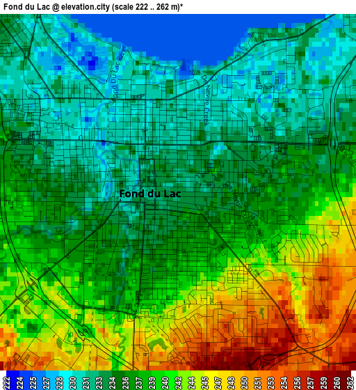
Below is the Elevation map of Fond du Lac, which displays elevation range with different colors. Scale of the first map is from 222 to 262 m (728 to 860 ft) with average elevation of 237.1 meters (=778 ft) [note 1]
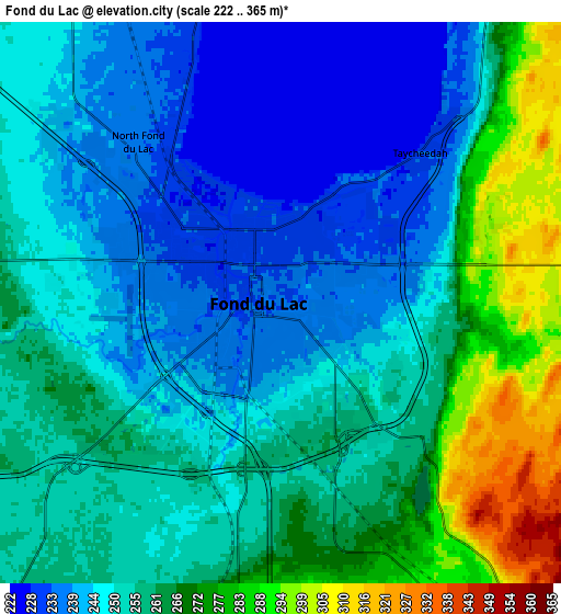
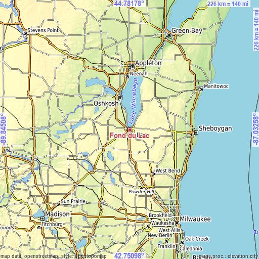
These maps also provides idea of topography and contour of this city, they are displayed at different zoom levels. More info about maps, scale and edge coordinates you can find below images.
| \ | Map #1 | Map #2 | Topo.Map |
| Scale [m] | 222..262 m | 222..365 m | × |
| Scale [ft] | 728..860 ft | 728..1198 ft | × |
| Average | 237.1 m = 778 ft | 255.1 m = 837 ft | × |
| Width | 7.06 km = 4.4 mi | 14.11 km = 8.8 mi | 225.8 km = 140.3 mi |
| Height | 7.06 km = 4.4 mi | 14.11 km = 8.8 mi | 225.8 km = 140.3 mi |
| ↑Max Latitude | 43.806723° | 43.838429° | 44.78178° |
| Latitude at center | 43.775° | 43.775° | 43.775° |
| ↓Min Latitude | 43.74326° | 43.711504° | 42.75098° |
| ← Min Longitude | -88.482775° | -88.526721° | -89.84508° |
| Longitude center | -88.43883° | -88.43883° | -88.43883° |
| →Max Longitude | -88.394885° | -88.350939° | -87.03258° |
Nearby cities:
Cities around Fond du Lac sort by population:
• Waupun elevation 276 m
28.2 km,  236°
236°
• North Fond du Lac 233 m
5.4 km,  318°
318°
• Lomira 323 m
20.4 km,  181°
181°
• Campbellsport 316 m
23.5 km,  146°
146°
• Lamartine 269 m
11.4 km,  246°
246°
• Ashford 319 m
21.6 km,  165°
165°
• Saint Peter 326 m
10.4 km,  48°
48°
• Eldorado 271 m
15.7 km,  290°
290°
• Brothertown 248 m
23.9 km,  25°
25°
• Theresa 292 m
28.7 km, 181°
• Oakfield 274 m
13.1 km,  221°
221°
• Rosendale 275 m
19.3 km,  280°
280°
Multilingual:
 En español:
Fond du Lac elevación 234 m.
 En France:
Fond du Lac élévation 234 m.
 Auf Deutsch:
Fond du Lac höhe über dem Meeresspiegel ist 234 m.

Sources and notes:
- [note 1] Map square and city borders are not equal. Map elevation data is calculated only from area inside that square.
- [src 1] Elevation data from geonames database provided with same terms of usage.
- [src 2] The elevation map of Fond du Lac is generated using elevation data from NASA's 3 arcsec (90m) resolution SRTM data.
- [src 3] Base (background) map © OpenStreetMap contributors tiles are generated by Geofabrik and OpenTopoMap.
Copyright & License:
This Fond du Lac Elevation Map is licensed under CC BY-SA. You may reuse any part from this page, if you give a proper credit by linking to this URL:
 More info on terms of use page.