Darlington elevation
Darlington (Wisconsin, Lafayette County), United States elevation is 264 meters and Darlington elevation in feet is 866 ft above sea level [src 1]. Darlington is a seat of a second-order administrative division (feature code) with elevation that is 15 meters (49 ft) smaller than average city elevation in United States.
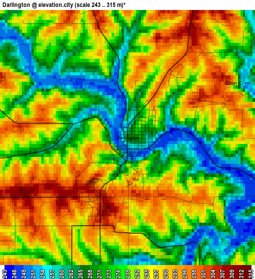
Below is the Elevation map of Darlington, which displays elevation range with different colors. Scale of the first map is from 243 to 315 m (797 to 1033 ft) with average elevation of 279.5 meters (=917 ft) [note 1]
These maps also provides idea of topography and contour of this city, they are displayed at different zoom levels. More info about maps, scale and edge coordinates you can find below images.
| \ | Map #1 | Topo.Map |
| Scale [m] | 243..315 m | × |
| Scale [ft] | 797..1033 ft | × |
| Average | 279.5 m = 917 ft | × |
| Width | 7.18 km = 4.5 mi | 229.9 km = 142.9 mi |
| Height | 7.18 km = 4.5 mi | 229.9 km = 142.9 mi |
| ↑Max Latitude | 42.715356° | 43.70821° |
| Latitude at center | 42.68306° | 42.68306° |
| ↓Min Latitude | 42.650747° | 41.64071° |
| ← Min Longitude | -90.161575° | -91.52388° |
| Longitude center | -90.11763° | -90.11763° |
| →Max Longitude | -90.073685° | -88.71138° |
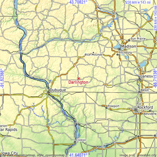
Nearby cities:
Cities around Darlington sort by population:
• Platteville elevation 300 m
30 km,  280°
280°
• Monroe 322 m
40.2 km,  103°
103°
• Dodgeville 369 m
30.8 km,  358°
358°
• Galena 197 m
39.1 km,  220°
220°
• Mineral Point 318 m
20.3 km,  345°
345°
• Cuba City 309 m
27 km,  251°
251°
• Stockton 308 m
38.2 km,  166°
166°
• Warren 302 m
23.3 km,  153°
153°
• Hazel Green 296 m
30.9 km,  237°
237°
• Shullsburg 306 m
15.3 km, 217°
• The Galena Territory 278 m
36.4 km,  207°
207°
• Dickeyville 291 m
39.3 km,  260°
260°
Multilingual:
 En español:
Darlington elevación 264 m.
 En France:
Darlington élévation 264 m.
 Auf Deutsch:
Darlington höhe über dem Meeresspiegel ist 264 m.

Sources and notes:
- [note 1] Map square and city borders are not equal. Map elevation data is calculated only from area inside that square.
- [src 1] Elevation data from geonames database provided with same terms of usage.
- [src 2] The elevation map of Darlington is generated using elevation data from NASA's 3 arcsec (90m) resolution SRTM data.
- [src 3] Base (background) map © OpenStreetMap contributors tiles are generated by Geofabrik and OpenTopoMap.
Copyright & License:
This Darlington Elevation Map is licensed under CC BY-SA. You may reuse any part from this page, if you give a proper credit by linking to this URL:
 More info on terms of use page.