Cato elevation
Cato (Wisconsin, Manitowoc County), United States elevation is 261 meters and Cato elevation in feet is 856 ft above sea level [src 1]. Cato is a populated place (feature code) with elevation that is 18 meters (59 ft) smaller than average city elevation in United States.
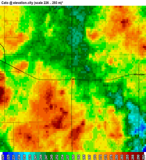
Below is the Elevation map of Cato, which displays elevation range with different colors. Scale of the first map is from 226 to 293 m (741 to 961 ft) with average elevation of 262.6 meters (=862 ft) [note 1]
These maps also provides idea of topography and contour of this city, they are displayed at different zoom levels. More info about maps, scale and edge coordinates you can find below images.
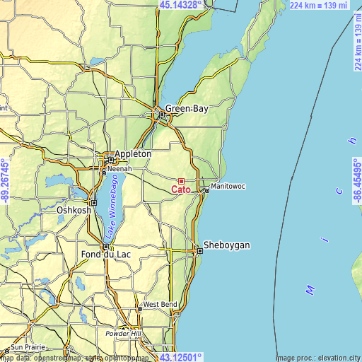
| \ | Map #1 | Topo.Map |
| Scale [m] | 226..293 m | × |
| Scale [ft] | 741..961 ft | × |
| Average | 262.6 m = 862 ft | × |
| Width | 7.01 km = 4.4 mi | 224.4 km = 139.4 mi |
| Height | 7.01 km = 4.4 mi | 224.4 km = 139.4 mi |
| ↑Max Latitude | 44.174297° | 45.14328° |
| Latitude at center | 44.14277° | 44.14277° |
| ↓Min Latitude | 44.111226° | 43.12501° |
| ← Min Longitude | -87.905145° | -89.26745° |
| Longitude center | -87.8612° | -87.8612° |
| →Max Longitude | -87.817255° | -86.45495° |
Nearby cities:
Cities around Cato sort by population:
• Manitowoc elevation 189 m
17.3 km,  110°
110°
• Two Rivers 184 m
23.3 km,  86°
86°
• Chilton 274 m
27.2 km,  242°
242°
• New Holstein 286 m
27.9 km,  219°
219°
• Brillion 256 m
16.6 km,  283°
283°
• Denmark 267 m
23 km,  6°
6°
• Cleveland 196 m
26.9 km,  160°
160°
• Mishicot 184 m
20.6 km,  58°
58°
• Cooperstown 238 m
20.1 km,  20°
20°
• Reedsville 254 m
7.7 km, 278°
• Glenmore 280 m
27.5 km,  348°
348°
• Hilbert 257 m
24.2 km,  269°
269°
Multilingual:
 En español:
Cato elevación 261 m.
 En France:
Cato élévation 261 m.


Sources and notes:
- [note 1] Map square and city borders are not equal. Map elevation data is calculated only from area inside that square.
- [src 1] Elevation data from geonames database provided with same terms of usage.
- [src 2] The elevation map of Cato is generated using elevation data from NASA's 3 arcsec (90m) resolution SRTM data.
- [src 3] Base (background) map © OpenStreetMap contributors tiles are generated by Geofabrik and OpenTopoMap.
Copyright & License:
This Cato Elevation Map is licensed under CC BY-SA. You may reuse any part from this page, if you give a proper credit by linking to this URL:
 More info on terms of use page.