Poultney elevation
Poultney (Vermont, Rutland County), United States elevation is 131 meters and Poultney elevation in feet is 430 ft above sea level [src 1]. Poultney is a populated place (feature code) with elevation that is 148 meters (486 ft) smaller than average city elevation in United States.
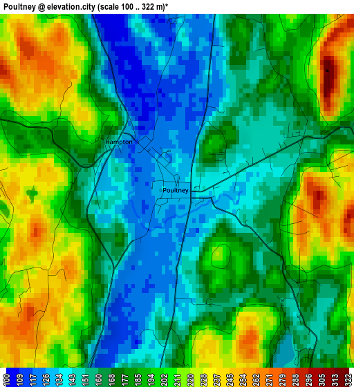
Below is the Elevation map of Poultney, which displays elevation range with different colors. Scale of the first map is from 100 to 322 m (328 to 1056 ft) with average elevation of 179.3 meters (=588 ft) [note 1]
These maps also provides idea of topography and contour of this city, they are displayed at different zoom levels. More info about maps, scale and edge coordinates you can find below images.
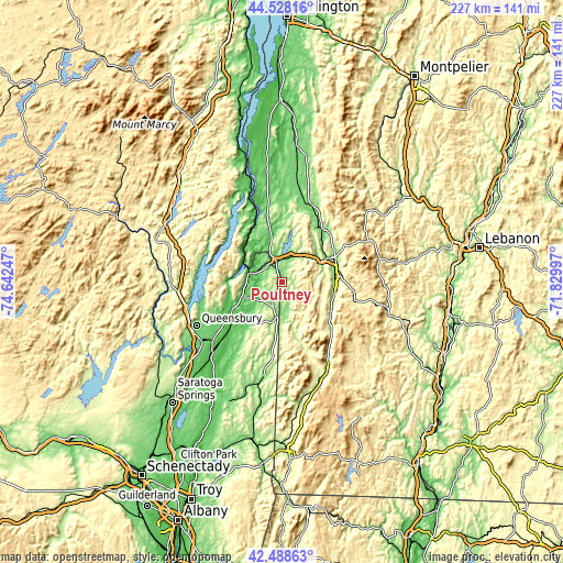
| \ | Map #1 | Topo.Map |
| Scale [m] | 100..322 m | × |
| Scale [ft] | 328..1056 ft | × |
| Average | 179.3 m = 588 ft | × |
| Width | 7.09 km = 4.4 mi | 226.8 km = 140.9 mi |
| Height | 7.09 km = 4.4 mi | 226.8 km = 140.9 mi |
| ↑Max Latitude | 43.548869° | 44.52816° |
| Latitude at center | 43.51701° | 43.51701° |
| ↓Min Latitude | 43.485134° | 42.48863° |
| ← Min Longitude | -73.280165° | -74.64247° |
| Longitude center | -73.23622° | -73.23622° |
| →Max Longitude | -73.192275° | -71.82997° |
Nearby cities:
Cities around Poultney sort by population:
• Rutland elevation 200 m
23.7 km,  63°
63°
• Whitehall 45 m
14.2 km,  287°
287°
• Clarendon 182 m
21.5 km,  90°
90°
• Granville 129 m
12.3 km,  188°
188°
• Fair Haven 119 m
9 km,  344°
344°
• Hartford 118 m
21.3 km,  216°
216°
• West Rutland 153 m
17.6 km, 61°
• Castleton 139 m
11.4 km,  23°
23°
• Pawlet 219 m
19.5 km,  165°
165°
• Danby 213 m
27.2 km,  134°
134°
• Chittenden 348 m
31.4 km,  47°
47°
• Mendon 317 m
29 km, 58°
Multilingual:
 En español:
Poultney elevación 131 m.
 En France:
Poultney élévation 131 m.
 Auf Deutsch:
Poultney höhe über dem Meeresspiegel ist 131 m.

Sources and notes:
- [note 1] Map square and city borders are not equal. Map elevation data is calculated only from area inside that square.
- [src 1] Elevation data from geonames database provided with same terms of usage.
- [src 2] The elevation map of Poultney is generated using elevation data from NASA's 3 arcsec (90m) resolution SRTM data.
- [src 3] Base (background) map © OpenStreetMap contributors tiles are generated by Geofabrik and OpenTopoMap.
Copyright & License:
This Poultney Elevation Map is licensed under CC BY-SA. You may reuse any part from this page, if you give a proper credit by linking to this URL:
 More info on terms of use page.