Brattleboro elevation
Brattleboro (Vermont, Windham County), United States elevation is 79 meters and Brattleboro elevation in feet is 259 ft above sea level [src 1]. Brattleboro is a populated place (feature code) with elevation that is 200 meters (656 ft) smaller than average city elevation in United States.
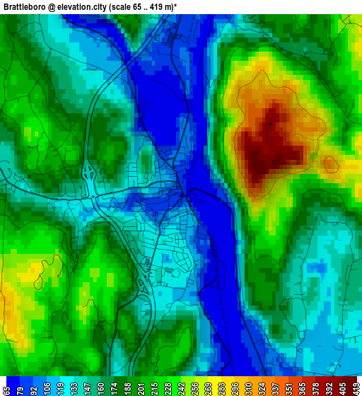
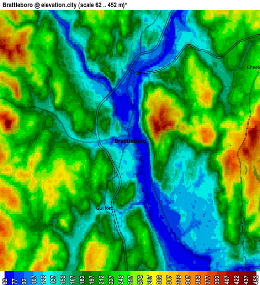
Below is the Elevation map of Brattleboro, which displays elevation range with different colors. Scale of the first map is from 65 to 419 m (213 to 1375 ft) with average elevation of 173.6 meters (=570 ft) [note 1]
These maps also provides idea of topography and contour of this city, they are displayed at different zoom levels. More info about maps, scale and edge coordinates you can find below images.
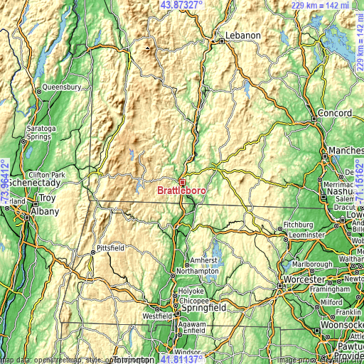
| \ | Map #1 | Map #2 | Topo.Map |
| Scale [m] | 65..419 m | 62..452 m | × |
| Scale [ft] | 213..1375 ft | 203..1483 ft | × |
| Average | 173.6 m = 570 ft | 201.5 m = 661 ft | × |
| Width | 7.16 km = 4.4 mi | 14.33 km = 8.9 mi | 229.3 km = 142.5 mi |
| Height | 7.16 km = 4.4 mi | 14.33 km = 8.9 mi | 229.3 km = 142.5 mi |
| ↑Max Latitude | 42.883129° | 42.915321° | 43.87327° |
| Latitude at center | 42.85092° | 42.85092° | 42.85092° |
| ↓Min Latitude | 42.818694° | 42.786452° | 41.81137° |
| ← Min Longitude | -72.601815° | -72.645761° | -73.96412° |
| Longitude center | -72.55787° | -72.55787° | -72.55787° |
| →Max Longitude | -72.513925° | -72.469979° | -71.15162° |
Nearby cities:
Cities around Brattleboro sort by population:
• Swanzey elevation 158 m
22.6 km,  84°
84°
• Chesterfield 259 m
8.2 km,  60°
60°
• West Brattleboro 149 m
3.7 km,  278°
278°
• Bernardston 115 m
20 km,  178°
178°
• Westmoreland 129 m
15.5 km,  37°
37°
• Colrain 187 m
22.8 km,  209°
209°
• Winchester 135 m
16.7 km,  121°
121°
• Hinsdale 70 m
9.3 km,  141°
141°
• Dover 588 m
22.5 km,  297°
297°
• West Swanzey 162 m
19.4 km, 83°
• Northfield 91 m
19.2 km,  153°
153°
• Newfane 171 m
17 km,  331°
331°
Multilingual:
 En español:
Brattleboro elevación 79 m.
 En France:
Brattleboro élévation 79 m.
 Auf Deutsch:
Brattleboro höhe über dem Meeresspiegel ist 79 m.

Sources and notes:
- [note 1] Map square and city borders are not equal. Map elevation data is calculated only from area inside that square.
- [src 1] Elevation data from geonames database provided with same terms of usage.
- [src 2] The elevation map of Brattleboro is generated using elevation data from NASA's 3 arcsec (90m) resolution SRTM data.
- [src 3] Base (background) map © OpenStreetMap contributors tiles are generated by Geofabrik and OpenTopoMap.
Copyright & License:
This Brattleboro Elevation Map is licensed under CC BY-SA. You may reuse any part from this page, if you give a proper credit by linking to this URL:
 More info on terms of use page.