Telford elevation
Telford (Pennsylvania, Bucks County), United States elevation is 136 meters and Telford elevation in feet is 446 ft above sea level [src 1]. Telford is a populated place (feature code) with elevation that is 143 meters (469 ft) smaller than average city elevation in United States.
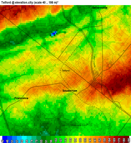
Below is the Elevation map of Telford, which displays elevation range with different colors. Scale of the first map is from 40 to 186 m (131 to 610 ft) with average elevation of 122.7 meters (=403 ft) [note 1]
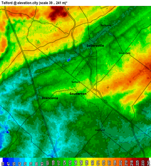
These maps also provides idea of topography and contour of this city, they are displayed at different zoom levels. More info about maps, scale and edge coordinates you can find below images.
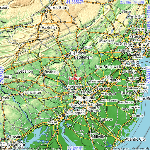
| \ | Map #1 | Map #2 | Topo.Map |
| Scale [m] | 40..186 m | 39..241 m | × |
| Scale [ft] | 131..610 ft | 128..791 ft | × |
| Average | 122.7 m = 403 ft | 125 m = 410 ft | × |
| Width | 7.45 km = 4.6 mi | 14.9 km = 9.3 mi | 238.4 km = 148.1 mi |
| Height | 7.45 km = 4.6 mi | 14.9 km = 9.3 mi | 238.4 km = 148.1 mi |
| ↑Max Latitude | 40.355546° | 40.389026° | 41.38567° |
| Latitude at center | 40.32205° | 40.32205° | 40.32205° |
| ↓Min Latitude | 40.288537° | 40.255007° | 39.2414° |
| ← Min Longitude | -75.371895° | -75.415841° | -76.7342° |
| Longitude center | -75.32795° | -75.32795° | -75.32795° |
| →Max Longitude | -75.284005° | -75.240059° | -73.9217° |
Nearby cities:
Cities around Telford sort by population:
• Lansdale elevation 111 m
9.7 km,  157°
157°
• Montgomeryville 141 m
11 km,  139°
139°
• Harleysville 86 m
6.9 km,  226°
226°
• Perkasie 115 m
6.3 km,  28°
28°
• Kulpsville 88 m
8.8 km,  184°
184°
• Souderton 126 m
1.2 km,  168°
168°
• Sellersville 108 m
4.1 km, 28°
• Chalfont 87 m
10.8 km,  110°
110°
• Brittany Farms-Highlands 126 m
11.3 km,  121°
121°
• Hatfield 103 m
5.3 km,  152°
152°
• Dublin 176 m
12.1 km,  62°
62°
• Woxall 133 m
10.3 km,  262°
262°
Multilingual:
 En español:
Telford elevación 136 m.
 En France:
Telford élévation 136 m.


Sources and notes:
- [note 1] Map square and city borders are not equal. Map elevation data is calculated only from area inside that square.
- [src 1] Elevation data from geonames database provided with same terms of usage.
- [src 2] The elevation map of Telford is generated using elevation data from NASA's 3 arcsec (90m) resolution SRTM data.
- [src 3] Base (background) map © OpenStreetMap contributors tiles are generated by Geofabrik and OpenTopoMap.
Copyright & License:
This Telford Elevation Map is licensed under CC BY-SA. You may reuse any part from this page, if you give a proper credit by linking to this URL:
 More info on terms of use page.