Chalfont elevation
Chalfont (Pennsylvania, Bucks County), United States elevation is 87 meters and Chalfont elevation in feet is 285 ft above sea level [src 1]. Chalfont is a populated place (feature code) with elevation that is 192 meters (630 ft) smaller than average city elevation in United States.
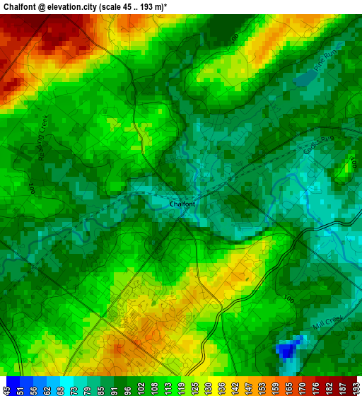
Below is the Elevation map of Chalfont, which displays elevation range with different colors. Scale of the first map is from 45 to 193 m (148 to 633 ft) with average elevation of 106.5 meters (=349 ft) [note 1]
These maps also provides idea of topography and contour of this city, they are displayed at different zoom levels. More info about maps, scale and edge coordinates you can find below images.
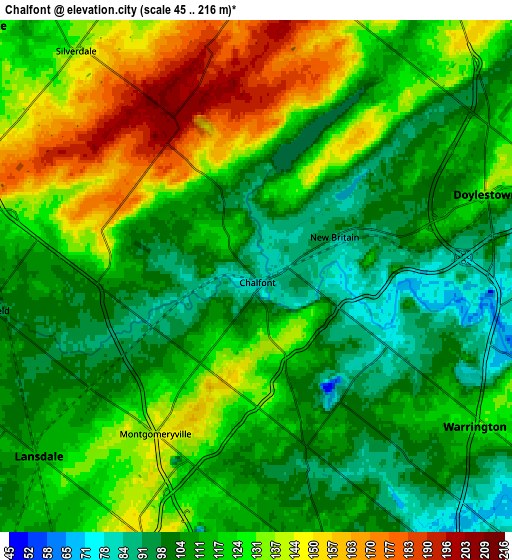
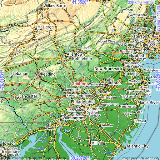
| \ | Map #1 | Map #2 | Topo.Map |
| Scale [m] | 45..193 m | 45..216 m | × |
| Scale [ft] | 148..633 ft | 148..709 ft | × |
| Average | 106.5 m = 349 ft | 119.3 m = 391 ft | × |
| Width | 7.45 km = 4.6 mi | 14.91 km = 9.3 mi | 238.5 km = 148.2 mi |
| Height | 7.45 km = 4.6 mi | 14.91 km = 9.3 mi | 238.5 km = 148.2 mi |
| ↑Max Latitude | 40.321953° | 40.35545° | 41.3526° |
| Latitude at center | 40.28844° | 40.28844° | 40.28844° |
| ↓Min Latitude | 40.25491° | 40.221364° | 39.20726° |
| ← Min Longitude | -75.253005° | -75.296951° | -76.61531° |
| Longitude center | -75.20906° | -75.20906° | -75.20906° |
| →Max Longitude | -75.165115° | -75.121169° | -73.80281° |
Nearby cities:
Cities around Chalfont sort by population:
• Lansdale elevation 111 m
8.2 km,  230°
230°
• Montgomeryville 141 m
5.4 km,  212°
212°
• Doylestown 131 m
7.1 km,  70°
70°
• Souderton 126 m
10.2 km,  284°
284°
• Telford 136 m
10.8 km,  290°
290°
• Sellersville 108 m
10.9 km,  311°
311°
• Spring House 92 m
11.6 km,  187°
187°
• Brittany Farms-Highlands 126 m
2.2 km, 190°
• Hatfield 103 m
7.7 km,  262°
262°
• North Wales 115 m
10.4 km, 214°
• New Britain 93 m
2.7 km,  63°
63°
• Dublin 176 m
9.3 km,  3°
3°
Multilingual:
 En español:
Chalfont elevación 87 m.
 En France:
Chalfont élévation 87 m.


Sources and notes:
- [note 1] Map square and city borders are not equal. Map elevation data is calculated only from area inside that square.
- [src 1] Elevation data from geonames database provided with same terms of usage.
- [src 2] The elevation map of Chalfont is generated using elevation data from NASA's 3 arcsec (90m) resolution SRTM data.
- [src 3] Base (background) map © OpenStreetMap contributors tiles are generated by Geofabrik and OpenTopoMap.
Copyright & License:
This Chalfont Elevation Map is licensed under CC BY-SA. You may reuse any part from this page, if you give a proper credit by linking to this URL:
 More info on terms of use page.