Quakertown elevation
Quakertown (Pennsylvania, Bucks County), United States elevation is 157 meters and Quakertown elevation in feet is 515 ft above sea level [src 1]. Quakertown is a populated place (feature code) with elevation that is 122 meters (400 ft) smaller than average city elevation in United States.
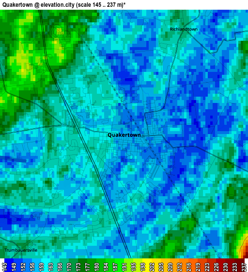
Below is the Elevation map of Quakertown, which displays elevation range with different colors. Scale of the first map is from 145 to 237 m (476 to 778 ft) with average elevation of 162.9 meters (=534 ft) [note 1]
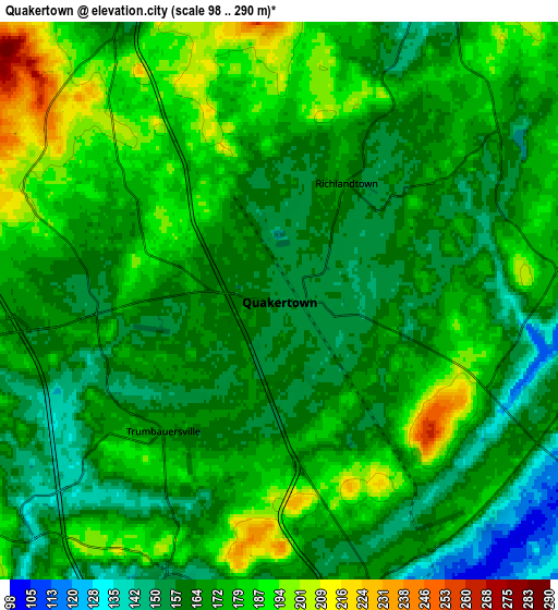
These maps also provides idea of topography and contour of this city, they are displayed at different zoom levels. More info about maps, scale and edge coordinates you can find below images.
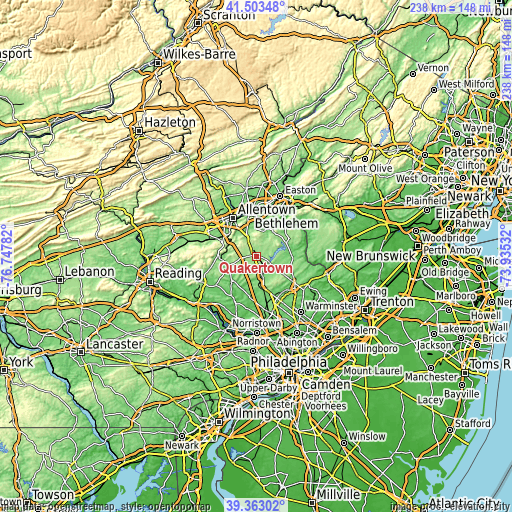
| \ | Map #1 | Map #2 | Topo.Map |
| Scale [m] | 145..237 m | 98..290 m | × |
| Scale [ft] | 476..778 ft | 322..951 ft | × |
| Average | 162.9 m = 534 ft | 170.9 m = 561 ft | × |
| Width | 7.44 km = 4.6 mi | 14.88 km = 9.2 mi | 238 km = 147.9 mi |
| Height | 7.44 km = 4.6 mi | 14.88 km = 9.2 mi | 238 km = 147.9 mi |
| ↑Max Latitude | 40.475207° | 40.508627° | 41.50348° |
| Latitude at center | 40.44177° | 40.44177° | 40.44177° |
| ↓Min Latitude | 40.408316° | 40.374846° | 39.36302° |
| ← Min Longitude | -75.385515° | -75.429461° | -76.74782° |
| Longitude center | -75.34157° | -75.34157° | -75.34157° |
| →Max Longitude | -75.297625° | -75.253679° | -73.93532° |
Nearby cities:
Cities around Quakertown sort by population:
• Perkasie elevation 115 m
8.8 km,  151°
151°
• Bedminster 133 m
13.9 km,  97°
97°
• Souderton 126 m
14.5 km,  174°
174°
• Telford 136 m
13.4 km,  175°
175°
• Sellersville 108 m
10.2 km,  162°
162°
• Pennsburg 118 m
13.9 km,  246°
246°
• East Greenville 126 m
14.1 km, 253°
• Coopersburg 147 m
8.8 km,  331°
331°
• Red Hill 117 m
14.1 km,  237°
237°
• Dublin 176 m
14.2 km,  123°
123°
• Spinnerstown 175 m
8.1 km,  267°
267°
• Richlandtown 167 m
3.6 km,  29°
29°
Multilingual:
 En español:
Quakertown elevación 157 m.
 En France:
Quakertown élévation 157 m.
 Auf Deutsch:
Quakertown höhe über dem Meeresspiegel ist 157 m.

Sources and notes:
- [note 1] Map square and city borders are not equal. Map elevation data is calculated only from area inside that square.
- [src 1] Elevation data from geonames database provided with same terms of usage.
- [src 2] The elevation map of Quakertown is generated using elevation data from NASA's 3 arcsec (90m) resolution SRTM data.
- [src 3] Base (background) map © OpenStreetMap contributors tiles are generated by Geofabrik and OpenTopoMap.
Copyright & License:
This Quakertown Elevation Map is licensed under CC BY-SA. You may reuse any part from this page, if you give a proper credit by linking to this URL:
 More info on terms of use page.