Kittanning elevation
Kittanning (Pennsylvania, Armstrong County), United States elevation is 245 meters and Kittanning elevation in feet is 804 ft above sea level [src 1]. Kittanning is a seat of a second-order administrative division (feature code) with elevation that is 34 meters (112 ft) smaller than average city elevation in United States.
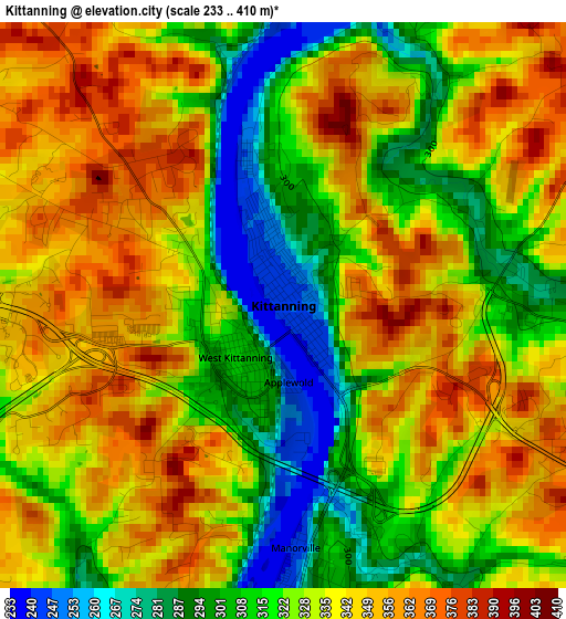
Below is the Elevation map of Kittanning, which displays elevation range with different colors. Scale of the first map is from 233 to 410 m (764 to 1345 ft) with average elevation of 331 meters (=1086 ft) [note 1]
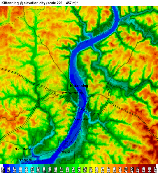
These maps also provides idea of topography and contour of this city, they are displayed at different zoom levels. More info about maps, scale and edge coordinates you can find below images.
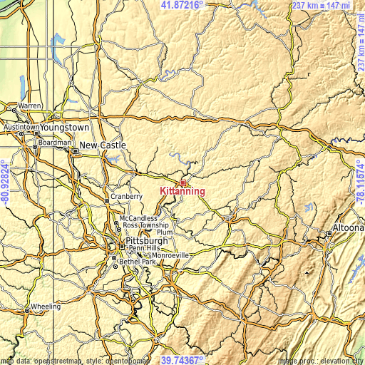
| \ | Map #1 | Map #2 | Topo.Map |
| Scale [m] | 233..410 m | 229..457 m | × |
| Scale [ft] | 764..1345 ft | 751..1499 ft | × |
| Average | 331 m = 1086 ft | 345.3 m = 1133 ft | × |
| Width | 7.4 km = 4.6 mi | 14.79 km = 9.2 mi | 236.7 km = 147.1 mi |
| Height | 7.4 km = 4.6 mi | 14.79 km = 9.2 mi | 236.7 km = 147.1 mi |
| ↑Max Latitude | 40.8497° | 40.882933° | 41.87216° |
| Latitude at center | 40.81645° | 40.81645° | 40.81645° |
| ↓Min Latitude | 40.783184° | 40.7499° | 39.74367° |
| ← Min Longitude | -79.565935° | -79.609881° | -80.92824° |
| Longitude center | -79.52199° | -79.52199° | -79.52199° |
| →Max Longitude | -79.478045° | -79.434099° | -78.11574° |
Nearby cities:
Cities around Kittanning sort by population:
• Vandergrift elevation 274 m
24 km,  188°
188°
• Ford City 241 m
5 km, 187°
• Leechburg 243 m
22.2 km,  198°
198°
• Orchard Hills 348 m
25.6 km,  181°
181°
• Freeport 244 m
21 km,  220°
220°
• Saxonburg 395 m
25.2 km,  254°
254°
• West Leechburg 308 m
22.9 km, 199°
• West Hills 351 m
2 km,  295°
295°
• North Apollo 251 m
24.7 km, 186°
• Lenape Heights 298 m
5.8 km, 178°
• West Kittanning 308 m
0.9 km, 222°
• Chicora 372 m
23.6 km,  308°
308°
Multilingual:
 En español:
Kittanning elevación 245 m.
 En France:
Kittanning élévation 245 m.
 Auf Deutsch:
Kittanning höhe über dem Meeresspiegel ist 245 m.

Sources and notes:
- [note 1] Map square and city borders are not equal. Map elevation data is calculated only from area inside that square.
- [src 1] Elevation data from geonames database provided with same terms of usage.
- [src 2] The elevation map of Kittanning is generated using elevation data from NASA's 3 arcsec (90m) resolution SRTM data.
- [src 3] Base (background) map © OpenStreetMap contributors tiles are generated by Geofabrik and OpenTopoMap.
Copyright & License:
This Kittanning Elevation Map is licensed under CC BY-SA. You may reuse any part from this page, if you give a proper credit by linking to this URL:
 More info on terms of use page.