Etna elevation
Etna (Pennsylvania, Allegheny County), United States elevation is 225 meters and Etna elevation in feet is 738 ft above sea level [src 1]. Etna is a populated place (feature code) with elevation that is 54 meters (177 ft) smaller than average city elevation in United States.
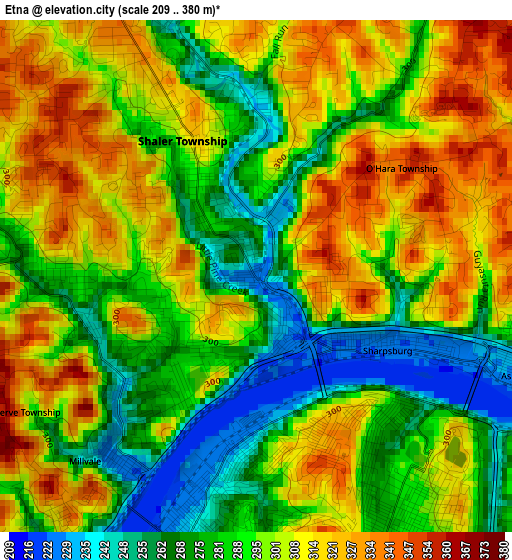
Below is the Elevation map of Etna, which displays elevation range with different colors. Scale of the first map is from 209 to 380 m (686 to 1247 ft) with average elevation of 295.6 meters (=970 ft) [note 1]
These maps also provides idea of topography and contour of this city, they are displayed at different zoom levels. More info about maps, scale and edge coordinates you can find below images.
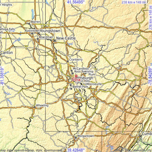
| \ | Map #1 | Topo.Map |
| Scale [m] | 209..380 m | × |
| Scale [ft] | 686..1247 ft | × |
| Average | 295.6 m = 970 ft | × |
| Width | 7.43 km = 4.6 mi | 237.8 km = 147.8 mi |
| Height | 7.43 km = 4.6 mi | 237.8 km = 147.8 mi |
| ↑Max Latitude | 40.537646° | 41.56495° |
| Latitude at center | 40.50424° | 40.50424° |
| ↓Min Latitude | 40.470818° | 39.42648° |
| ← Min Longitude | -79.992885° | -81.35519° |
| Longitude center | -79.94894° | -79.94894° |
| →Max Longitude | -79.904995° | -78.54269° |
Nearby cities:
Cities around Etna sort by population:
• Pittsburgh elevation 239 m
8.1 km,  209°
209°
• Allison Park 276 m
6.2 km,  352°
352°
• Glenshaw 334 m
3.5 km,  333°
333°
• Bellevue 297 m
8.8 km,  262°
262°
• West View 349 m
7.5 km,  285°
285°
• Fox Chapel 302 m
5.9 km,  80°
80°
• Millvale 244 m
3.7 km,  222°
222°
• Sharpsburg 226 m
2.2 km,  119°
119°
• Aspinwall 228 m
4 km,  110°
110°
• Verona 228 m
9 km,  88°
88°
• Blawnox 246 m
7.6 km,  99°
99°
• Bloomfield 289 m
4.8 km,  181°
181°
Multilingual:
 En español:
Etna elevación 225 m.
 En France:
Etna élévation 225 m.


Sources and notes:
- [note 1] Map square and city borders are not equal. Map elevation data is calculated only from area inside that square.
- [src 1] Elevation data from geonames database provided with same terms of usage.
- [src 2] The elevation map of Etna is generated using elevation data from NASA's 3 arcsec (90m) resolution SRTM data.
- [src 3] Base (background) map © OpenStreetMap contributors tiles are generated by Geofabrik and OpenTopoMap.
Copyright & License:
This Etna Elevation Map is licensed under CC BY-SA. You may reuse any part from this page, if you give a proper credit by linking to this URL:
 More info on terms of use page.