Conway elevation
Conway (Pennsylvania, Beaver County), United States elevation is 226 meters and Conway elevation in feet is 741 ft above sea level [src 1]. Conway is a populated place (feature code) with elevation that is 53 meters (174 ft) smaller than average city elevation in United States.
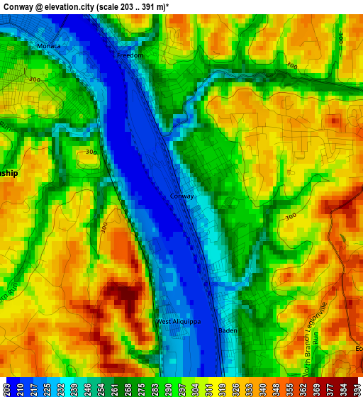
Below is the Elevation map of Conway, which displays elevation range with different colors. Scale of the first map is from 203 to 391 m (666 to 1283 ft) with average elevation of 289.6 meters (=950 ft) [note 1]
These maps also provides idea of topography and contour of this city, they are displayed at different zoom levels. More info about maps, scale and edge coordinates you can find below images.
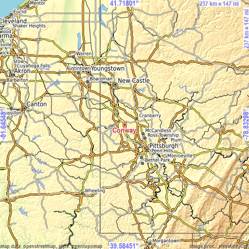
| \ | Map #1 | Topo.Map |
| Scale [m] | 203..391 m | × |
| Scale [ft] | 666..1283 ft | × |
| Average | 289.6 m = 950 ft | × |
| Width | 7.41 km = 4.6 mi | 237.2 km = 147.4 mi |
| Height | 7.41 km = 4.6 mi | 237.2 km = 147.4 mi |
| ↑Max Latitude | 40.693118° | 41.71801° |
| Latitude at center | 40.65979° | 40.65979° |
| ↓Min Latitude | 40.626445° | 39.58451° |
| ← Min Longitude | -80.283175° | -81.64548° |
| Longitude center | -80.23923° | -80.23923° |
| →Max Longitude | -80.195285° | -78.83298° |
Nearby cities:
Cities around Conway sort by population:
• Fernway elevation 317 m
9.9 km,  66°
66°
• Economy 242 m
6.8 km,  169°
169°
• Aliquippa 225 m
2.6 km,  181°
181°
• Ambridge 237 m
7.9 km, 171°
• New Brighton 223 m
9.9 km,  322°
322°
• Monaca 224 m
4.1 km, 318°
• Beaver 243 m
6.8 km,  305°
305°
• Baden 237 m
2.9 km,  161°
161°
• Rochester 241 m
6.2 km, 319°
• Freedom 237 m
3.1 km,  339°
339°
• Bell Acres 364 m
9.9 km,  141°
141°
• Leetsdale 217 m
11.1 km, 166°
Multilingual:
 En español:
Conway elevación 226 m.
 En France:
Conway élévation 226 m.


Sources and notes:
- [note 1] Map square and city borders are not equal. Map elevation data is calculated only from area inside that square.
- [src 1] Elevation data from geonames database provided with same terms of usage.
- [src 2] The elevation map of Conway is generated using elevation data from NASA's 3 arcsec (90m) resolution SRTM data.
- [src 3] Base (background) map © OpenStreetMap contributors tiles are generated by Geofabrik and OpenTopoMap.
Copyright & License:
This Conway Elevation Map is licensed under CC BY-SA. You may reuse any part from this page, if you give a proper credit by linking to this URL:
 More info on terms of use page.