Brookville elevation
Brookville (Pennsylvania, Jefferson County), United States elevation is 388 meters and Brookville elevation in feet is 1273 ft above sea level [src 1]. Brookville is a seat of a second-order administrative division (feature code) with elevation that is 109 meters (358 ft) bigger than average city elevation in United States.
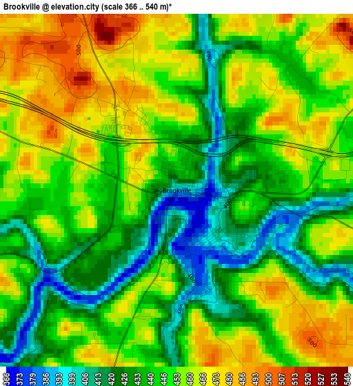
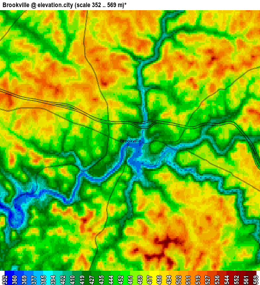
Below is the Elevation map of Brookville, which displays elevation range with different colors. Scale of the first map is from 366 to 540 m (1201 to 1772 ft) with average elevation of 447.2 meters (=1467 ft) [note 1]
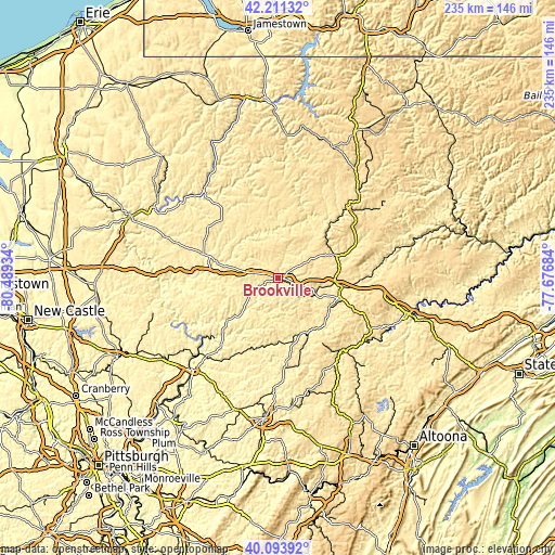
These maps also provides idea of topography and contour of this city, they are displayed at different zoom levels. More info about maps, scale and edge coordinates you can find below images.
| \ | Map #1 | Map #2 | Topo.Map |
| Scale [m] | 366..540 m | 352..569 m | × |
| Scale [ft] | 1201..1772 ft | 1155..1867 ft | × |
| Average | 447.2 m = 1467 ft | 464.3 m = 1523 ft | × |
| Width | 7.36 km = 4.6 mi | 14.71 km = 9.1 mi | 235.4 km = 146.3 mi |
| Height | 7.36 km = 4.6 mi | 14.71 km = 9.1 mi | 235.4 km = 146.3 mi |
| ↑Max Latitude | 41.194246° | 41.227306° | 42.21132° |
| Latitude at center | 41.16117° | 41.16117° | 41.16117° |
| ↓Min Latitude | 41.128077° | 41.094967° | 40.09392° |
| ← Min Longitude | -79.127035° | -79.170981° | -80.48934° |
| Longitude center | -79.08309° | -79.08309° | -79.08309° |
| →Max Longitude | -79.039145° | -78.995199° | -77.67684° |
Nearby cities:
Cities around Brookville sort by population:
• DuBois elevation 432 m
27.5 km,  99°
99°
• Clarion 456 m
26 km,  283°
283°
• Punxsutawney 378 m
25.9 km,  158°
158°
• Treasure Lake 551 m
30.8 km,  87°
87°
• Marienville 530 m
34.4 km,  354°
354°
• Reynoldsville 422 m
17.8 km,  113°
113°
• Brockway 446 m
25.7 km,  67°
67°
• Albion 443 m
25.2 km,  153°
153°
• Sandy 435 m
26.8 km, 102°
• Marianne 447 m
30.4 km,  288°
288°
• Sykesville 415 m
25.1 km,  119°
119°
• Falls Creek 446 m
23.4 km, 94°
Multilingual:
 En español:
Brookville elevación 388 m.
 En France:
Brookville élévation 388 m.
 Auf Deutsch:
Brookville höhe über dem Meeresspiegel ist 388 m.

Sources and notes:
- [note 1] Map square and city borders are not equal. Map elevation data is calculated only from area inside that square.
- [src 1] Elevation data from geonames database provided with same terms of usage.
- [src 2] The elevation map of Brookville is generated using elevation data from NASA's 3 arcsec (90m) resolution SRTM data.
- [src 3] Base (background) map © OpenStreetMap contributors tiles are generated by Geofabrik and OpenTopoMap.
Copyright & License:
This Brookville Elevation Map is licensed under CC BY-SA. You may reuse any part from this page, if you give a proper credit by linking to this URL:
 More info on terms of use page.