Black Lick elevation
Black Lick (Pennsylvania, Indiana County), United States elevation is 320 meters and Black Lick elevation in feet is 1050 ft above sea level [src 1]. Black Lick is a populated place (feature code) with elevation that is 41 meters (135 ft) bigger than average city elevation in United States.
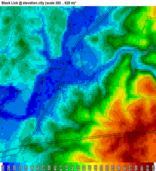
Below is the Elevation map of Black Lick, which displays elevation range with different colors. Scale of the first map is from 282 to 628 m (925 to 2060 ft) with average elevation of 392.5 meters (=1288 ft) [note 1]
These maps also provides idea of topography and contour of this city, they are displayed at different zoom levels. More info about maps, scale and edge coordinates you can find below images.
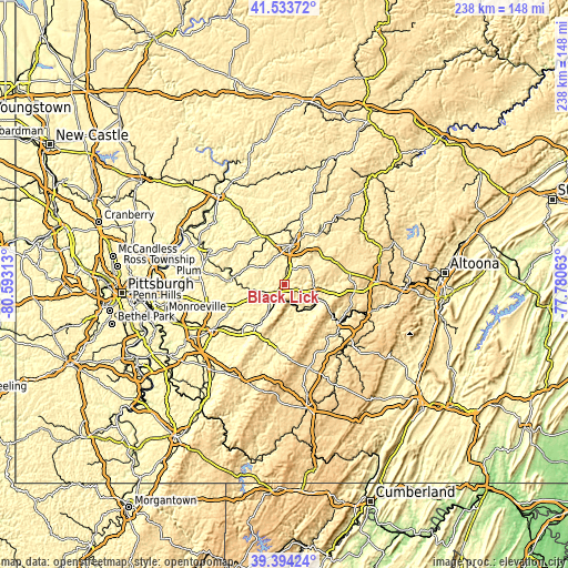
| \ | Map #1 | Topo.Map |
| Scale [m] | 282..628 m | × |
| Scale [ft] | 925..2060 ft | × |
| Average | 392.5 m = 1288 ft | × |
| Width | 7.43 km = 4.6 mi | 237.9 km = 147.8 mi |
| Height | 7.43 km = 4.6 mi | 237.9 km = 147.8 mi |
| ↑Max Latitude | 40.505922° | 41.53372° |
| Latitude at center | 40.4725° | 40.4725° |
| ↓Min Latitude | 40.439062° | 39.39424° |
| ← Min Longitude | -79.230825° | -80.59313° |
| Longitude center | -79.18688° | -79.18688° |
| →Max Longitude | -79.142935° | -77.78063° |
Nearby cities:
Cities around Black Lick sort by population:
• Indiana elevation 403 m
16.8 km,  9°
9°
• Latrobe 309 m
23.4 km,  224°
224°
• Westmont 538 m
26.5 km,  131°
131°
• Loyalhanna 301 m
22.3 km, 221°
• Blairsville 309 m
7.8 km,  233°
233°
• Derry 358 m
18.1 km,  211°
211°
• Lawson Heights 352 m
26.4 km, 220°
• Homer City 311 m
8.2 km, 14°
• Ligonier 368 m
25.9 km,  189°
189°
• Chevy Chase Heights 435 m
18.6 km, 11°
• Waterford 405 m
24.3 km,  176°
176°
• Clymer 381 m
26.3 km,  34°
34°
Multilingual:
 En español:
Black Lick elevación 320 m.
 En France:
Black Lick élévation 320 m.
 Auf Deutsch:
Black Lick höhe über dem Meeresspiegel ist 320 m.

Sources and notes:
- [note 1] Map square and city borders are not equal. Map elevation data is calculated only from area inside that square.
- [src 1] Elevation data from geonames database provided with same terms of usage.
- [src 2] The elevation map of Black Lick is generated using elevation data from NASA's 3 arcsec (90m) resolution SRTM data.
- [src 3] Base (background) map © OpenStreetMap contributors tiles are generated by Geofabrik and OpenTopoMap.
Copyright & License:
This Black Lick Elevation Map is licensed under CC BY-SA. You may reuse any part from this page, if you give a proper credit by linking to this URL:
 More info on terms of use page.