Russells Point elevation
Russells Point (Ohio, Logan County), United States elevation is 306 meters and Russells Point elevation in feet is 1004 ft above sea level [src 1]. Russells Point is a populated place (feature code) with elevation that is 27 meters (89 ft) bigger than average city elevation in United States.
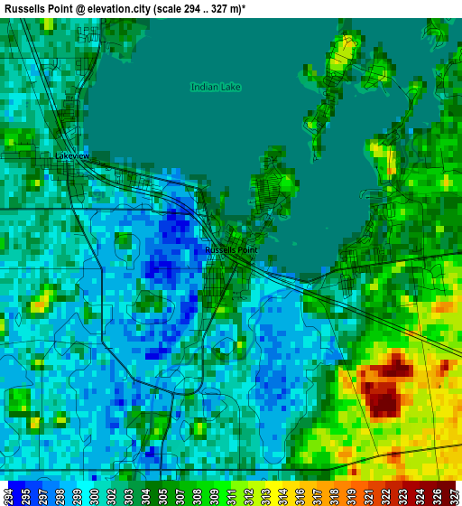
Below is the Elevation map of Russells Point, which displays elevation range with different colors. Scale of the first map is from 294 to 327 m (965 to 1073 ft) with average elevation of 303.2 meters (=995 ft) [note 1]
These maps also provides idea of topography and contour of this city, they are displayed at different zoom levels. More info about maps, scale and edge coordinates you can find below images.
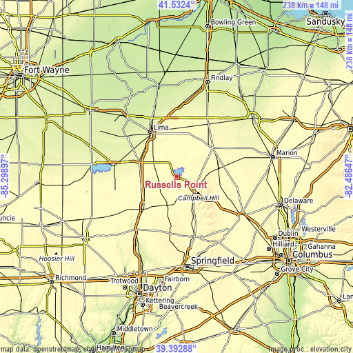
| \ | Map #1 | Topo.Map |
| Scale [m] | 294..327 m | × |
| Scale [ft] | 965..1073 ft | × |
| Average | 303.2 m = 995 ft | × |
| Width | 7.43 km = 4.6 mi | 237.9 km = 147.8 mi |
| Height | 7.43 km = 4.6 mi | 237.9 km = 147.8 mi |
| ↑Max Latitude | 40.504582° | 41.5324° |
| Latitude at center | 40.47116° | 40.47116° |
| ↓Min Latitude | 40.437721° | 39.39288° |
| ← Min Longitude | -83.936665° | -85.29897° |
| Longitude center | -83.89272° | -83.89272° |
| →Max Longitude | -83.848775° | -82.48647° |
Nearby cities:
Cities around Russells Point sort by population:
• Sidney elevation 293 m
30.5 km,  226°
226°
• Bellefontaine 381 m
16.6 km,  137°
137°
• Wapakoneta 272 m
27.6 km,  292°
292°
• Kenton 297 m
30.9 km,  50°
50°
• Northwood 350 m
13.6 km,  89°
89°
• Cridersville 269 m
29.8 km,  313°
313°
• West Liberty 332 m
27 km,  154°
154°
• Anna 314 m
25.2 km,  250°
250°
• Jackson Center 312 m
13 km, 254°
• De Graff 305 m
17.8 km,  186°
186°
• Botkins 304 m
24.3 km,  269°
269°
• Lakeview 301 m
3 km,  300°
300°
Multilingual:
 En español:
Russells Point elevación 306 m.
 En France:
Russells Point élévation 306 m.
 Auf Deutsch:
Russells Point höhe über dem Meeresspiegel ist 306 m.

Sources and notes:
- [note 1] Map square and city borders are not equal. Map elevation data is calculated only from area inside that square.
- [src 1] Elevation data from geonames database provided with same terms of usage.
- [src 2] The elevation map of Russells Point is generated using elevation data from NASA's 3 arcsec (90m) resolution SRTM data.
- [src 3] Base (background) map © OpenStreetMap contributors tiles are generated by Geofabrik and OpenTopoMap.
Copyright & License:
This Russells Point Elevation Map is licensed under CC BY-SA. You may reuse any part from this page, if you give a proper credit by linking to this URL:
 More info on terms of use page.