Coshocton elevation
Coshocton (Ohio, Coshocton County), United States elevation is 234 meters and Coshocton elevation in feet is 768 ft above sea level [src 1]. Coshocton is a seat of a second-order administrative division (feature code) with elevation that is 45 meters (148 ft) smaller than average city elevation in United States.
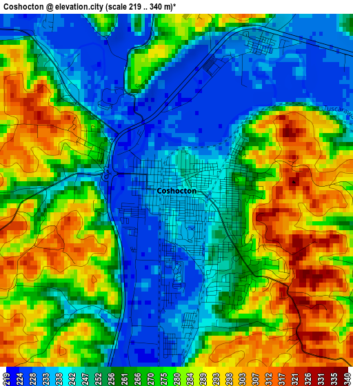
Below is the Elevation map of Coshocton, which displays elevation range with different colors. Scale of the first map is from 219 to 340 m (719 to 1115 ft) with average elevation of 263.9 meters (=866 ft) [note 1]
These maps also provides idea of topography and contour of this city, they are displayed at different zoom levels. More info about maps, scale and edge coordinates you can find below images.
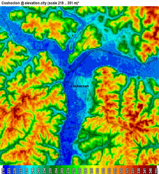
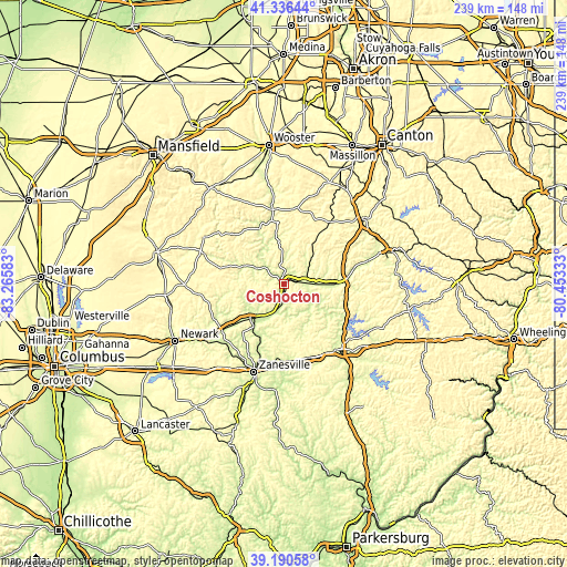
| \ | Map #1 | Map #2 | Topo.Map |
| Scale [m] | 219..340 m | 218..351 m | × |
| Scale [ft] | 719..1115 ft | 715..1152 ft | × |
| Average | 263.9 m = 866 ft | 275.2 m = 903 ft | × |
| Width | 7.46 km = 4.6 mi | 14.91 km = 9.3 mi | 238.6 km = 148.3 mi |
| Height | 7.46 km = 4.6 mi | 14.91 km = 9.3 mi | 238.6 km = 148.3 mi |
| ↑Max Latitude | 40.305541° | 40.339046° | 41.33644° |
| Latitude at center | 40.27202° | 40.27202° | 40.27202° |
| ↓Min Latitude | 40.238482° | 40.204928° | 39.19058° |
| ← Min Longitude | -81.903525° | -81.947471° | -83.26583° |
| Longitude center | -81.85958° | -81.85958° | -81.85958° |
| →Max Longitude | -81.815635° | -81.771689° | -80.45333° |
Nearby cities:
Cities around Coshocton sort by population:
• Cambridge elevation 252 m
35.3 km,  139°
139°
• Newcomerstown 244 m
21.5 km,  89°
89°
• Millersburg 272 m
31.8 km,  351°
351°
• North Zanesville 272 m
34.8 km,  200°
200°
• New Concord 264 m
32.7 km,  160°
160°
• West Lafayette 242 m
9.2 km, 87°
• Sugarcreek 305 m
31.7 km,  35°
35°
• Sugarcreek Police Dept 302 m
31.6 km, 35°
• Dresden 227 m
21.1 km,  217°
217°
• Oak Hill 293 m
36 km,  296°
296°
• Frazeysburg 229 m
28 km,  232°
232°
• Mantua 318 m
26.5 km, 144°
Multilingual:
 En español:
Coshocton elevación 234 m.
 En France:
Coshocton élévation 234 m.
 Auf Deutsch:
Coshocton höhe über dem Meeresspiegel ist 234 m.

Sources and notes:
- [note 1] Map square and city borders are not equal. Map elevation data is calculated only from area inside that square.
- [src 1] Elevation data from geonames database provided with same terms of usage.
- [src 2] The elevation map of Coshocton is generated using elevation data from NASA's 3 arcsec (90m) resolution SRTM data.
- [src 3] Base (background) map © OpenStreetMap contributors tiles are generated by Geofabrik and OpenTopoMap.
Copyright & License:
This Coshocton Elevation Map is licensed under CC BY-SA. You may reuse any part from this page, if you give a proper credit by linking to this URL:
 More info on terms of use page.